Burr Topo Map Nebraska
To zoom in, hover over the map of Burr
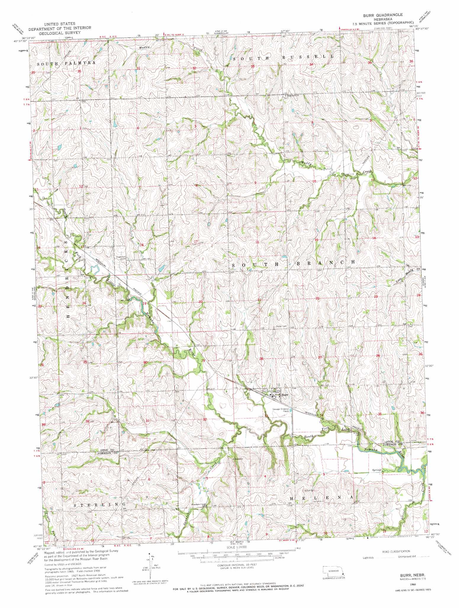
USGS Topo Quad 40096e3 - 1:24,000 scale
| Topo Map Name: | Burr |
| USGS Topo Quad ID: | 40096e3 |
| Print Size: | ca. 21 1/4" wide x 27" high |
| Southeast Coordinates: | 40.5° N latitude / 96.25° W longitude |
| Map Center Coordinates: | 40.5625° N latitude / 96.3125° W longitude |
| U.S. State: | NE |
| Filename: | O40096e3.jpg |
| Download Map JPG Image: | Burr topo map 1:24,000 scale |
| Map Type: | Topographic |
| Topo Series: | 7.5´ |
| Map Scale: | 1:24,000 |
| Source of Map Images: | United States Geological Survey (USGS) |
| Alternate Map Versions: |
Burr NE 1966, updated 1968 Download PDF Buy paper map Burr NE 2011 Download PDF Buy paper map Burr NE 2014 Download PDF Buy paper map |
1:24,000 Topo Quads surrounding Burr
Walton |
Eagle |
Elmwood |
Weeping Water |
Avoca |
Bennet |
Palmyra |
Unadilla |
Syracuse |
Dunbar |
Firth |
Douglas |
Burr |
Cook |
Talmage |
Adams |
Sterling |
Saint Mary |
Tecumseh Nw |
Tecumseh Ne |
Filley |
Crab Orchard |
Vesta |
Tecumseh |
Tecumseh Se |
> Back to 40096e1 at 1:100,000 scale
> Back to 40096a1 at 1:250,000 scale
> Back to U.S. Topo Maps home
Burr topo map: Gazetteer
Burr: Airports
Watermeier Airport elevation 354m 1161′Burr: Populated Places
Burr elevation 344m 1128′Burr: Post Offices
Burr Post Office elevation 344m 1128′Burr: Streams
Saunders Creek elevation 333m 1092′Silver Creek elevation 326m 1069′
Burr digital topo map on disk
Buy this Burr topo map showing relief, roads, GPS coordinates and other geographical features, as a high-resolution digital map file on DVD: