Manley Topo Map Nebraska
To zoom in, hover over the map of Manley
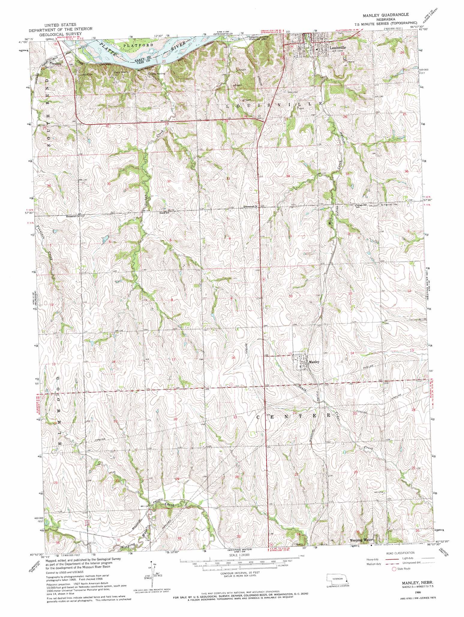
USGS Topo Quad 40096h2 - 1:24,000 scale
| Topo Map Name: | Manley |
| USGS Topo Quad ID: | 40096h2 |
| Print Size: | ca. 21 1/4" wide x 27" high |
| Southeast Coordinates: | 40.875° N latitude / 96.125° W longitude |
| Map Center Coordinates: | 40.9375° N latitude / 96.1875° W longitude |
| U.S. State: | NE |
| Filename: | O40096h2.jpg |
| Download Map JPG Image: | Manley topo map 1:24,000 scale |
| Map Type: | Topographic |
| Topo Series: | 7.5´ |
| Map Scale: | 1:24,000 |
| Source of Map Images: | United States Geological Survey (USGS) |
| Alternate Map Versions: |
Manley NE 1966, updated 1968 Download PDF Buy paper map Manley NE 2011 Download PDF Buy paper map Manley NE 2014 Download PDF Buy paper map |
1:24,000 Topo Quads surrounding Manley
Mead |
Wann |
Gretna |
Ralston |
Omaha South |
Ashland West |
Ashland East |
Springfield |
Cedar Creek |
Plattsmouth |
Greenwood |
Murdock |
Manley |
Weeping Water Ne |
Murray |
Eagle |
Elmwood |
Weeping Water |
Avoca |
Nehawka |
Palmyra |
Unadilla |
Syracuse |
Dunbar |
Nebraska City Nw |
> Back to 40096e1 at 1:100,000 scale
> Back to 40096a1 at 1:250,000 scale
> Back to U.S. Topo Maps home
Manley topo map: Gazetteer
Manley: Dams
Luetchens Dam elevation 350m 1148′Midwestern Feedlot Retention Dam elevation 366m 1200′
Manley: Parks
Louisville Lakes State Recreation Area elevation 312m 1023′Platte River State Park elevation 338m 1108′
Saint Patricks Cemetery Historical Marker elevation 371m 1217′
Manley: Populated Places
Louisville elevation 324m 1062′Manley elevation 390m 1279′
Manley: Post Offices
Manley Post Office elevation 390m 1279′Manley: Reservoirs
Luetchens Reservoir elevation 350m 1148′Midwestern Feeding Company Reservoir elevation 366m 1200′
Manley: Streams
Decker Creek elevation 312m 1023′Mill Creek elevation 317m 1040′
Manley: Trails
Platte River State Park Trails elevation 338m 1108′Manley digital topo map on disk
Buy this Manley topo map showing relief, roads, GPS coordinates and other geographical features, as a high-resolution digital map file on DVD: