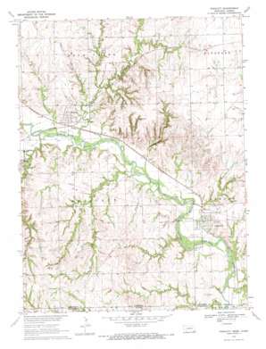
Endicott Topo Map Nebraska
To zoom in, hover over the map of Endicott
USGS Topo Quad 40097a1 - 1:24,000 scale
| Topo Map Name: | Endicott |
| USGS Topo Quad ID: | 40097a1 |
| Print Size: | ca. 21 1/4" wide x 27" high |
| Southeast Coordinates: | 40° N latitude / 97° W longitude |
| Map Center Coordinates: | 40.0625° N latitude / 97.0625° W longitude |
| U.S. States: | NE, KS |
| Filename: | O40097A1.jpg |
| Download Map JPG Image: | Endicott topo map 1:24,000 scale |
| Map Type: | Topographic |
| Topo Series: | 7.5´ |
| Map Scale: | 1:24,000 |
| Source of Map Images: | United States Geological Survey (USGS) |
| Alternate Map Versions: |
Endicott NE 1970, updated 1972 Download PDF Buy paper map Endicott NE 2011 Download PDF Buy paper map Endicott NE 2014 Download PDF Buy paper map |
1:24,000 Topo Quads surrounding Endicott
> Back to 40097a1 at 1:100,000 scale
> Back to 40096a1 at 1:250,000 scale
> Back to U.S. Topo Maps home
Endicott topo map: Gazetteer
Endicott: Parks
Rock Creek Station State Historical Park elevation 415m 1361′Rock Creek Station State Recreation Area elevation 421m 1381′
Rock Glen State Wildlife Mangement Area elevation 437m 1433′
Rose Creek State Wildlife Management Area elevation 388m 1272′
Endicott: Populated Places
Endicott elevation 410m 1345′Rudy elevation 388m 1272′
Steele City elevation 388m 1272′
Endicott: Post Offices
Endicott Post Office elevation 410m 1345′Shea Post Office (historical) elevation 436m 1430′
Steele City Post Office elevation 388m 1272′
Endicott: Streams
Cole Creek elevation 386m 1266′Coon Creek elevation 384m 1259′
Elm Creek elevation 393m 1289′
Rock Creek elevation 387m 1269′
Rose Creek elevation 387m 1269′
Rose Creek elevation 387m 1269′
School Creek elevation 375m 1230′
School Creek elevation 375m 1230′
Smith Creek elevation 387m 1269′
Spring Creek elevation 390m 1279′
Turkey Creek elevation 379m 1243′
Endicott: Trails
Rock Creek Station Trails elevation 415m 1361′Endicott: Valleys
Steele City Canyon elevation 392m 1286′Endicott digital topo map on disk
Buy this Endicott topo map showing relief, roads, GPS coordinates and other geographical features, as a high-resolution digital map file on DVD:


