Fairbury Sw Topo Map Nebraska
To zoom in, hover over the map of Fairbury Sw
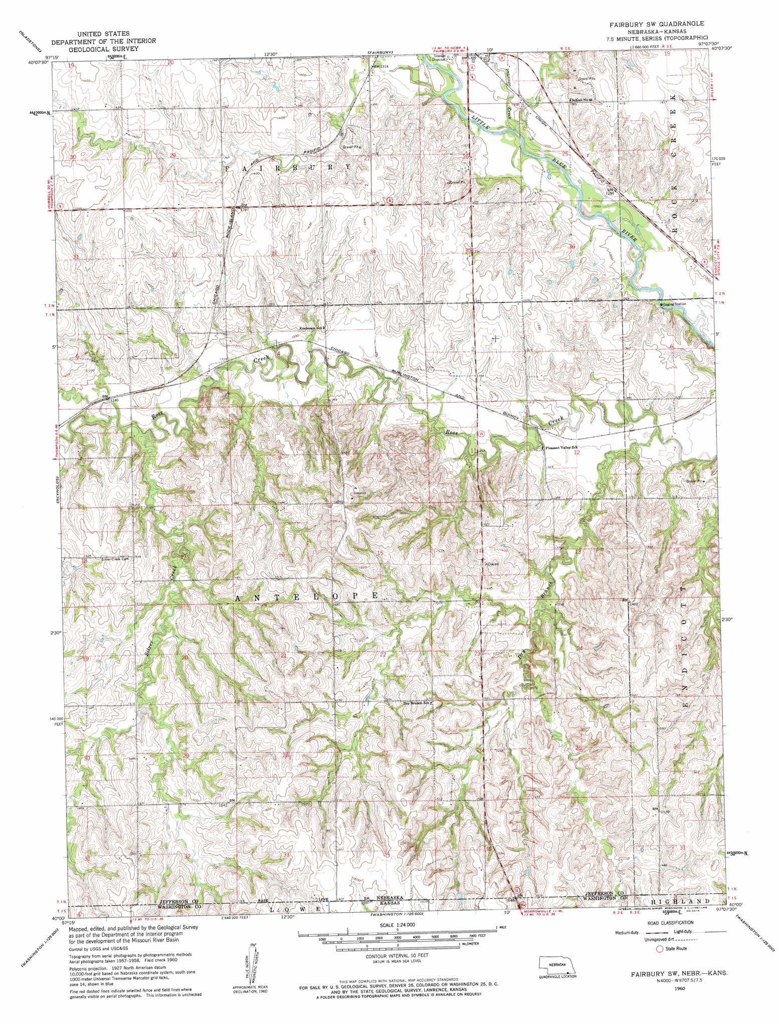
USGS Topo Quad 40097a2 - 1:24,000 scale
| Topo Map Name: | Fairbury Sw |
| USGS Topo Quad ID: | 40097a2 |
| Print Size: | ca. 21 1/4" wide x 27" high |
| Southeast Coordinates: | 40° N latitude / 97.125° W longitude |
| Map Center Coordinates: | 40.0625° N latitude / 97.1875° W longitude |
| U.S. States: | NE, KS |
| Filename: | O40097A2.jpg |
| Download Map JPG Image: | Fairbury Sw topo map 1:24,000 scale |
| Map Type: | Topographic |
| Topo Series: | 7.5´ |
| Map Scale: | 1:24,000 |
| Source of Map Images: | United States Geological Survey (USGS) |
| Alternate Map Versions: |
Fairbury SW NE 1960, updated 1961 Download PDF Buy paper map Fairbury SW NE 2011 Download PDF Buy paper map Fairbury SW NE 2014 Download PDF Buy paper map |
1:24,000 Topo Quads surrounding Fairbury Sw
Tobias Sw |
Daykin |
Western Sw |
Western Se |
Plymouth |
Alexandria |
Gladstone |
Fairbury |
Jansen |
Harbine |
Hubbell |
Reynolds |
Fairbury Sw |
Endicott |
Diller |
Narka |
Mahaska |
Washington Nw |
Washington Ne |
Hanover West |
Cuba |
Haddam |
Morrowville |
Washington |
Hanover Sw |
> Back to 40097a1 at 1:100,000 scale
> Back to 40096a1 at 1:250,000 scale
> Back to U.S. Topo Maps home
Fairbury Sw topo map: Gazetteer
Fairbury Sw: Dams
Haake Dam elevation 414m 1358′Fairbury Sw: Reservoirs
Haake Reservoir elevation 414m 1358′Fairbury Sw: Streams
Brawner Creek elevation 392m 1286′Dry Branch elevation 392m 1286′
Silver Creek elevation 401m 1315′
Fairbury Sw digital topo map on disk
Buy this Fairbury Sw topo map showing relief, roads, GPS coordinates and other geographical features, as a high-resolution digital map file on DVD: