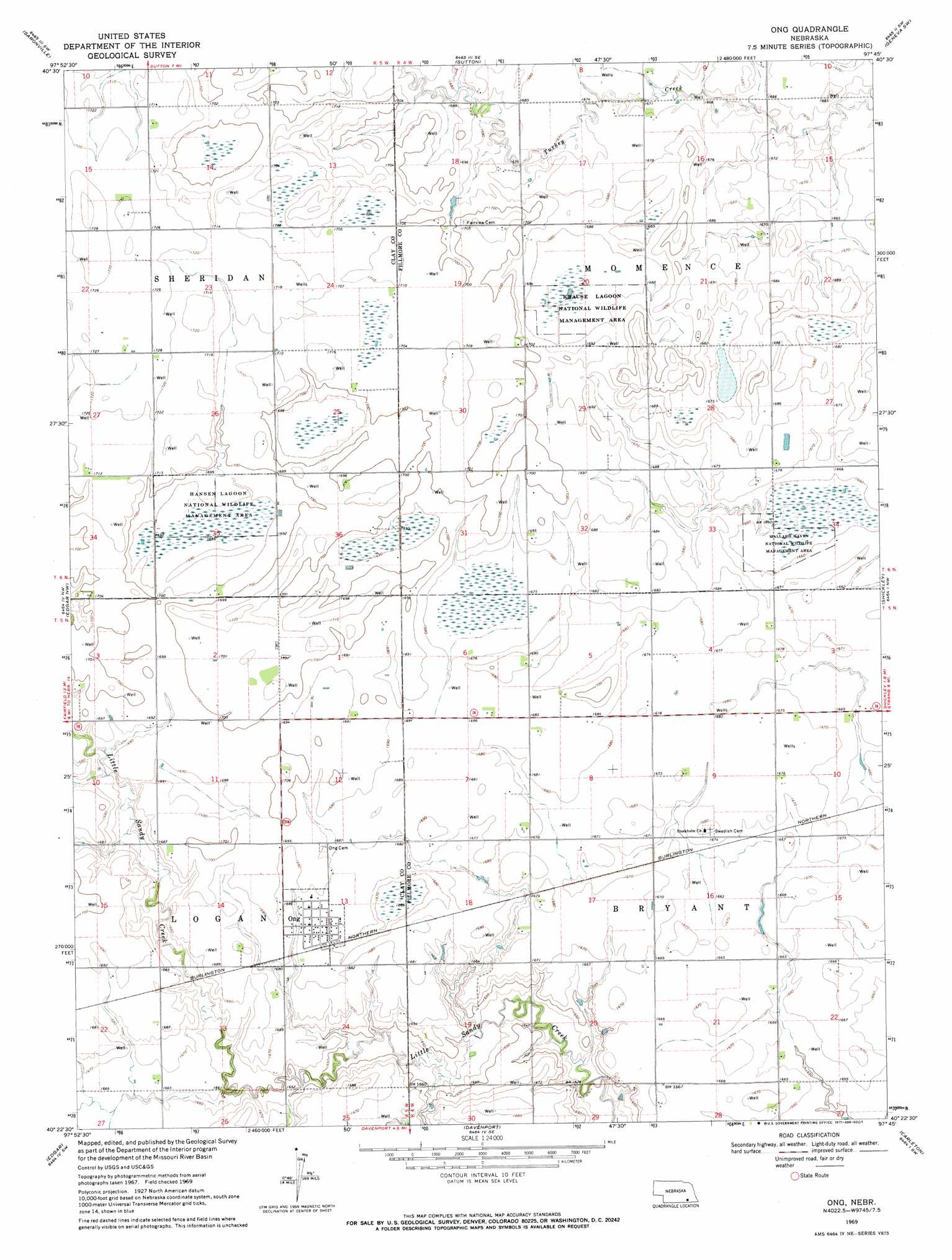
Ong Topo Map Nebraska
To zoom in, hover over the map of Ong
USGS Topo Quad 40097d7 - 1:24,000 scale
| Topo Map Name: | Ong |
| USGS Topo Quad ID: | 40097d7 |
| Print Size: | ca. 21 1/4" wide x 27" high |
| Southeast Coordinates: | 40.375° N latitude / 97.75° W longitude |
| Map Center Coordinates: | 40.4375° N latitude / 97.8125° W longitude |
| U.S. State: | NE |
| Filename: | O40097d7.jpg |
| Download Map JPG Image: | Ong topo map 1:24,000 scale |
| Map Type: | Topographic |
| Topo Series: | 7.5´ |
| Map Scale: | 1:24,000 |
| Source of Map Images: | United States Geological Survey (USGS) |
| Alternate Map Versions: |
Ong NE 1969, updated 1971 Download PDF Buy paper map Ong NE 2011 Download PDF Buy paper map Ong NE 2014 Download PDF Buy paper map |
1:24,000 Topo Quads surrounding Ong
Harvard Ne |
Stockham |
Bixby |
Grafton |
Fairmont |
Harvard |
Saronville |
Sutton |
Geneva Sw |
Geneva |
Fairfield |
Edgar Nw |
Ong |
Shickley |
Strang |
Fairfield Se |
Edgar |
Davenport |
Carleton |
Bruning |
Nelson |
Oak |
Ruskin |
Deshler |
Hebron |
> Back to 40097a1 at 1:100,000 scale
> Back to 40096a1 at 1:250,000 scale
> Back to U.S. Topo Maps home
Ong topo map: Gazetteer
Ong: Dams
Yost Dam elevation 512m 1679′Ong: Parks
Green Wing State Wildlife Management Area elevation 515m 1689′Hansen Lagoon Natl Wildlife Mgt Area elevation 515m 1689′
Krause Lagoon Natl Wildlife Mgt Area elevation 511m 1676′
Mallard Haven Natl Wildlife Mgt Area elevation 505m 1656′
Stockholm Lutheran Church and Swedish Cemetery Historical Marker elevation 511m 1676′
Ong: Populated Places
Ong elevation 513m 1683′Ong: Post Offices
Ong Post Office elevation 513m 1683′Ong: Reservoirs
Yost Reservoir elevation 512m 1679′Ong: Streams
Little Sandy Creek elevation 504m 1653′Ong digital topo map on disk
Buy this Ong topo map showing relief, roads, GPS coordinates and other geographical features, as a high-resolution digital map file on DVD: