Pleasant Hill Topo Map Nebraska
To zoom in, hover over the map of Pleasant Hill
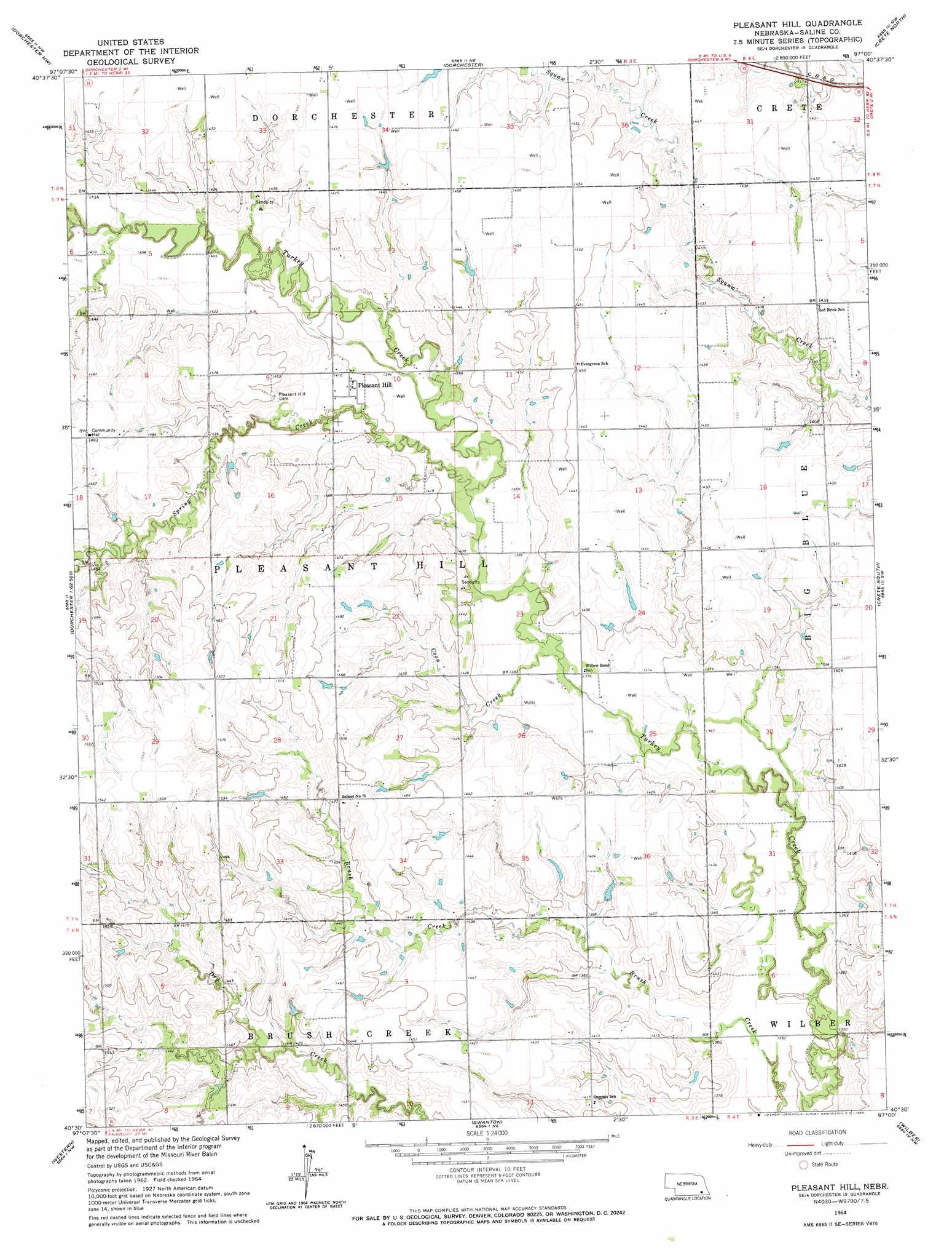
USGS Topo Quad 40097e1 - 1:24,000 scale
| Topo Map Name: | Pleasant Hill |
| USGS Topo Quad ID: | 40097e1 |
| Print Size: | ca. 21 1/4" wide x 27" high |
| Southeast Coordinates: | 40.5° N latitude / 97° W longitude |
| Map Center Coordinates: | 40.5625° N latitude / 97.0625° W longitude |
| U.S. State: | NE |
| Filename: | O40097e1.jpg |
| Download Map JPG Image: | Pleasant Hill topo map 1:24,000 scale |
| Map Type: | Topographic |
| Topo Series: | 7.5´ |
| Map Scale: | 1:24,000 |
| Source of Map Images: | United States Geological Survey (USGS) |
| Alternate Map Versions: |
Pleasant Hill NE 1964, updated 1965 Download PDF Buy paper map Pleasant Hill NE 2011 Download PDF Buy paper map Pleasant Hill NE 2014 Download PDF Buy paper map |
1:24,000 Topo Quads surrounding Pleasant Hill
Beaver Crossing |
Goehner |
Milford |
Pleasant Dale |
Emerald |
Friend |
Dorchester Nw |
Dorchester |
Crete North |
Denton |
Friend Se |
Dorchester Sw |
Pleasant Hill |
Crete South |
Hallam |
Tobias |
Western |
Swanton |
Wilber |
Clatonia |
Daykin |
Western Sw |
Western Se |
Plymouth |
Beatrice West |
> Back to 40097e1 at 1:100,000 scale
> Back to 40096a1 at 1:250,000 scale
> Back to U.S. Topo Maps home
Pleasant Hill topo map: Gazetteer
Pleasant Hill: Dams
Mahloch-Kastanek Dam elevation 429m 1407′Pleasant Hill: Populated Places
Pleasant Hill elevation 428m 1404′Pleasant Hill: Post Offices
Pleasant Hill Post Office (historical) elevation 428m 1404′Pleasant Hill: Reservoirs
Mahloch-Kastanek Reservoir elevation 429m 1407′Pleasant Hill: Streams
Coon Creek elevation 417m 1368′Spring Creek elevation 421m 1381′
Pleasant Hill digital topo map on disk
Buy this Pleasant Hill topo map showing relief, roads, GPS coordinates and other geographical features, as a high-resolution digital map file on DVD: