Friend Sw Topo Map Nebraska
To zoom in, hover over the map of Friend Sw
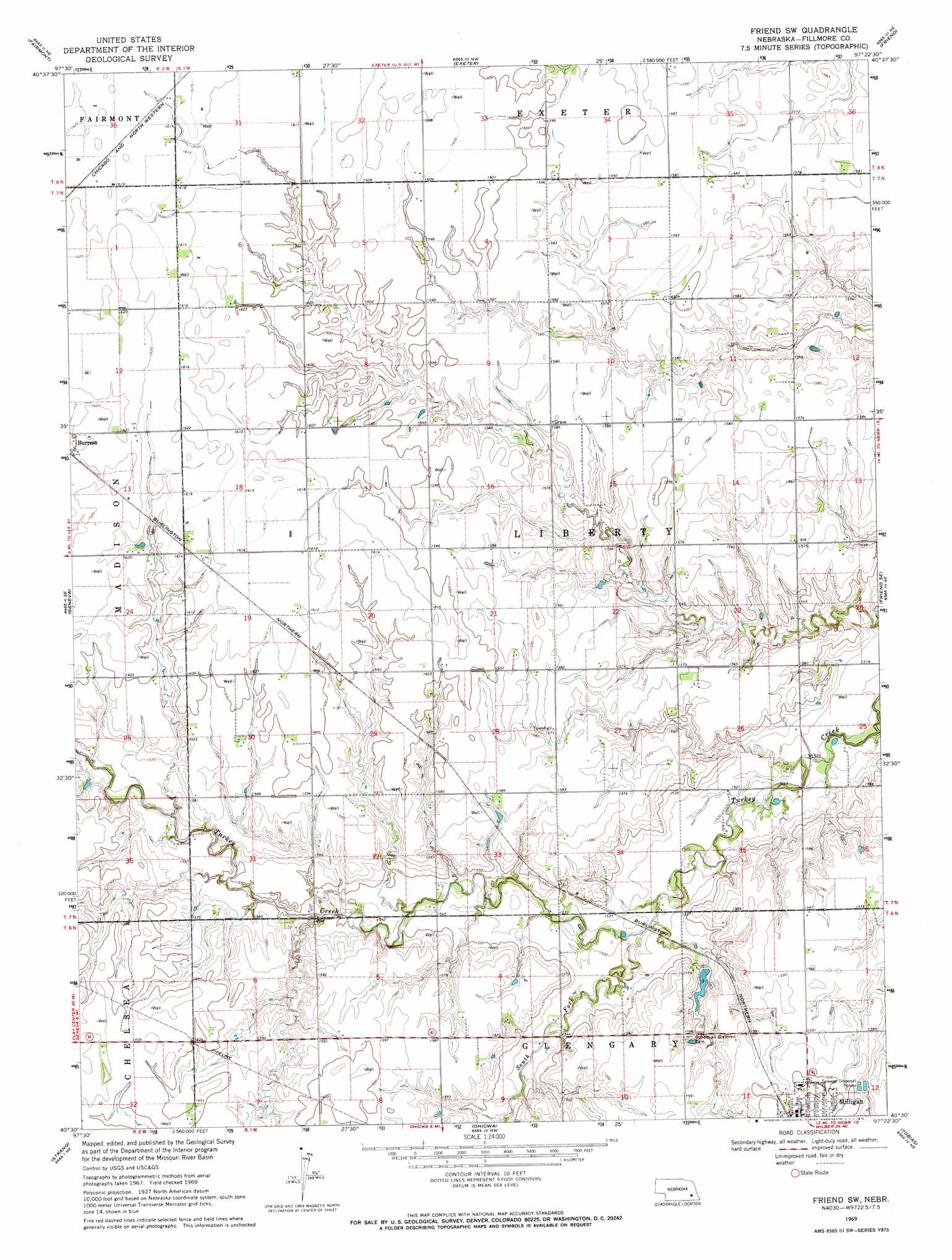
USGS Topo Quad 40097e4 - 1:24,000 scale
| Topo Map Name: | Friend Sw |
| USGS Topo Quad ID: | 40097e4 |
| Print Size: | ca. 21 1/4" wide x 27" high |
| Southeast Coordinates: | 40.5° N latitude / 97.375° W longitude |
| Map Center Coordinates: | 40.5625° N latitude / 97.4375° W longitude |
| U.S. State: | NE |
| Filename: | O40097e4.jpg |
| Download Map JPG Image: | Friend Sw topo map 1:24,000 scale |
| Map Type: | Topographic |
| Topo Series: | 7.5´ |
| Map Scale: | 1:24,000 |
| Source of Map Images: | United States Geological Survey (USGS) |
| Alternate Map Versions: |
Friend SW NE 1969, updated 1971 Download PDF Buy paper map Friend SW NE 2011 Download PDF Buy paper map Friend SW NE 2014 Download PDF Buy paper map |
1:24,000 Topo Quads surrounding Friend Sw
York Sw |
York South |
Utica Sw |
Beaver Crossing |
Goehner |
Grafton |
Fairmont |
Exeter |
Friend |
Dorchester Nw |
Geneva Sw |
Geneva |
Friend Sw |
Friend Se |
Dorchester Sw |
Shickley |
Strang |
Ohiowa |
Tobias |
Western |
Carleton |
Bruning |
Tobias Sw |
Daykin |
Western Sw |
> Back to 40097e1 at 1:100,000 scale
> Back to 40096a1 at 1:250,000 scale
> Back to U.S. Topo Maps home
Friend Sw topo map: Gazetteer
Friend Sw: Dams
Kubicek Dam elevation 469m 1538′Friend Sw: Parks
Blizzard of 1888 Historical Marker elevation 482m 1581′Friend Sw: Populated Places
Milligan elevation 489m 1604′Townhall elevation 480m 1574′
Friend Sw: Post Offices
Milligan Post Office elevation 489m 1604′Friend Sw: Reservoirs
Cedar View Recreation Reservoir elevation 469m 1538′Friend Sw: Streams
South Fork Turkey Creek elevation 463m 1519′Friend Sw digital topo map on disk
Buy this Friend Sw topo map showing relief, roads, GPS coordinates and other geographical features, as a high-resolution digital map file on DVD: