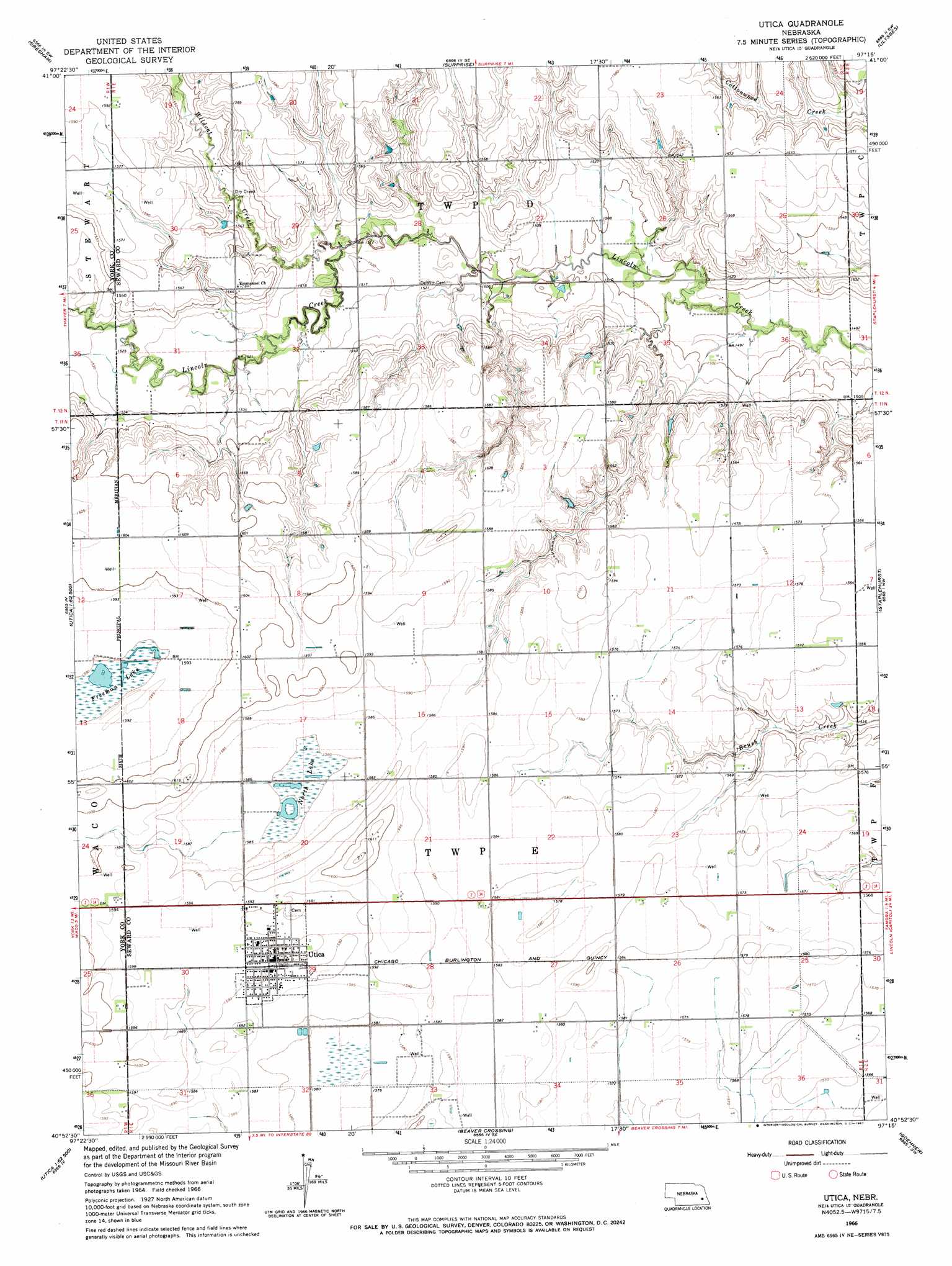
Utica Topo Map Nebraska
To zoom in, hover over the map of Utica
USGS Topo Quad 40097h3 - 1:24,000 scale
| Topo Map Name: | Utica |
| USGS Topo Quad ID: | 40097h3 |
| Print Size: | ca. 21 1/4" wide x 27" high |
| Southeast Coordinates: | 40.875° N latitude / 97.25° W longitude |
| Map Center Coordinates: | 40.9375° N latitude / 97.3125° W longitude |
| U.S. State: | NE |
| Filename: | O40097h3.jpg |
| Download Map JPG Image: | Utica topo map 1:24,000 scale |
| Map Type: | Topographic |
| Topo Series: | 7.5´ |
| Map Scale: | 1:24,000 |
| Source of Map Images: | United States Geological Survey (USGS) |
| Alternate Map Versions: |
Utica NE 1966, updated 1967 Download PDF Buy paper map Utica NE 2011 Download PDF Buy paper map Utica NE 2014 Download PDF Buy paper map |
1:24,000 Topo Quads surrounding Utica
Osceola |
Shelby |
Rising City |
Garrison |
Brainard |
Stromsburg |
Gresham |
Surprise |
Ulysses |
Dwight |
York North |
Waco |
Utica |
Staplehurst |
Seward |
York South |
Utica Sw |
Beaver Crossing |
Goehner |
Milford |
Fairmont |
Exeter |
Friend |
Dorchester Nw |
Dorchester |
> Back to 40097e1 at 1:100,000 scale
> Back to 40096a1 at 1:250,000 scale
> Back to U.S. Topo Maps home
Utica topo map: Gazetteer
Utica: Dams
Langenheim-Brackham Dam elevation 484m 1587′Utica: Lakes
North Lake elevation 482m 1581′Utica: Parks
Conns Park elevation 484m 1587′Freeman Lake Federal Waterfowl Production Area elevation 485m 1591′
North Ball Park elevation 482m 1581′
North Lake Basin State Wildlife Management Area elevation 482m 1581′
South Ball Park elevation 485m 1591′
Utica: Populated Places
Utica elevation 485m 1591′Utica: Post Offices
Utica Post Office elevation 485m 1591′Utica: Reservoirs
Langenheim-Brackham Reservoir elevation 484m 1587′Utica digital topo map on disk
Buy this Utica topo map showing relief, roads, GPS coordinates and other geographical features, as a high-resolution digital map file on DVD: