Riverton Topo Map Nebraska
To zoom in, hover over the map of Riverton
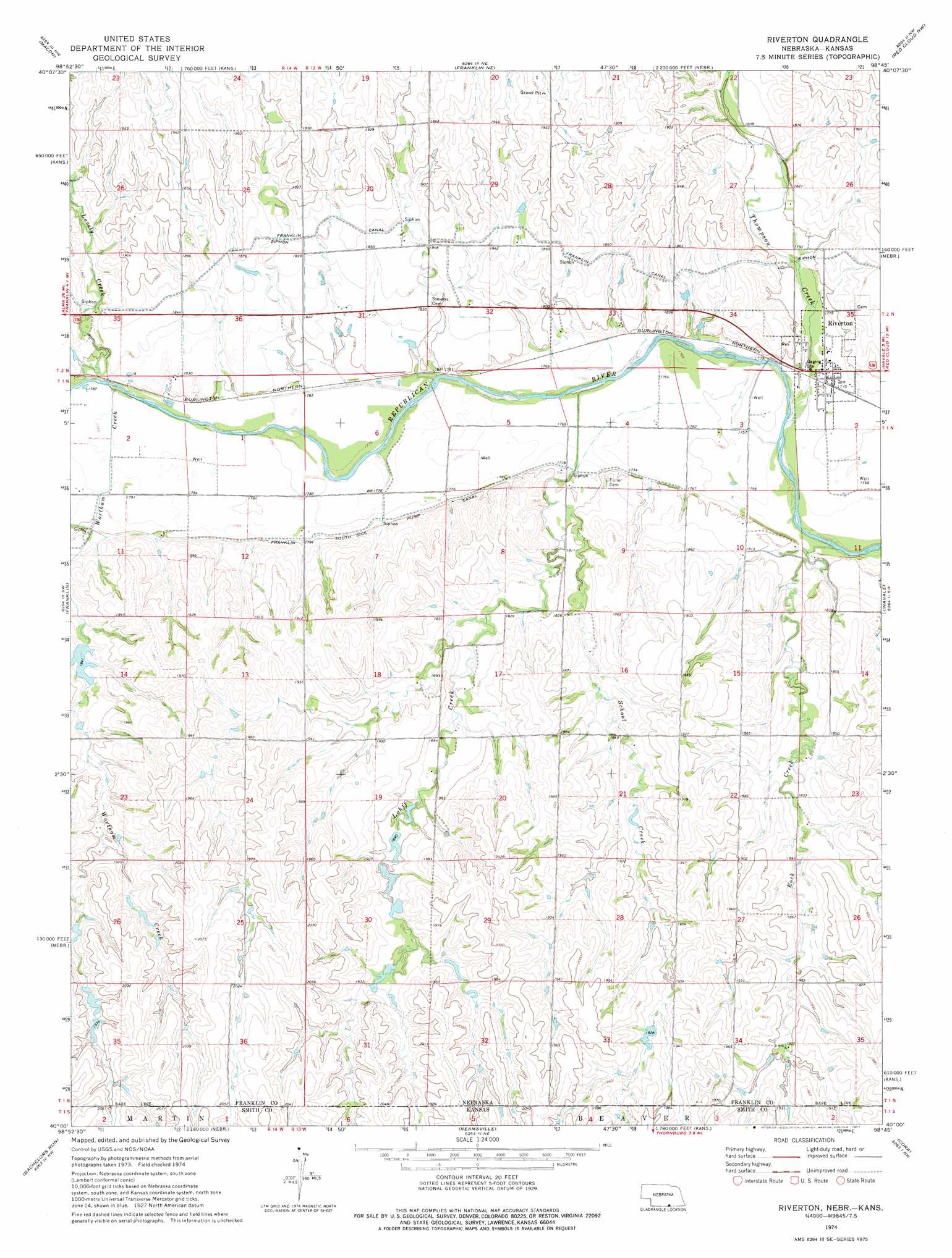
USGS Topo Quad 40098a7 - 1:24,000 scale
| Topo Map Name: | Riverton |
| USGS Topo Quad ID: | 40098a7 |
| Print Size: | ca. 21 1/4" wide x 27" high |
| Southeast Coordinates: | 40° N latitude / 98.75° W longitude |
| Map Center Coordinates: | 40.0625° N latitude / 98.8125° W longitude |
| U.S. States: | NE, KS |
| Filename: | O40098a7.jpg |
| Download Map JPG Image: | Riverton topo map 1:24,000 scale |
| Map Type: | Topographic |
| Topo Series: | 7.5´ |
| Map Scale: | 1:24,000 |
| Source of Map Images: | United States Geological Survey (USGS) |
| Alternate Map Versions: |
Riverton NE 1974, updated 1977 Download PDF Buy paper map Riverton NE 2011 Download PDF Buy paper map Riverton NE 2014 Download PDF Buy paper map |
1:24,000 Topo Quads surrounding Riverton
Hildreth |
Upland |
Upland Se |
Campbell |
Bladen |
Republican City Ne |
Macon |
Franklin Ne |
Red Cloud Nw |
Red Cloud Ne |
Bloomington |
Franklin |
Riverton |
Inavale |
Red Cloud |
Kensington Ne |
Bachelors Run |
Reamsville |
Cora |
Mccracken Branch |
Kensington |
Athol |
Smith Center |
Bellaire |
Lebanon |
> Back to 40098a1 at 1:100,000 scale
> Back to 40098a1 at 1:250,000 scale
> Back to U.S. Topo Maps home
Riverton topo map: Gazetteer
Riverton: Canals
Franklin South Side Pump Canal elevation 551m 1807′Riverton: Dams
Hawkins Dam elevation 587m 1925′Kugler Dam elevation 559m 1833′
Sindt Dam elevation 563m 1847′
Riverton: Populated Places
Riverton elevation 539m 1768′Riverton: Post Offices
Riverton Post Office elevation 539m 1768′Riverton: Reservoirs
Hawkins Reservoir elevation 587m 1925′Kugler Reservoir elevation 559m 1833′
Sindt Reservoir elevation 563m 1847′
Riverton: Streams
Lohff Creek elevation 537m 1761′Lohff Creek elevation 537m 1761′
Lovely Creek elevation 546m 1791′
Rock Creek elevation 534m 1751′
Rock Creek elevation 535m 1755′
School Creek elevation 546m 1791′
School Creek elevation 546m 1791′
Thompson Creek elevation 535m 1755′
Wortham Creek elevation 543m 1781′
Wortham Creek elevation 543m 1781′
Riverton digital topo map on disk
Buy this Riverton topo map showing relief, roads, GPS coordinates and other geographical features, as a high-resolution digital map file on DVD: