Mount Clare Topo Map Nebraska
To zoom in, hover over the map of Mount Clare
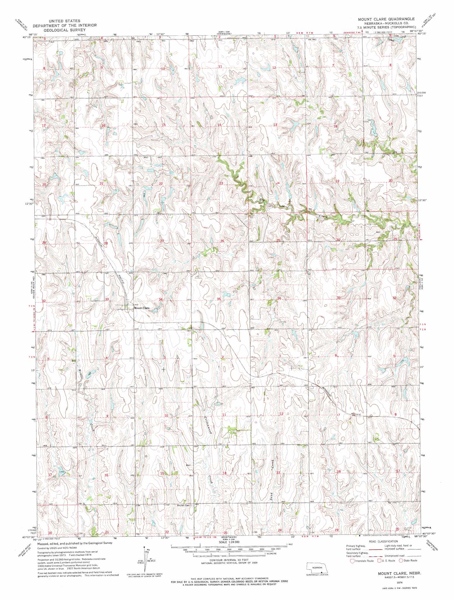
USGS Topo Quad 40098b2 - 1:24,000 scale
| Topo Map Name: | Mount Clare |
| USGS Topo Quad ID: | 40098b2 |
| Print Size: | ca. 21 1/4" wide x 27" high |
| Southeast Coordinates: | 40.125° N latitude / 98.125° W longitude |
| Map Center Coordinates: | 40.1875° N latitude / 98.1875° W longitude |
| U.S. State: | NE |
| Filename: | O40098b2.jpg |
| Download Map JPG Image: | Mount Clare topo map 1:24,000 scale |
| Map Type: | Topographic |
| Topo Series: | 7.5´ |
| Map Scale: | 1:24,000 |
| Source of Map Images: | United States Geological Survey (USGS) |
| Alternate Map Versions: |
Mount Clare NE 1974, updated 1977 Download PDF Buy paper map Mount Clare NE 2011 Download PDF Buy paper map Mount Clare NE 2014 Download PDF Buy paper map |
1:24,000 Topo Quads surrounding Mount Clare
Ayr |
Pauline |
Fairfield Nw |
Fairfield |
Edgar Nw |
Blue Hill |
Lawrence |
Deweese |
Fairfield Se |
Edgar |
Cowles |
Guide Rock Ne |
Mount Clare |
Nelson |
Oak |
Amboy |
Guide Rock |
Bostwick |
Superior |
Hardy |
Burr Oak Nw |
Northbranch |
Mankato Nw |
Webber |
Scandia Nw |
> Back to 40098a1 at 1:100,000 scale
> Back to 40098a1 at 1:250,000 scale
> Back to U.S. Topo Maps home
Mount Clare topo map: Gazetteer
Mount Clare: Dams
Buschkoetter Dam elevation 568m 1863′Childress Dam elevation 539m 1768′
Childress Dam elevation 544m 1784′
Lyon Dam elevation 533m 1748′
NBC Dam elevation 561m 1840′
Thayer Dam elevation 551m 1807′
Tumbelson Dam elevation 549m 1801′
Walden Dam elevation 558m 1830′
Wehrman Dam-1 Dam elevation 540m 1771′
Mount Clare: Populated Places
Mount Clare elevation 579m 1899′Mount Clare: Post Offices
Mount Clare Post Office (historical) elevation 579m 1899′Mount Clare: Reservoirs
Buschkoetter Reservoir elevation 568m 1863′Childress Reservoir elevation 539m 1768′
Childress Reservoir elevation 544m 1784′
Lyon Reservoir elevation 533m 1748′
NBC Reservoir elevation 561m 1840′
Thayer Reservoir elevation 551m 1807′
Tumbelson Reservoir elevation 549m 1801′
Walden Reservoir elevation 558m 1830′
Wehrman Reservoir elevation 540m 1771′
Mount Clare digital topo map on disk
Buy this Mount Clare topo map showing relief, roads, GPS coordinates and other geographical features, as a high-resolution digital map file on DVD: