Hastings Nw Topo Map Nebraska
To zoom in, hover over the map of Hastings Nw
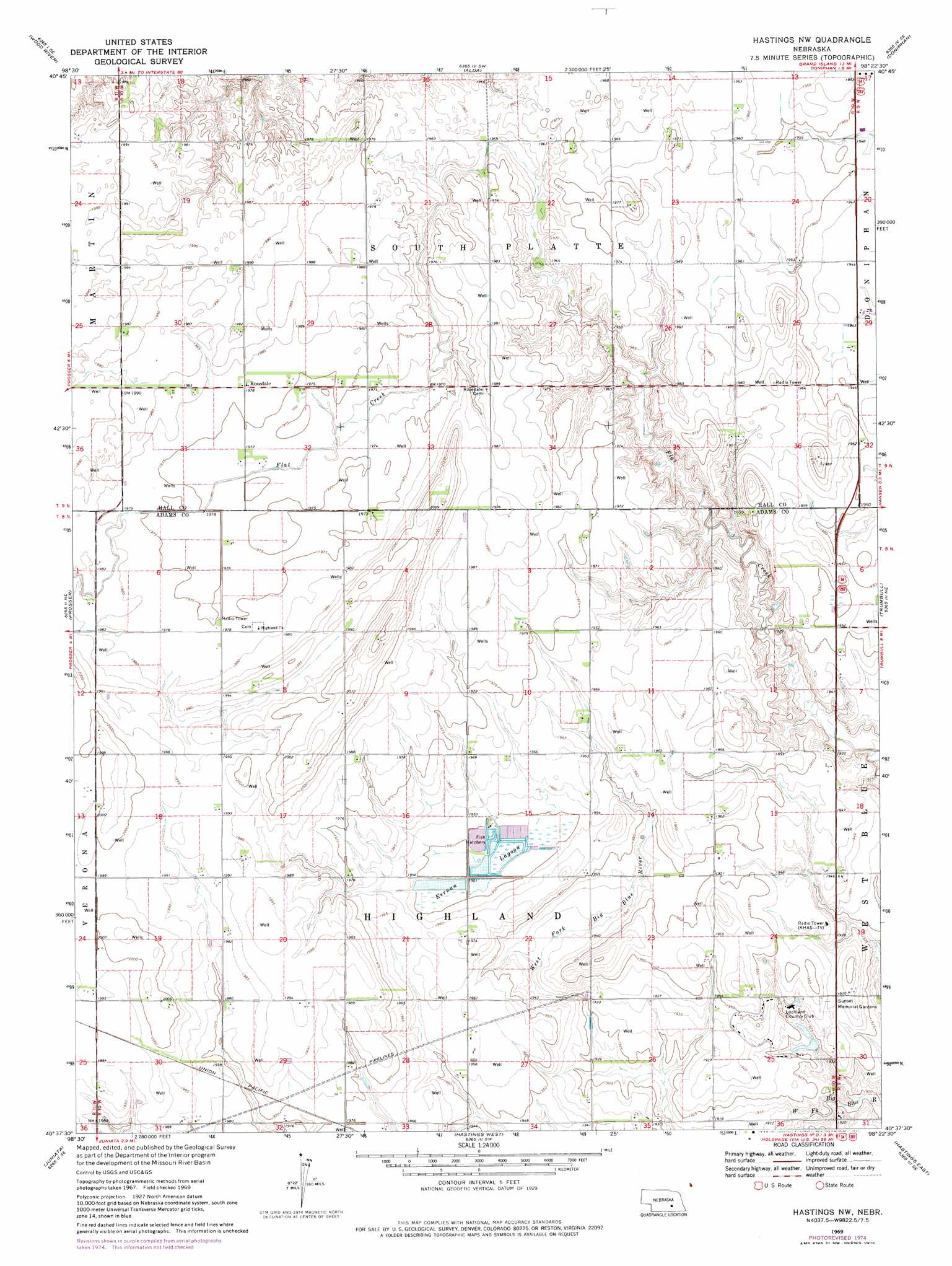
USGS Topo Quad 40098f4 - 1:24,000 scale
| Topo Map Name: | Hastings Nw |
| USGS Topo Quad ID: | 40098f4 |
| Print Size: | ca. 21 1/4" wide x 27" high |
| Southeast Coordinates: | 40.625° N latitude / 98.375° W longitude |
| Map Center Coordinates: | 40.6875° N latitude / 98.4375° W longitude |
| U.S. State: | NE |
| Filename: | O40098f4.jpg |
| Download Map JPG Image: | Hastings Nw topo map 1:24,000 scale |
| Map Type: | Topographic |
| Topo Series: | 7.5´ |
| Map Scale: | 1:24,000 |
| Source of Map Images: | United States Geological Survey (USGS) |
| Alternate Map Versions: |
Hastings NW NE 1969, updated 1971 Download PDF Buy paper map Hastings NW NE 1969, updated 1977 Download PDF Buy paper map Hastings NW NE 2011 Download PDF Buy paper map Hastings NW NE 2014 Download PDF Buy paper map |
1:24,000 Topo Quads surrounding Hastings Nw
Cameron |
Shelton Ne |
Abbott |
Grand Island |
Phillips |
Shelton |
Wood River |
Alda |
Doniphan |
Giltner |
Denman |
Prosser |
Hastings Nw |
Trumbull |
Harvard Nw |
Kenesaw |
Juniata |
Hastings West |
Hastings East |
Inland |
Holstein |
Roseland |
Ayr |
Pauline |
Fairfield Nw |
> Back to 40098e1 at 1:100,000 scale
> Back to 40098a1 at 1:250,000 scale
> Back to U.S. Topo Maps home
Hastings Nw topo map: Gazetteer
Hastings Nw: Lakes
Kernan Lagoon elevation 594m 1948′Hastings Nw: Populated Places
Rosedale elevation 603m 1978′Hastings Nw digital topo map on disk
Buy this Hastings Nw topo map showing relief, roads, GPS coordinates and other geographical features, as a high-resolution digital map file on DVD: