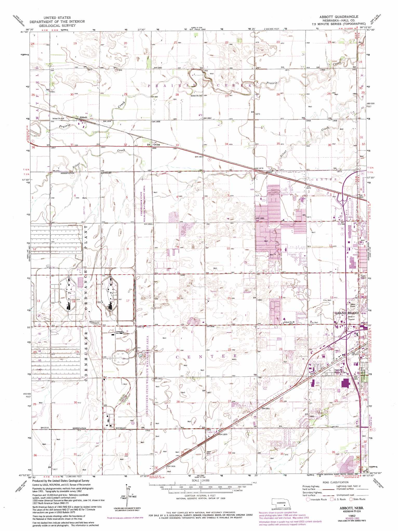
Abbott Topo Map Nebraska
To zoom in, hover over the map of Abbott
USGS Topo Quad 40098h4 - 1:24,000 scale
| Topo Map Name: | Abbott |
| USGS Topo Quad ID: | 40098h4 |
| Print Size: | ca. 21 1/4" wide x 27" high |
| Southeast Coordinates: | 40.875° N latitude / 98.375° W longitude |
| Map Center Coordinates: | 40.9375° N latitude / 98.4375° W longitude |
| U.S. State: | NE |
| Filename: | O40098h4.jpg |
| Download Map JPG Image: | Abbott topo map 1:24,000 scale |
| Map Type: | Topographic |
| Topo Series: | 7.5´ |
| Map Scale: | 1:24,000 |
| Source of Map Images: | United States Geological Survey (USGS) |
| Alternate Map Versions: |
Abbott NE 1962, updated 1964 Download PDF Buy paper map Abbott NE 1962, updated 1977 Download PDF Buy paper map Abbott NE 1962, updated 1984 Download PDF Buy paper map Abbott NE 1962, updated 1993 Download PDF Buy paper map Abbott NE 2011 Download PDF Buy paper map Abbott NE 2014 Download PDF Buy paper map |
1:24,000 Topo Quads surrounding Abbott
Farwell |
Nysted |
Saint Paul |
Palmer |
Archer |
Boelus |
Dannebrog |
Saint Paul Sw |
Saint Lebory |
Chapman |
Cameron |
Shelton Ne |
Abbott |
Grand Island |
Phillips |
Shelton |
Wood River |
Alda |
Doniphan |
Giltner |
Denman |
Prosser |
Hastings Nw |
Trumbull |
Harvard Nw |
> Back to 40098e1 at 1:100,000 scale
> Back to 40098a1 at 1:250,000 scale
> Back to U.S. Topo Maps home
Abbott topo map: Gazetteer
Abbott: Parks
Cornhusker State Wildlife Management Area-Parcel Three elevation 580m 1902′Cornhusker State Wildlife Management Area-Parcel Two elevation 577m 1893′
George Park elevation 571m 1873′
Abbott: Populated Places
Abbott elevation 579m 1899′Ovina elevation 576m 1889′
West Park Plaza Mobile Home Park elevation 578m 1896′
Abbott: Post Offices
Abbott Post Office (historical) elevation 579m 1899′Ovina Post Office (historical) elevation 576m 1889′
Abbott digital topo map on disk
Buy this Abbott topo map showing relief, roads, GPS coordinates and other geographical features, as a high-resolution digital map file on DVD: