Bloomington Topo Map Nebraska
To zoom in, hover over the map of Bloomington
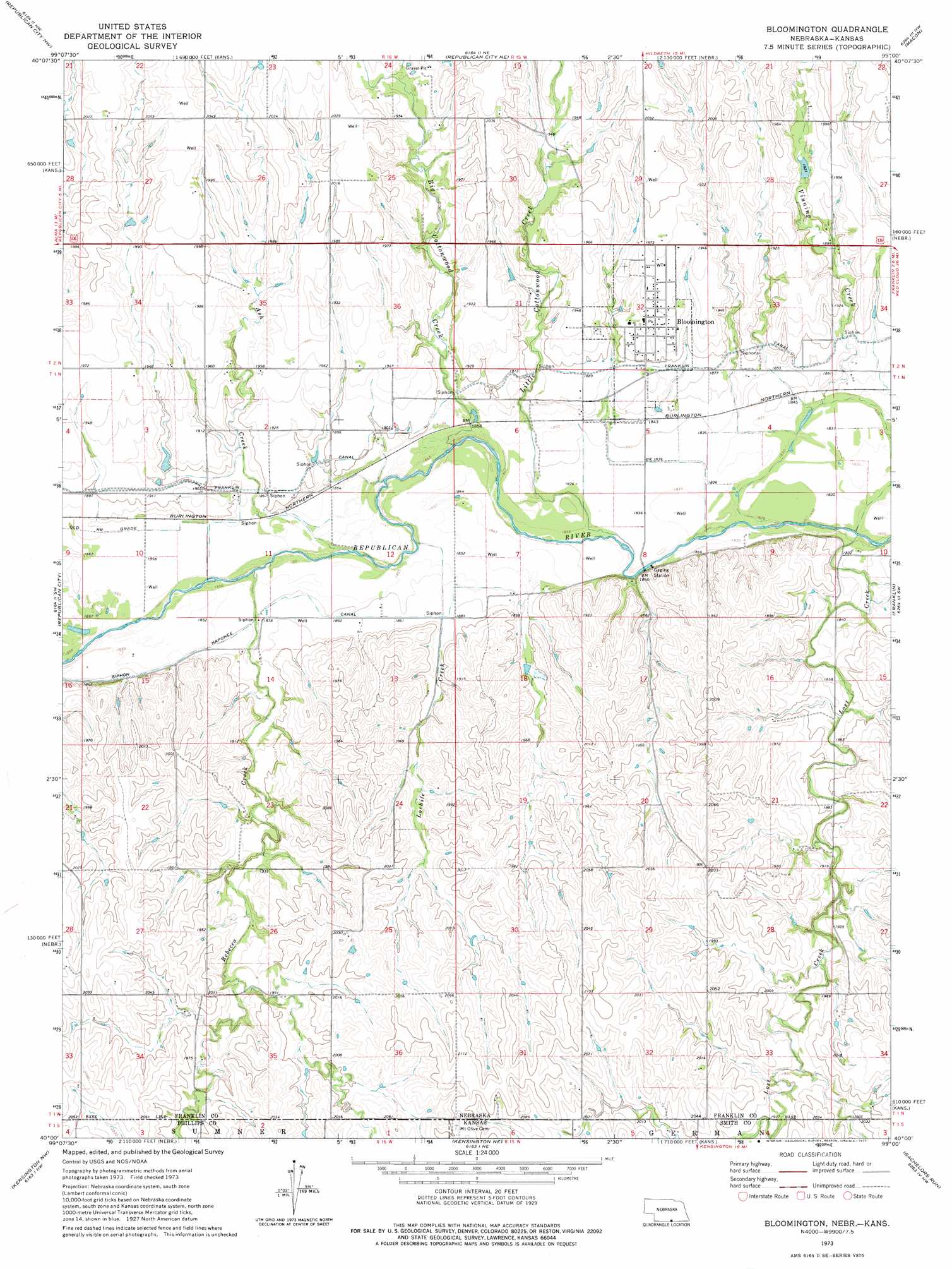
USGS Topo Quad 40099a1 - 1:24,000 scale
| Topo Map Name: | Bloomington |
| USGS Topo Quad ID: | 40099a1 |
| Print Size: | ca. 21 1/4" wide x 27" high |
| Southeast Coordinates: | 40° N latitude / 99° W longitude |
| Map Center Coordinates: | 40.0625° N latitude / 99.0625° W longitude |
| U.S. States: | NE, KS |
| Filename: | O40099a1.jpg |
| Download Map JPG Image: | Bloomington topo map 1:24,000 scale |
| Map Type: | Topographic |
| Topo Series: | 7.5´ |
| Map Scale: | 1:24,000 |
| Source of Map Images: | United States Geological Survey (USGS) |
| Alternate Map Versions: |
Bloomington NE 1973, updated 1977 Download PDF Buy paper map Bloomington NE 2011 Download PDF Buy paper map Bloomington NE 2014 Download PDF Buy paper map |
1:24,000 Topo Quads surrounding Bloomington
Ragan |
Wilcox |
Hildreth |
Upland |
Upland Se |
Huntley |
Republican City Nw |
Republican City Ne |
Macon |
Franklin Ne |
Alma |
Republican City |
Bloomington |
Franklin |
Riverton |
Stuttgart Ne |
Kensington Nw |
Kensington Ne |
Bachelors Run |
Reamsville |
Phillipsburg North |
Gretna |
Kensington |
Athol |
Smith Center |
> Back to 40099a1 at 1:100,000 scale
> Back to 40098a1 at 1:250,000 scale
> Back to U.S. Topo Maps home
Bloomington topo map: Gazetteer
Bloomington: Airports
Smith Airport elevation 589m 1932′Bloomington: Dams
James Dam elevation 604m 1981′Kahrs Dam elevation 583m 1912′
Rasmussen Dam elevation 585m 1919′
Bloomington: Populated Places
Bloomington elevation 593m 1945′Bloomington: Post Offices
Bloomington Post Office elevation 593m 1945′Bloomington: Reservoirs
James Reservoir elevation 604m 1981′Kahrs Reservoir elevation 583m 1912′
Rasmussen Reservoir elevation 585m 1919′
Bloomington: Streams
Ash Creek elevation 563m 1847′Big Cottonwood Creek elevation 561m 1840′
Little Cottonwood Creek elevation 559m 1833′
Lochile Creek elevation 562m 1843′
Lost Creek elevation 555m 1820′
Lost Creek elevation 555m 1820′
Rebecca Creek elevation 565m 1853′
Rebecca Creek elevation 565m 1853′
Vinning Creek elevation 555m 1820′
Bloomington digital topo map on disk
Buy this Bloomington topo map showing relief, roads, GPS coordinates and other geographical features, as a high-resolution digital map file on DVD: