Oxford Topo Map Nebraska
To zoom in, hover over the map of Oxford
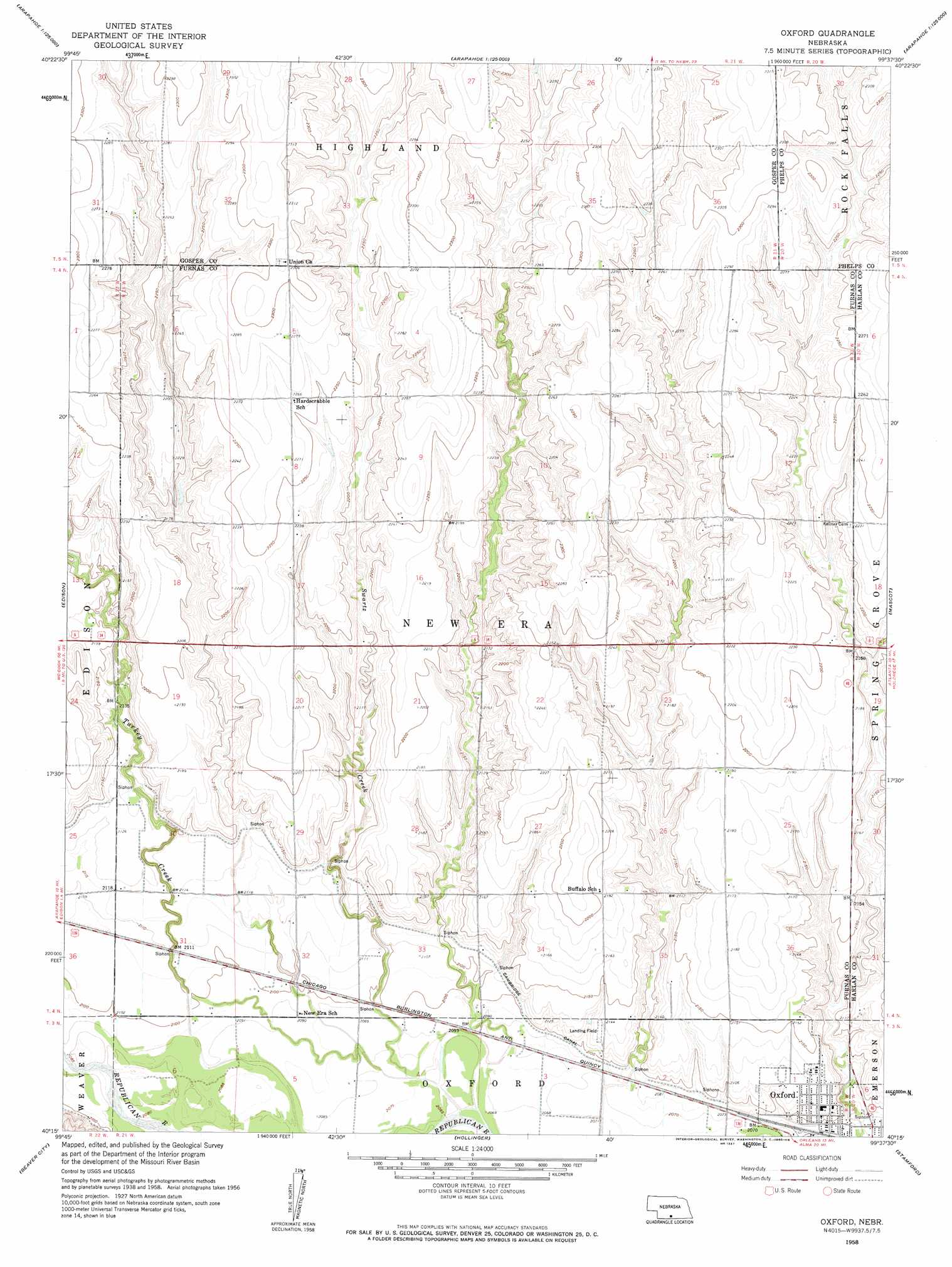
USGS Topo Quad 40099c6 - 1:24,000 scale
| Topo Map Name: | Oxford |
| USGS Topo Quad ID: | 40099c6 |
| Print Size: | ca. 21 1/4" wide x 27" high |
| Southeast Coordinates: | 40.25° N latitude / 99.625° W longitude |
| Map Center Coordinates: | 40.3125° N latitude / 99.6875° W longitude |
| U.S. State: | NE |
| Filename: | O40099c6.jpg |
| Download Map JPG Image: | Oxford topo map 1:24,000 scale |
| Map Type: | Topographic |
| Topo Series: | 7.5´ |
| Map Scale: | 1:24,000 |
| Source of Map Images: | United States Geological Survey (USGS) |
| Alternate Map Versions: |
Oxford NE 1958, updated 1960 Download PDF Buy paper map Oxford NE 2011 Download PDF Buy paper map Oxford NE 2014 Download PDF Buy paper map |
1:24,000 Topo Quads surrounding Oxford
Elwood Sw |
Elwood |
Bertrand |
Bertrand Se |
Elm Creek Sw |
Arapahoe Nw |
Arapahoe Ne |
Oxford Nw |
Loomis |
Holdrege West |
Arapahoe |
Edison |
Oxford |
Mascot |
Atlanta |
Hendley |
Beaver City |
Hollinger |
Stamford |
Orleans |
Beaver City Sw |
Beaver City Se |
Precept |
Stamford Se |
Alma Sw |
> Back to 40099a1 at 1:100,000 scale
> Back to 40098a1 at 1:250,000 scale
> Back to U.S. Topo Maps home
Oxford topo map: Gazetteer
Oxford: Airports
Oxford Municipal Airport elevation 655m 2148′Oxford: Canals
Cambridge Canal elevation 643m 2109′Oxford: Dams
Grove Dam elevation 671m 2201′Maaske Dam elevation 696m 2283′
Oxford: Parks
Oxford State Wildlife Management Area elevation 634m 2080′Republican River Flood of 1935 Historical Marker elevation 633m 2076′
Oxford: Reservoirs
Grove Reservoir elevation 671m 2201′Maaske Reservoir elevation 696m 2283′
Oxford: Streams
Swartz Creek elevation 630m 2066′Oxford digital topo map on disk
Buy this Oxford topo map showing relief, roads, GPS coordinates and other geographical features, as a high-resolution digital map file on DVD: