Kearney Se Topo Map Nebraska
To zoom in, hover over the map of Kearney Se
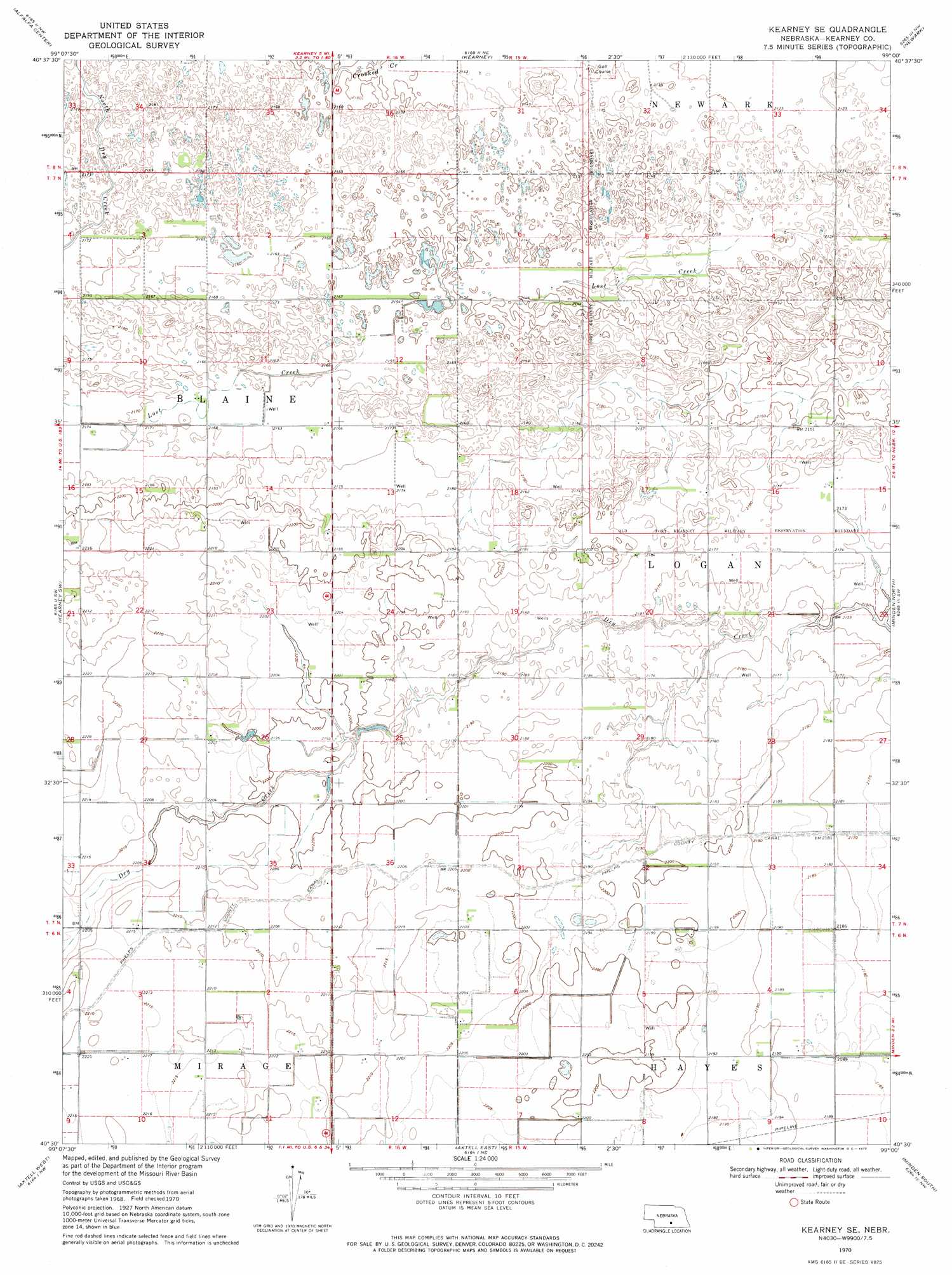
USGS Topo Quad 40099e1 - 1:24,000 scale
| Topo Map Name: | Kearney Se |
| USGS Topo Quad ID: | 40099e1 |
| Print Size: | ca. 21 1/4" wide x 27" high |
| Southeast Coordinates: | 40.5° N latitude / 99° W longitude |
| Map Center Coordinates: | 40.5625° N latitude / 99.0625° W longitude |
| U.S. State: | NE |
| Filename: | O40099e1.jpg |
| Download Map JPG Image: | Kearney Se topo map 1:24,000 scale |
| Map Type: | Topographic |
| Topo Series: | 7.5´ |
| Map Scale: | 1:24,000 |
| Source of Map Images: | United States Geological Survey (USGS) |
| Alternate Map Versions: |
Kearney SE NE 1970, updated 1972 Download PDF Buy paper map Kearney SE NE 2011 Download PDF Buy paper map Kearney SE NE 2014 Download PDF Buy paper map |
1:24,000 Topo Quads surrounding Kearney Se
Amherst |
Riverdale |
Pleasanton Se |
Buckeye Valley |
Gibbon North |
Elm Creek East |
Alfalfa Center |
Kearney |
Newark |
Gibbon South |
Elm Creek Se |
Kearney Sw |
Kearney Se |
Minden North |
Heartwell |
Holdrege East |
Axtell West |
Axtell East |
Minden South |
Norman |
Ragan |
Wilcox |
Hildreth |
Upland |
Upland Se |
> Back to 40099e1 at 1:100,000 scale
> Back to 40098a1 at 1:250,000 scale
> Back to U.S. Topo Maps home
Kearney Se topo map: Gazetteer
Kearney Se: Airports
Cavanaugh Airport elevation 666m 2185′Kearney Se: Streams
Lost Creek elevation 652m 2139′Kearney Se digital topo map on disk
Buy this Kearney Se topo map showing relief, roads, GPS coordinates and other geographical features, as a high-resolution digital map file on DVD: