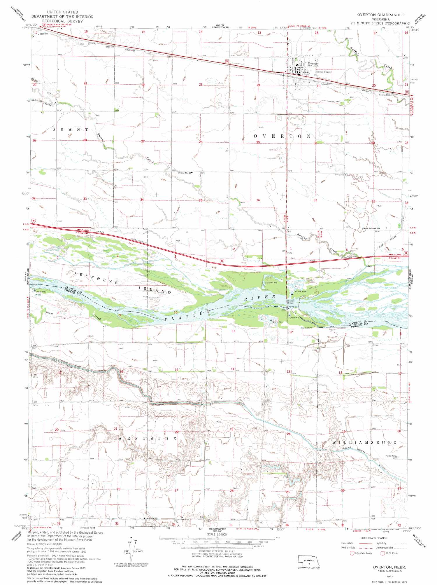
Overton Topo Map Nebraska
To zoom in, hover over the map of Overton
USGS Topo Quad 40099f5 - 1:24,000 scale
| Topo Map Name: | Overton |
| USGS Topo Quad ID: | 40099f5 |
| Print Size: | ca. 21 1/4" wide x 27" high |
| Southeast Coordinates: | 40.625° N latitude / 99.5° W longitude |
| Map Center Coordinates: | 40.6875° N latitude / 99.5625° W longitude |
| U.S. State: | NE |
| Filename: | O40099f5.jpg |
| Download Map JPG Image: | Overton topo map 1:24,000 scale |
| Map Type: | Topographic |
| Topo Series: | 7.5´ |
| Map Scale: | 1:24,000 |
| Source of Map Images: | United States Geological Survey (USGS) |
| Alternate Map Versions: |
Overton NE 1962, updated 1964 Download PDF Buy paper map Overton NE 1962, updated 1983 Download PDF Buy paper map Overton NE 2011 Download PDF Buy paper map Overton NE 2014 Download PDF Buy paper map |
1:24,000 Topo Quads surrounding Overton
Buffalo |
Lexington Nw |
Sumner |
Miller |
Miller Ne |
Lexington West |
Lexington East |
Lexington Se |
Miller Sw |
Amherst |
Johnson Lake |
Bertrand Nw |
Overton |
Elm Creek West |
Elm Creek East |
Elwood |
Bertrand |
Bertrand Se |
Elm Creek Sw |
Elm Creek Se |
Arapahoe Ne |
Oxford Nw |
Loomis |
Holdrege West |
Holdrege East |
> Back to 40099e1 at 1:100,000 scale
> Back to 40098a1 at 1:250,000 scale
> Back to U.S. Topo Maps home
Overton topo map: Gazetteer
Overton: Bridges
Overton Bridge elevation 701m 2299′Overton: Crossings
Interchange 248 elevation 703m 2306′Overton: Dams
Johnson Dam elevation 729m 2391′Overton: Islands
Jeffreys Island elevation 712m 2335′Overton: Parks
Dogwood State Wildlife Management Area elevation 711m 2332′Tobin Indian Raid Historical Marker elevation 704m 2309′
Overton: Populated Places
Area Mobile Park elevation 707m 2319′Josselyn elevation 715m 2345′
Northside Village Mobile Home Park elevation 707m 2319′
Overton elevation 707m 2319′
Overton: Post Offices
Josselyn Post Office (historical) elevation 715m 2345′Overton Post Office elevation 707m 2319′
Overton: Reservoirs
Johnson Reservoir elevation 729m 2391′Overton: Streams
Plum Creek elevation 707m 2319′Spring Creek elevation 699m 2293′
Overton digital topo map on disk
Buy this Overton topo map showing relief, roads, GPS coordinates and other geographical features, as a high-resolution digital map file on DVD: