Bertrand Nw Topo Map Nebraska
To zoom in, hover over the map of Bertrand Nw
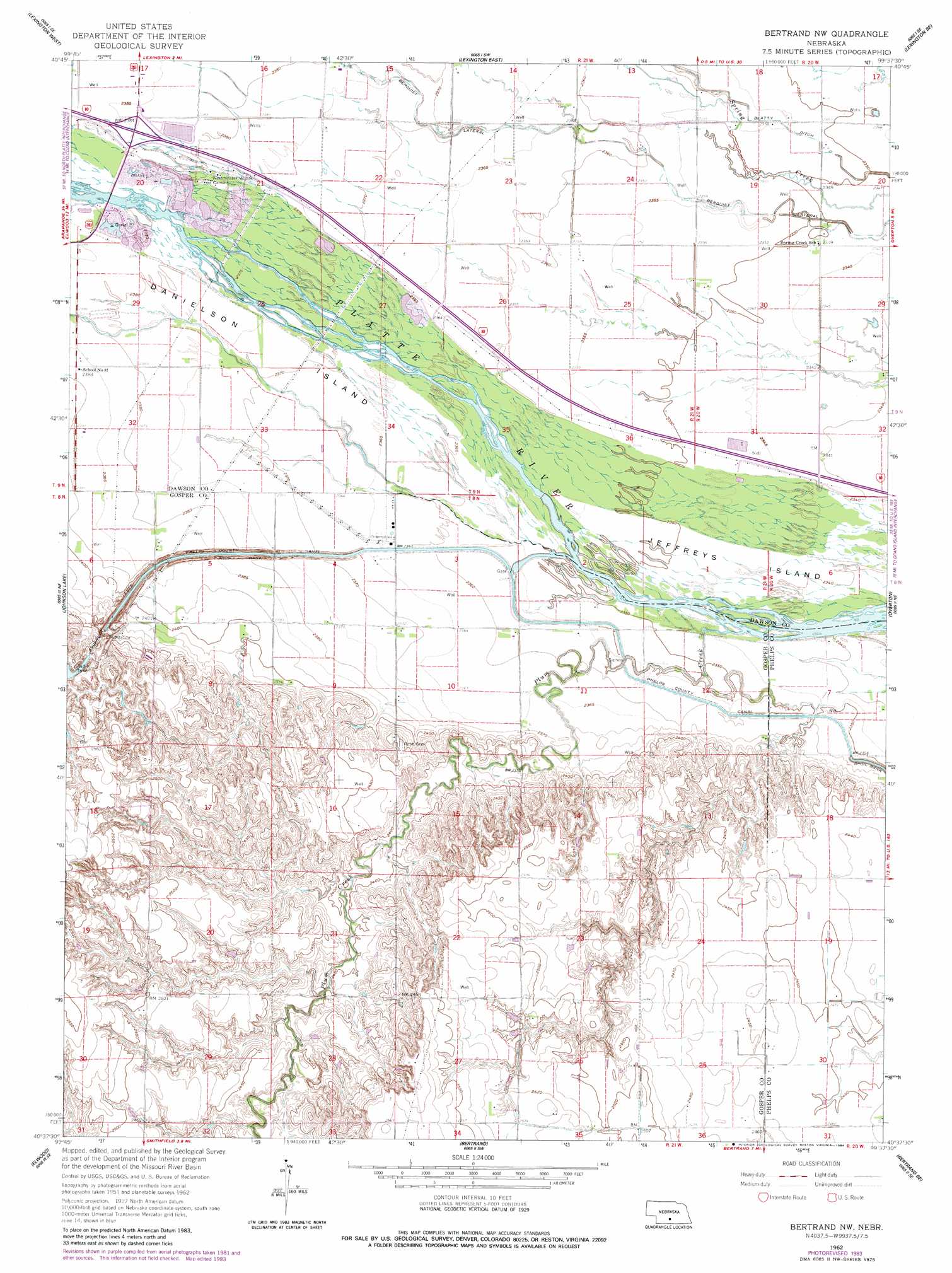
USGS Topo Quad 40099f6 - 1:24,000 scale
| Topo Map Name: | Bertrand Nw |
| USGS Topo Quad ID: | 40099f6 |
| Print Size: | ca. 21 1/4" wide x 27" high |
| Southeast Coordinates: | 40.625° N latitude / 99.625° W longitude |
| Map Center Coordinates: | 40.6875° N latitude / 99.6875° W longitude |
| U.S. State: | NE |
| Filename: | O40099f6.jpg |
| Download Map JPG Image: | Bertrand Nw topo map 1:24,000 scale |
| Map Type: | Topographic |
| Topo Series: | 7.5´ |
| Map Scale: | 1:24,000 |
| Source of Map Images: | United States Geological Survey (USGS) |
| Alternate Map Versions: |
Bertrand NW NE 1962, updated 1964 Download PDF Buy paper map Bertrand NW NE 1962, updated 1984 Download PDF Buy paper map Bertrand NW NE 2011 Download PDF Buy paper map Bertrand NW NE 2014 Download PDF Buy paper map |
1:24,000 Topo Quads surrounding Bertrand Nw
Cozad Nw |
Buffalo |
Lexington Nw |
Sumner |
Miller |
Cozad |
Lexington West |
Lexington East |
Lexington Se |
Miller Sw |
Elwood Nw |
Johnson Lake |
Bertrand Nw |
Overton |
Elm Creek West |
Elwood Sw |
Elwood |
Bertrand |
Bertrand Se |
Elm Creek Sw |
Arapahoe Nw |
Arapahoe Ne |
Oxford Nw |
Loomis |
Holdrege West |
> Back to 40099e1 at 1:100,000 scale
> Back to 40098a1 at 1:250,000 scale
> Back to U.S. Topo Maps home
Bertrand Nw topo map: Gazetteer
Bertrand Nw: Bridges
Lexington Bridge elevation 724m 2375′Lexington Bridge elevation 724m 2375′
Bertrand Nw: Canals
Beatty Ditch elevation 720m 2362′Bertrand Nw: Crossings
Interchange 237 elevation 727m 2385′Bertrand Nw: Dams
Earth Dam-Canal Mile 713 Dam elevation 754m 2473′Phillippi Dam elevation 738m 2421′
Bertrand Nw: Islands
Danielson Island elevation 725m 2378′Bertrand Nw: Reservoirs
Phillippi Reservoir elevation 738m 2421′Bertrand Nw digital topo map on disk
Buy this Bertrand Nw topo map showing relief, roads, GPS coordinates and other geographical features, as a high-resolution digital map file on DVD: