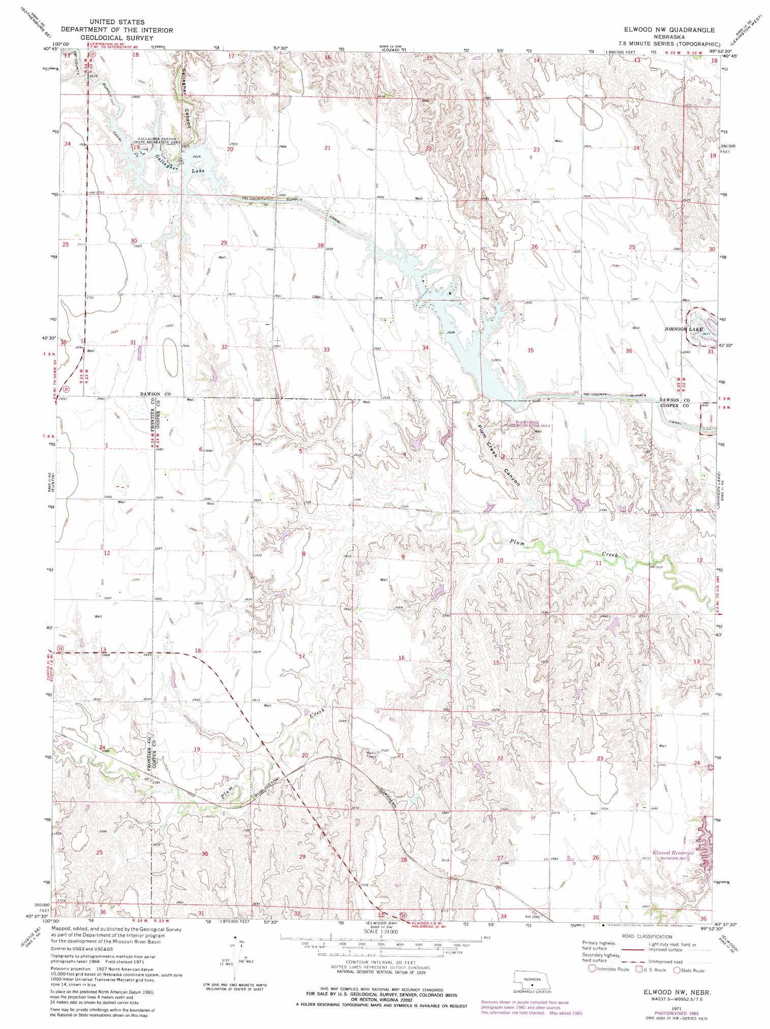
Elwood Nw Topo Map Nebraska
To zoom in, hover over the map of Elwood Nw
USGS Topo Quad 40099f8 - 1:24,000 scale
| Topo Map Name: | Elwood Nw |
| USGS Topo Quad ID: | 40099f8 |
| Print Size: | ca. 21 1/4" wide x 27" high |
| Southeast Coordinates: | 40.625° N latitude / 99.875° W longitude |
| Map Center Coordinates: | 40.6875° N latitude / 99.9375° W longitude |
| U.S. State: | NE |
| Filename: | O40099f8.jpg |
| Download Map JPG Image: | Elwood Nw topo map 1:24,000 scale |
| Map Type: | Topographic |
| Topo Series: | 7.5´ |
| Map Scale: | 1:24,000 |
| Source of Map Images: | United States Geological Survey (USGS) |
| Alternate Map Versions: |
Elwood NW NE 1971, updated 1973 Download PDF Buy paper map Elwood NW NE 1971, updated 1983 Download PDF Buy paper map Elwood NW NE 2011 Download PDF Buy paper map Elwood NW NE 2014 Download PDF Buy paper map |
1:24,000 Topo Quads surrounding Elwood Nw
Gothenburg |
Willow Island |
Cozad Nw |
Buffalo |
Lexington Nw |
Gothenburg Sw |
Gothenburg Se |
Cozad |
Lexington West |
Lexington East |
Farnam |
Eustis |
Elwood Nw |
Johnson Lake |
Bertrand Nw |
Eustis Sw |
Eustis Se |
Elwood Sw |
Elwood |
Bertrand |
Medicine Creek Dam |
Cambridge Ne |
Arapahoe Nw |
Arapahoe Ne |
Oxford Nw |
> Back to 40099e1 at 1:100,000 scale
> Back to 40098a1 at 1:250,000 scale
> Back to U.S. Topo Maps home
Elwood Nw topo map: Gazetteer
Elwood Nw: Dams
Bellamy Dam elevation 786m 2578′Earth Dam Canal Mile 605 elevation 803m 2634′
Earth Dam-Canal Mile 567 Dam elevation 812m 2664′
Earth Dam-Canal Mile 608 Dam elevation 800m 2624′
Franta Dam elevation 823m 2700′
Keller Dam elevation 784m 2572′
Schilling Dam Number 1 elevation 778m 2552′
Schilling Dam Number 2 elevation 782m 2565′
Elwood Nw: Parks
Gallagher Canyon State Recreation Area elevation 815m 2673′Plum Creek State Recreation Area elevation 800m 2624′
Elwood Nw: Reservoirs
Bellamy Reservoir elevation 786m 2578′Franta Reservoir elevation 823m 2700′
Keller Reservoir elevation 784m 2572′
Schilling Reservoir Number 1 elevation 778m 2552′
Schilling Reservoir Number 2 elevation 782m 2565′
Elwood Nw: Valleys
Plum Creek Canyon elevation 773m 2536′Elwood Nw digital topo map on disk
Buy this Elwood Nw topo map showing relief, roads, GPS coordinates and other geographical features, as a high-resolution digital map file on DVD: