Amherst Topo Map Nebraska
To zoom in, hover over the map of Amherst
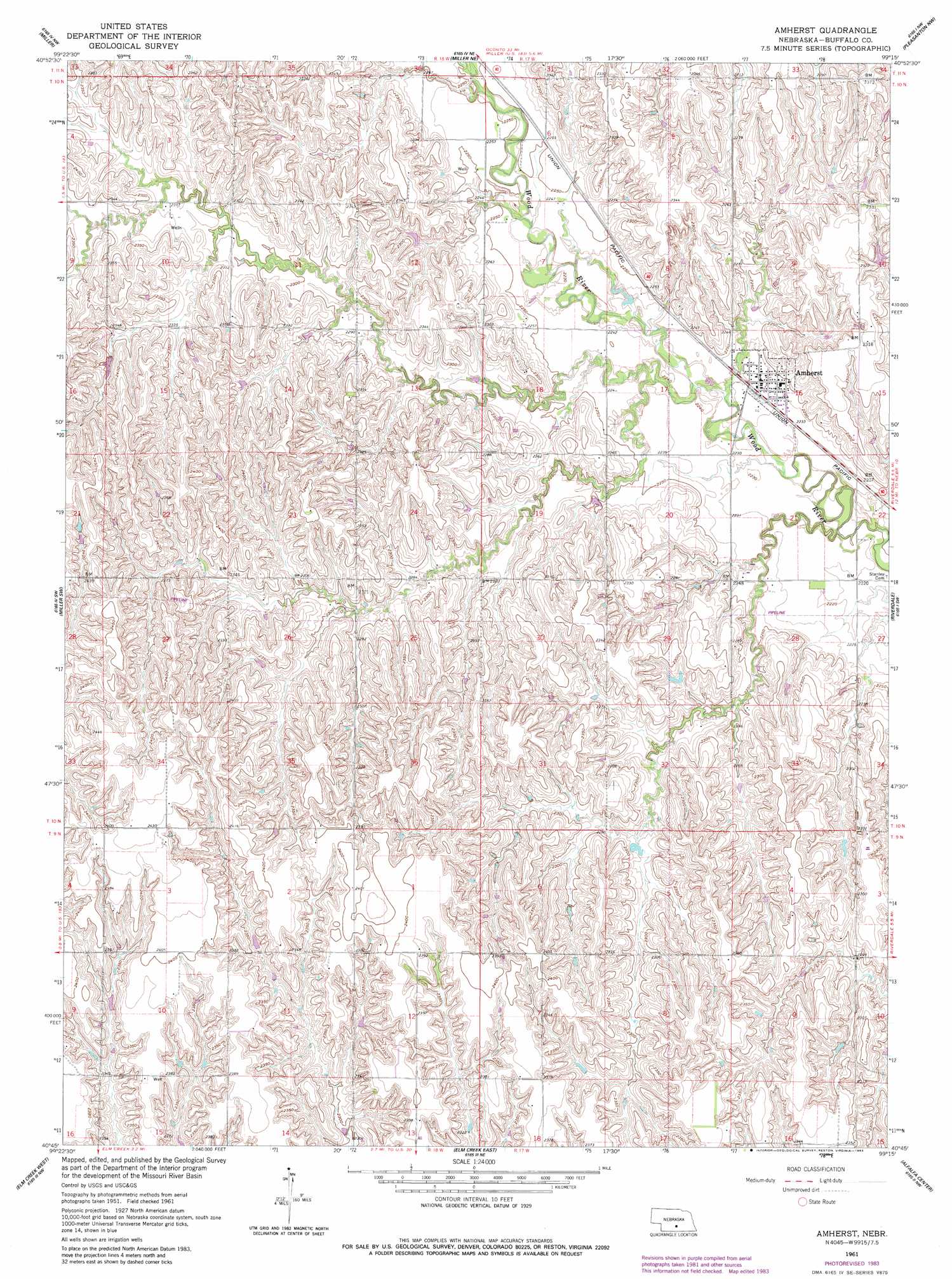
USGS Topo Quad 40099g3 - 1:24,000 scale
| Topo Map Name: | Amherst |
| USGS Topo Quad ID: | 40099g3 |
| Print Size: | ca. 21 1/4" wide x 27" high |
| Southeast Coordinates: | 40.75° N latitude / 99.25° W longitude |
| Map Center Coordinates: | 40.8125° N latitude / 99.3125° W longitude |
| U.S. State: | NE |
| Filename: | O40099g3.jpg |
| Download Map JPG Image: | Amherst topo map 1:24,000 scale |
| Map Type: | Topographic |
| Topo Series: | 7.5´ |
| Map Scale: | 1:24,000 |
| Source of Map Images: | United States Geological Survey (USGS) |
| Alternate Map Versions: |
Amherst NE 1961, updated 1963 Download PDF Buy paper map Amherst NE 1961, updated 1983 Download PDF Buy paper map Amherst NE 2011 Download PDF Buy paper map Amherst NE 2014 Download PDF Buy paper map |
1:24,000 Topo Quads surrounding Amherst
Eddyville |
Mason City Sw |
Mason City Se |
Litchfield Sw |
Hazard |
Sumner |
Miller |
Miller Ne |
Pleasanton Nw |
Pleasanton |
Lexington Se |
Miller Sw |
Amherst |
Riverdale |
Pleasanton Se |
Overton |
Elm Creek West |
Elm Creek East |
Alfalfa Center |
Kearney |
Bertrand Se |
Elm Creek Sw |
Elm Creek Se |
Kearney Sw |
Kearney Se |
> Back to 40099e1 at 1:100,000 scale
> Back to 40098a1 at 1:250,000 scale
> Back to U.S. Topo Maps home
Amherst topo map: Gazetteer
Amherst: Populated Places
Amherst elevation 717m 2352′Amherst: Post Offices
Amherst Post Office elevation 717m 2352′Amherst digital topo map on disk
Buy this Amherst topo map showing relief, roads, GPS coordinates and other geographical features, as a high-resolution digital map file on DVD: