Miller Ne Topo Map Nebraska
To zoom in, hover over the map of Miller Ne
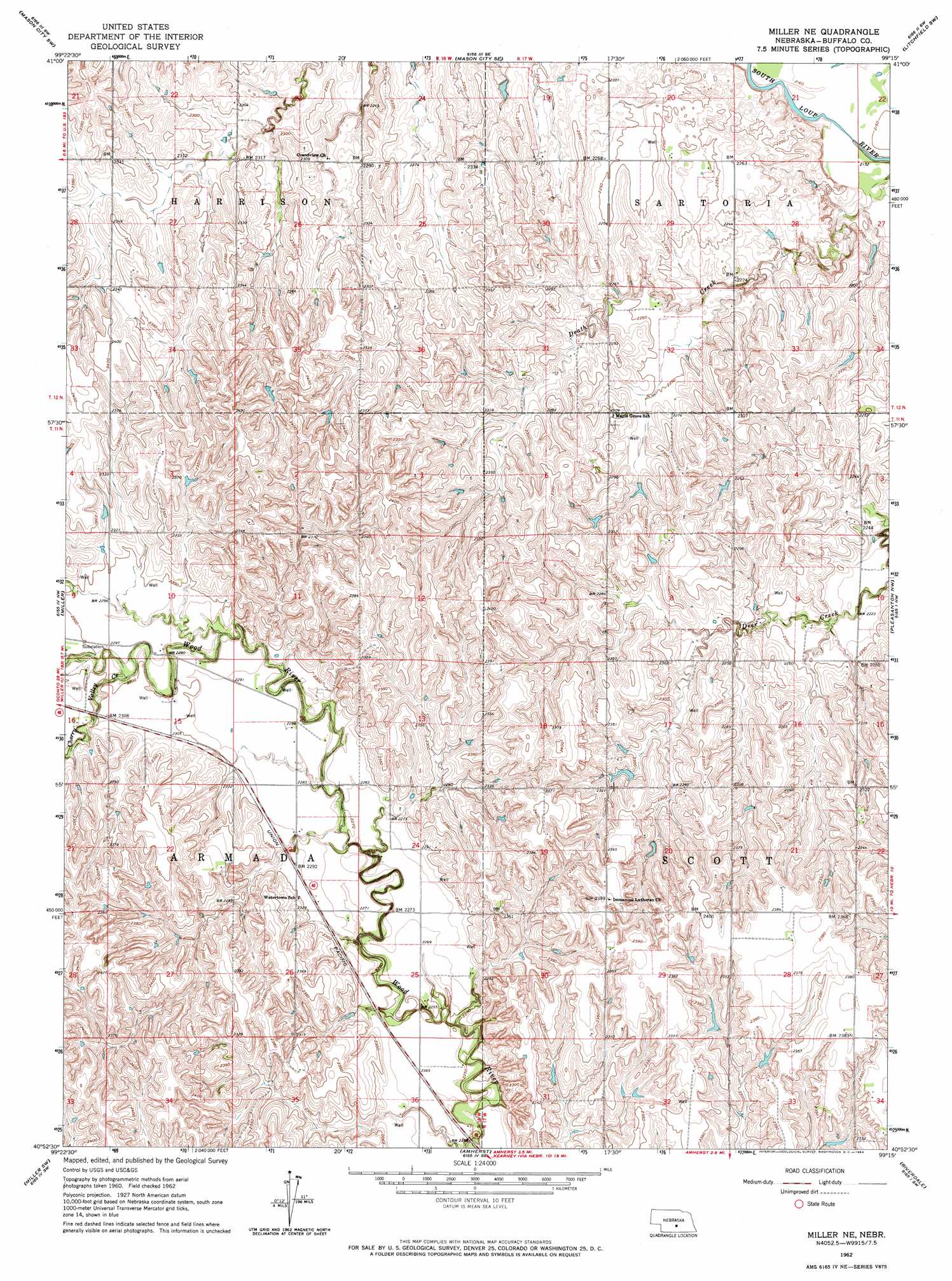
USGS Topo Quad 40099h3 - 1:24,000 scale
| Topo Map Name: | Miller Ne |
| USGS Topo Quad ID: | 40099h3 |
| Print Size: | ca. 21 1/4" wide x 27" high |
| Southeast Coordinates: | 40.875° N latitude / 99.25° W longitude |
| Map Center Coordinates: | 40.9375° N latitude / 99.3125° W longitude |
| U.S. State: | NE |
| Filename: | O40099h3.jpg |
| Download Map JPG Image: | Miller Ne topo map 1:24,000 scale |
| Map Type: | Topographic |
| Topo Series: | 7.5´ |
| Map Scale: | 1:24,000 |
| Source of Map Images: | United States Geological Survey (USGS) |
| Alternate Map Versions: |
Miller NE NE 1962, updated 1964 Download PDF Buy paper map Miller NE NE 2011 Download PDF Buy paper map Miller NE NE 2014 Download PDF Buy paper map |
1:24,000 Topo Quads surrounding Miller Ne
Eddyville Ne |
Mason City Nw |
Mason City |
Litchfield |
Litchfield Ne |
Eddyville |
Mason City Sw |
Mason City Se |
Litchfield Sw |
Hazard |
Sumner |
Miller |
Miller Ne |
Pleasanton Nw |
Pleasanton |
Lexington Se |
Miller Sw |
Amherst |
Riverdale |
Pleasanton Se |
Overton |
Elm Creek West |
Elm Creek East |
Alfalfa Center |
Kearney |
> Back to 40099e1 at 1:100,000 scale
> Back to 40098a1 at 1:250,000 scale
> Back to U.S. Topo Maps home
Miller Ne digital topo map on disk
Buy this Miller Ne topo map showing relief, roads, GPS coordinates and other geographical features, as a high-resolution digital map file on DVD: