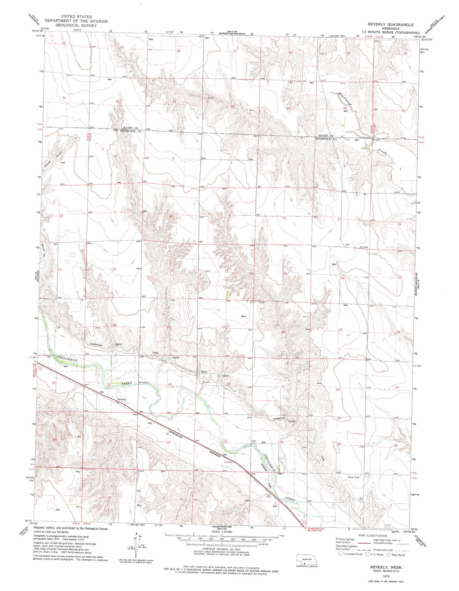
Beverly Topo Map Nebraska
To zoom in, hover over the map of Beverly
USGS Topo Quad 40100c8 - 1:24,000 scale
| Topo Map Name: | Beverly |
| USGS Topo Quad ID: | 40100c8 |
| Print Size: | ca. 21 1/4" wide x 27" high |
| Southeast Coordinates: | 40.25° N latitude / 100.875° W longitude |
| Map Center Coordinates: | 40.3125° N latitude / 100.9375° W longitude |
| U.S. State: | NE |
| Filename: | O40100c8.jpg |
| Download Map JPG Image: | Beverly topo map 1:24,000 scale |
| Map Type: | Topographic |
| Topo Series: | 7.5´ |
| Map Scale: | 1:24,000 |
| Source of Map Images: | United States Geological Survey (USGS) |
| Alternate Map Versions: |
Beverly NE 1973, updated 1977 Download PDF Buy paper map Beverly NE 2011 Download PDF Buy paper map Beverly NE 2014 Download PDF Buy paper map |
1:24,000 Topo Quads surrounding Beverly
Hayes Center Sw |
Hayes Center |
Camp Hayes Lake |
Camp Hayes Lake Se |
Curtis Sw |
Hamlet |
Palisade Ne |
Burger Canyon West |
Burger Canyon East |
Quick |
Palisade Sw |
Palisade |
Beverly |
Burger Canyon Se |
Red Willow Dam |
Stratton |
Trenton |
Culbertson Nw |
Culbertson |
Mccook West |
Trenton Sw |
Trenton Se |
Culbertson Sw |
Culbertson Se |
Mccook Sw |
> Back to 40100a1 at 1:100,000 scale
> Back to 40100a1 at 1:250,000 scale
> Back to U.S. Topo Maps home
Beverly topo map: Gazetteer
Beverly: Canals
Culbertson Canal elevation 831m 2726′Beverly: Dams
Beverly Dam elevation 840m 2755′Nowka Dam elevation 817m 2680′
Beverly: Populated Places
Beverly elevation 813m 2667′Beverly: Post Offices
Beverly Post Office (historical) elevation 813m 2667′Beverly: Reservoirs
Beverly Reservoir elevation 840m 2755′Nowka Reservoir elevation 817m 2680′
Beverly digital topo map on disk
Buy this Beverly topo map showing relief, roads, GPS coordinates and other geographical features, as a high-resolution digital map file on DVD: