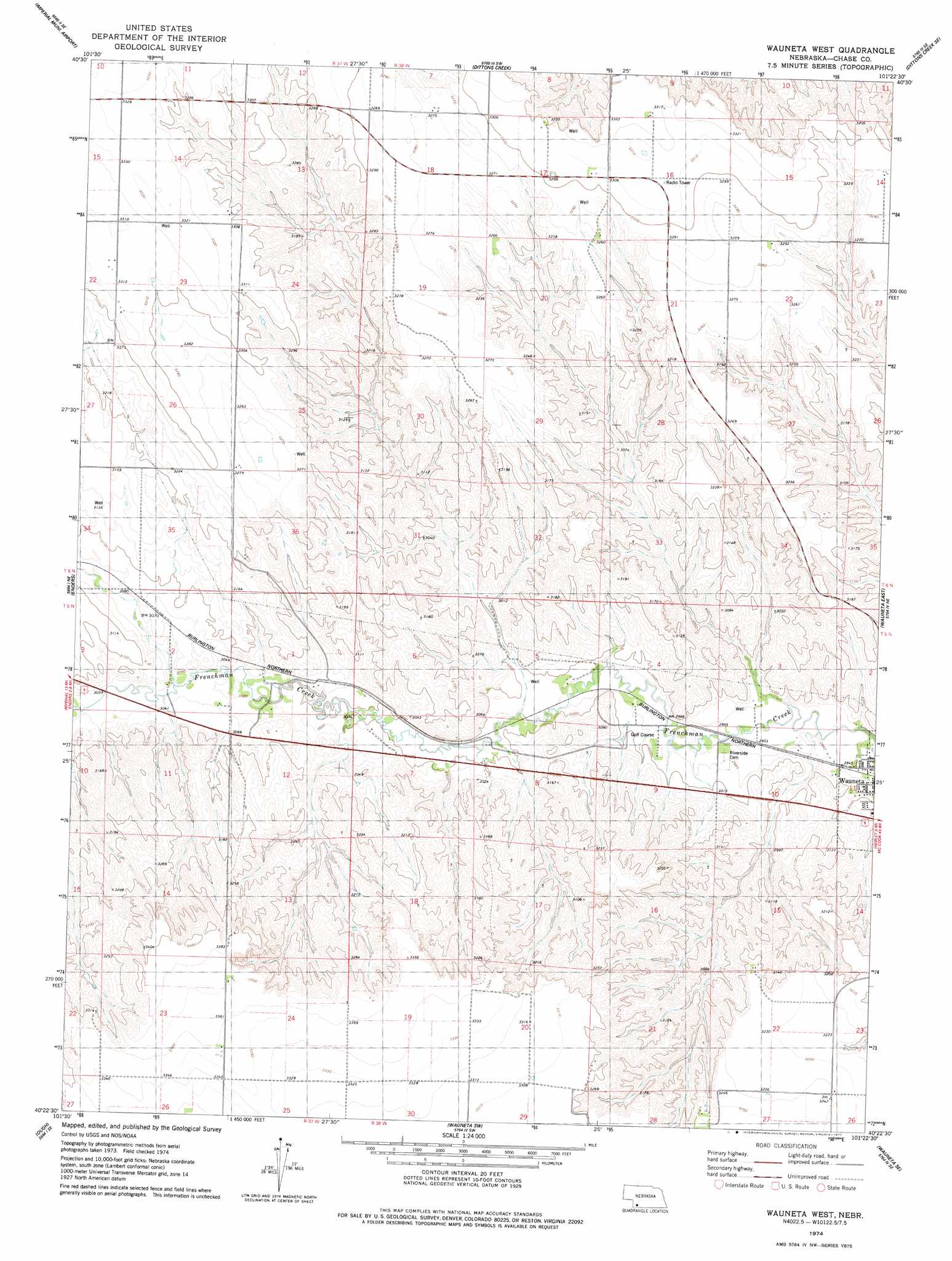
Wauneta West Topo Map Nebraska
To zoom in, hover over the map of Wauneta West
USGS Topo Quad 40101d4 - 1:24,000 scale
| Topo Map Name: | Wauneta West |
| USGS Topo Quad ID: | 40101d4 |
| Print Size: | ca. 21 1/4" wide x 27" high |
| Southeast Coordinates: | 40.375° N latitude / 101.375° W longitude |
| Map Center Coordinates: | 40.4375° N latitude / 101.4375° W longitude |
| U.S. State: | NE |
| Filename: | O40101d4.jpg |
| Download Map JPG Image: | Wauneta West topo map 1:24,000 scale |
| Map Type: | Topographic |
| Topo Series: | 7.5´ |
| Map Scale: | 1:24,000 |
| Source of Map Images: | United States Geological Survey (USGS) |
| Alternate Map Versions: |
Wauneta West NE 1974, updated 1977 Download PDF Buy paper map Wauneta West NE 2011 Download PDF Buy paper map Wauneta West NE 2014 Download PDF Buy paper map |
1:24,000 Topo Quads surrounding Wauneta West
Imperial Nw |
Imperial Ne |
Dittons Creek Nw |
Dittons Creek Ne |
Hayes Center Nw |
Imperial |
Imperial Muni Airport |
Dittons Creek |
Dittons Creek Se |
Hayes Center Sw |
Champion |
Enders |
Wauneta West |
Wauneta East |
Hamlet |
Champion Sw |
Ough |
Wauneta Sw |
Wauneta Se |
Palisade Sw |
Benkelman Nw |
Arrowhead Lake |
Rock Canyon |
Max Ne |
Stratton |
> Back to 40101a1 at 1:100,000 scale
> Back to 40100a1 at 1:250,000 scale
> Back to U.S. Topo Maps home
No gazetteer data is available for the Wauneta West topo map sheet.
Wauneta West digital topo map on disk
Buy this Wauneta West topo map showing relief, roads, GPS coordinates and other geographical features, as a high-resolution digital map file on DVD: