Champion Topo Map Nebraska
To zoom in, hover over the map of Champion
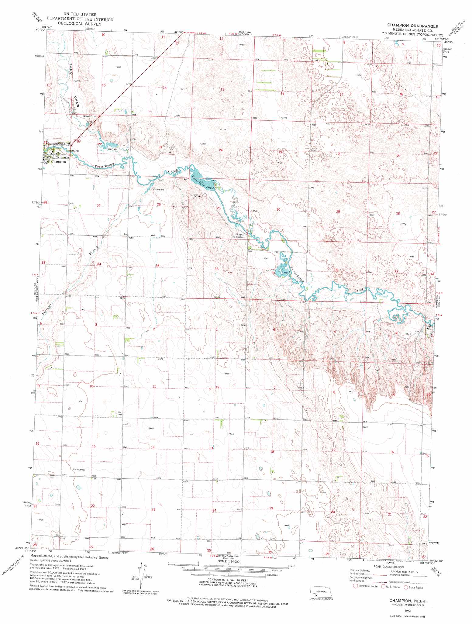
USGS Topo Quad 40101d6 - 1:24,000 scale
| Topo Map Name: | Champion |
| USGS Topo Quad ID: | 40101d6 |
| Print Size: | ca. 21 1/4" wide x 27" high |
| Southeast Coordinates: | 40.375° N latitude / 101.625° W longitude |
| Map Center Coordinates: | 40.4375° N latitude / 101.6875° W longitude |
| U.S. State: | NE |
| Filename: | O40101d6.jpg |
| Download Map JPG Image: | Champion topo map 1:24,000 scale |
| Map Type: | Topographic |
| Topo Series: | 7.5´ |
| Map Scale: | 1:24,000 |
| Source of Map Images: | United States Geological Survey (USGS) |
| Alternate Map Versions: |
Champion NE 1973, updated 1977 Download PDF Buy paper map Champion NE 2011 Download PDF Buy paper map Champion NE 2014 Download PDF Buy paper map |
1:24,000 Topo Quads surrounding Champion
Lamar Nw |
Lamar Ne |
Imperial Nw |
Imperial Ne |
Dittons Creek Nw |
Lamar |
Chase |
Imperial |
Imperial Muni Airport |
Dittons Creek |
Arterburn Lake |
Reservoir Lake |
Champion |
Enders |
Wauneta West |
Reservoir Lake Sw |
Reservoir Lake Se |
Champion Sw |
Ough |
Wauneta Sw |
Haigler Nw |
Haigler Ne |
Benkelman Nw |
Arrowhead Lake |
Rock Canyon |
> Back to 40101a1 at 1:100,000 scale
> Back to 40100a1 at 1:250,000 scale
> Back to U.S. Topo Maps home
Champion topo map: Gazetteer
Champion: Dams
Hoffmeister Dam elevation 970m 3182′Imperial Dam elevation 979m 3211′
Champion: Populated Places
Champion elevation 997m 3270′Champion: Post Offices
Champion Post Office elevation 997m 3270′Champion: Reservoirs
Hoffmeister Reservoir elevation 970m 3182′Imperial Reservoir elevation 979m 3211′
Reservoir Pond elevation 979m 3211′
Champion: Streams
Foerster Branch elevation 982m 3221′Champion: Valleys
Sand Draw elevation 988m 3241′Champion digital topo map on disk
Buy this Champion topo map showing relief, roads, GPS coordinates and other geographical features, as a high-resolution digital map file on DVD: