Snyder Lake Topo Map Colorado
To zoom in, hover over the map of Snyder Lake
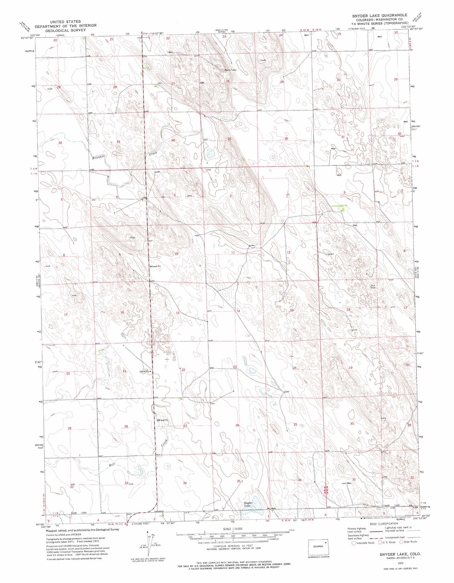
USGS Topo Quad 40102a8 - 1:24,000 scale
| Topo Map Name: | Snyder Lake |
| USGS Topo Quad ID: | 40102a8 |
| Print Size: | ca. 21 1/4" wide x 27" high |
| Southeast Coordinates: | 40° N latitude / 102.875° W longitude |
| Map Center Coordinates: | 40.0625° N latitude / 102.9375° W longitude |
| U.S. State: | CO |
| Filename: | o40102a8.jpg |
| Download Map JPG Image: | Snyder Lake topo map 1:24,000 scale |
| Map Type: | Topographic |
| Topo Series: | 7.5´ |
| Map Scale: | 1:24,000 |
| Source of Map Images: | United States Geological Survey (USGS) |
| Alternate Map Versions: |
Snyder Lake CO 1972, updated 1975 Download PDF Buy paper map Snyder Lake CO 2010 Download PDF Buy paper map Snyder Lake CO 2013 Download PDF Buy paper map Snyder Lake CO 2016 Download PDF Buy paper map |
1:24,000 Topo Quads surrounding Snyder Lake
Buffalo Springs Ranch |
Buffalo Springs Ranch Se |
Burdett |
Lone Star |
Clarkville Sw |
Akron |
Platner |
Otis |
Hyde |
Yuma North |
Akron Sw |
Akron Se |
Snyder Lake |
Otis Se |
Yuma South |
Elba |
Elba Ne |
De Nova Nw |
De Nova Ne |
Beverly Grove |
Elba Sw |
Elba Se |
De Nova |
De Nova Se |
Abarr |
> Back to 40102a1 at 1:100,000 scale
> Back to 40102a1 at 1:250,000 scale
> Back to U.S. Topo Maps home
Snyder Lake topo map: Gazetteer
Snyder Lake: Lakes
Snyder Lake elevation 1335m 4379′Snyder Lake: Streams
Brunker Creek elevation 1324m 4343′Hell Creek elevation 1336m 4383′
Snyder Lake digital topo map on disk
Buy this Snyder Lake topo map showing relief, roads, GPS coordinates and other geographical features, as a high-resolution digital map file on DVD: