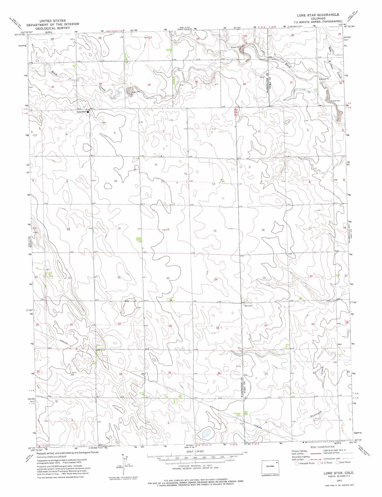
Lone Star Topo Map Colorado
To zoom in, hover over the map of Lone Star
USGS Topo Quad 40102c7 - 1:24,000 scale
| Topo Map Name: | Lone Star |
| USGS Topo Quad ID: | 40102c7 |
| Print Size: | ca. 21 1/4" wide x 27" high |
| Southeast Coordinates: | 40.25° N latitude / 102.75° W longitude |
| Map Center Coordinates: | 40.3125° N latitude / 102.8125° W longitude |
| U.S. State: | CO |
| Filename: | o40102c7.jpg |
| Download Map JPG Image: | Lone Star topo map 1:24,000 scale |
| Map Type: | Topographic |
| Topo Series: | 7.5´ |
| Map Scale: | 1:24,000 |
| Source of Map Images: | United States Geological Survey (USGS) |
| Alternate Map Versions: |
Lone Star CO 1972, updated 1975 Download PDF Buy paper map Lone Star CO 2010 Download PDF Buy paper map Lone Star CO 2013 Download PDF Buy paper map Lone Star CO 2016 Download PDF Buy paper map |
1:24,000 Topo Quads surrounding Lone Star
Reiradon Hill |
Leroy |
Saint Petersburg |
Rockland |
Haxtun Se |
Buffalo Springs Ranch Ne |
Glacken Hill |
New Haven |
Clarkville |
Clarkville Ne |
Buffalo Springs Ranch Se |
Burdett |
Lone Star |
Clarkville Sw |
Clarkville Se |
Platner |
Otis |
Hyde |
Yuma North |
Yuma Ne |
Akron Se |
Snyder Lake |
Otis Se |
Yuma South |
Schramm |
> Back to 40102a1 at 1:100,000 scale
> Back to 40102a1 at 1:250,000 scale
> Back to U.S. Topo Maps home
Lone Star digital topo map on disk
Buy this Lone Star topo map showing relief, roads, GPS coordinates and other geographical features, as a high-resolution digital map file on DVD: