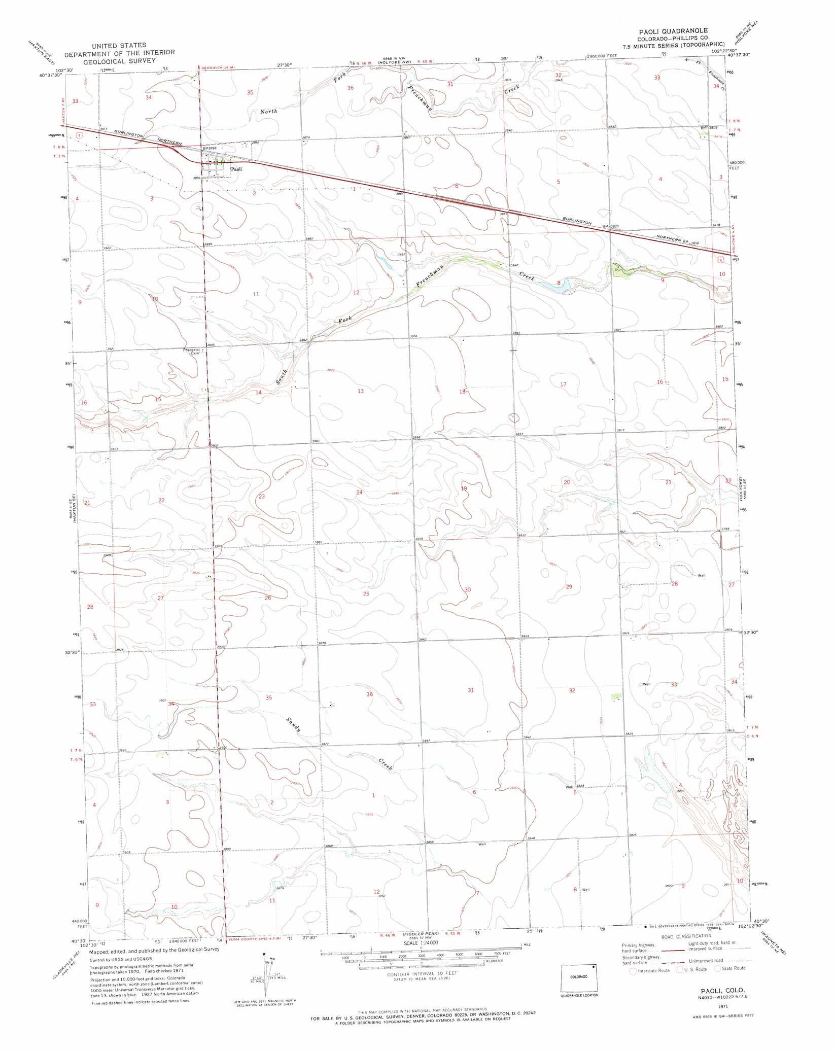
Paoli Topo Map Colorado
To zoom in, hover over the map of Paoli
USGS Topo Quad 40102e4 - 1:24,000 scale
| Topo Map Name: | Paoli |
| USGS Topo Quad ID: | 40102e4 |
| Print Size: | ca. 21 1/4" wide x 27" high |
| Southeast Coordinates: | 40.5° N latitude / 102.375° W longitude |
| Map Center Coordinates: | 40.5625° N latitude / 102.4375° W longitude |
| U.S. State: | CO |
| Filename: | o40102e4.jpg |
| Download Map JPG Image: | Paoli topo map 1:24,000 scale |
| Map Type: | Topographic |
| Topo Series: | 7.5´ |
| Map Scale: | 1:24,000 |
| Source of Map Images: | United States Geological Survey (USGS) |
| Alternate Map Versions: |
Paoli CO 1971, updated 1973 Download PDF Buy paper map Paoli CO 2010 Download PDF Buy paper map Paoli CO 2013 Download PDF Buy paper map Paoli CO 2016 Download PDF Buy paper map |
1:24,000 Topo Quads surrounding Paoli
Tamarack Ranch |
Marks Butte |
Julesburg Sw |
Julesburg Se |
Venango Sw |
Haxtun West |
Haxtun East |
Holyoke Nw |
Holyoke Ne |
Amherst |
Rockland |
Haxtun Se |
Paoli |
Holyoke |
Amherst Sw |
Clarkville |
Clarkville Ne |
Fiddler Peak |
Wauneta Ne |
Alvin Nw |
Clarkville Sw |
Clarkville Se |
Old Baldy |
Wauneta |
Alvin Sw |
> Back to 40102e1 at 1:100,000 scale
> Back to 40102a1 at 1:250,000 scale
> Back to U.S. Topo Maps home
Paoli topo map: Gazetteer
Paoli: Dams
Frenchman Creek Dam elevation 1187m 3894′Paoli: Populated Places
Paoli elevation 1187m 3894′Paoli: Reservoirs
Frenchman Creek Reservoir elevation 1187m 3894′Paoli: Streams
Sandy Creek elevation 1165m 3822′Paoli digital topo map on disk
Buy this Paoli topo map showing relief, roads, GPS coordinates and other geographical features, as a high-resolution digital map file on DVD: