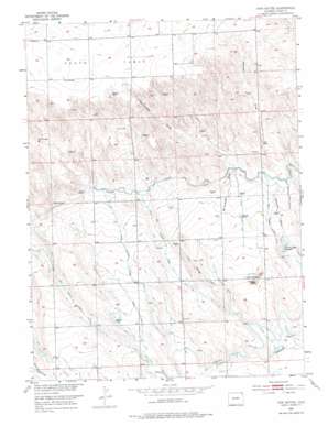
Twin Buttes Topo Map Colorado
To zoom in, hover over the map of Twin Buttes
USGS Topo Quad 40102h7 - 1:24,000 scale
| Topo Map Name: | Twin Buttes |
| USGS Topo Quad ID: | 40102h7 |
| Print Size: | ca. 21 1/4" wide x 27" high |
| Southeast Coordinates: | 40.875° N latitude / 102.75° W longitude |
| Map Center Coordinates: | 40.9375° N latitude / 102.8125° W longitude |
| U.S. State: | CO |
| Filename: | o40102h7.jpg |
| Download Map JPG Image: | Twin Buttes topo map 1:24,000 scale |
| Map Type: | Topographic |
| Topo Series: | 7.5´ |
| Map Scale: | 1:24,000 |
| Source of Map Images: | United States Geological Survey (USGS) |
| Alternate Map Versions: |
Twin Buttes CO 1953, updated 1954 Download PDF Buy paper map Twin Buttes CO 1953, updated 1975 Download PDF Buy paper map Twin Buttes CO 1971, updated 1973 Download PDF Buy paper map Twin Buttes CO 2010 Download PDF Buy paper map Twin Buttes CO 2013 Download PDF Buy paper map Twin Buttes CO 2016 Download PDF Buy paper map |
1:24,000 Topo Quads surrounding Twin Buttes
> Back to 40102e1 at 1:100,000 scale
> Back to 40102a1 at 1:250,000 scale
> Back to U.S. Topo Maps home
Twin Buttes topo map: Gazetteer
Twin Buttes: Canals
Byers Ditch elevation 1155m 3789′Harmony Ditch Number 1 elevation 1139m 3736′
Johnson Draw Reservoir elevation 1154m 3786′
North Sterling Lateral Number 44 elevation 1185m 3887′
North Sterling Lateral Number 46 elevation 1179m 3868′
North Sterling Lateral Number 47 elevation 1188m 3897′
North Sterling Lateral Number 52 elevation 1174m 3851′
North Sterling Lateral Number 52 B elevation 1187m 3894′
Twin Buttes Ditch elevation 1176m 3858′
Twin Buttes: Streams
Duck Creek elevation 1130m 3707′Twin Buttes: Summits
Twin Buttes elevation 1178m 3864′Twin Buttes: Valleys
Hawk Springs Draw elevation 1144m 3753′McCracken Draw elevation 1154m 3786′
Twin Buttes digital topo map on disk
Buy this Twin Buttes topo map showing relief, roads, GPS coordinates and other geographical features, as a high-resolution digital map file on DVD:


