Dead Horse Springs Topo Map Colorado
To zoom in, hover over the map of Dead Horse Springs
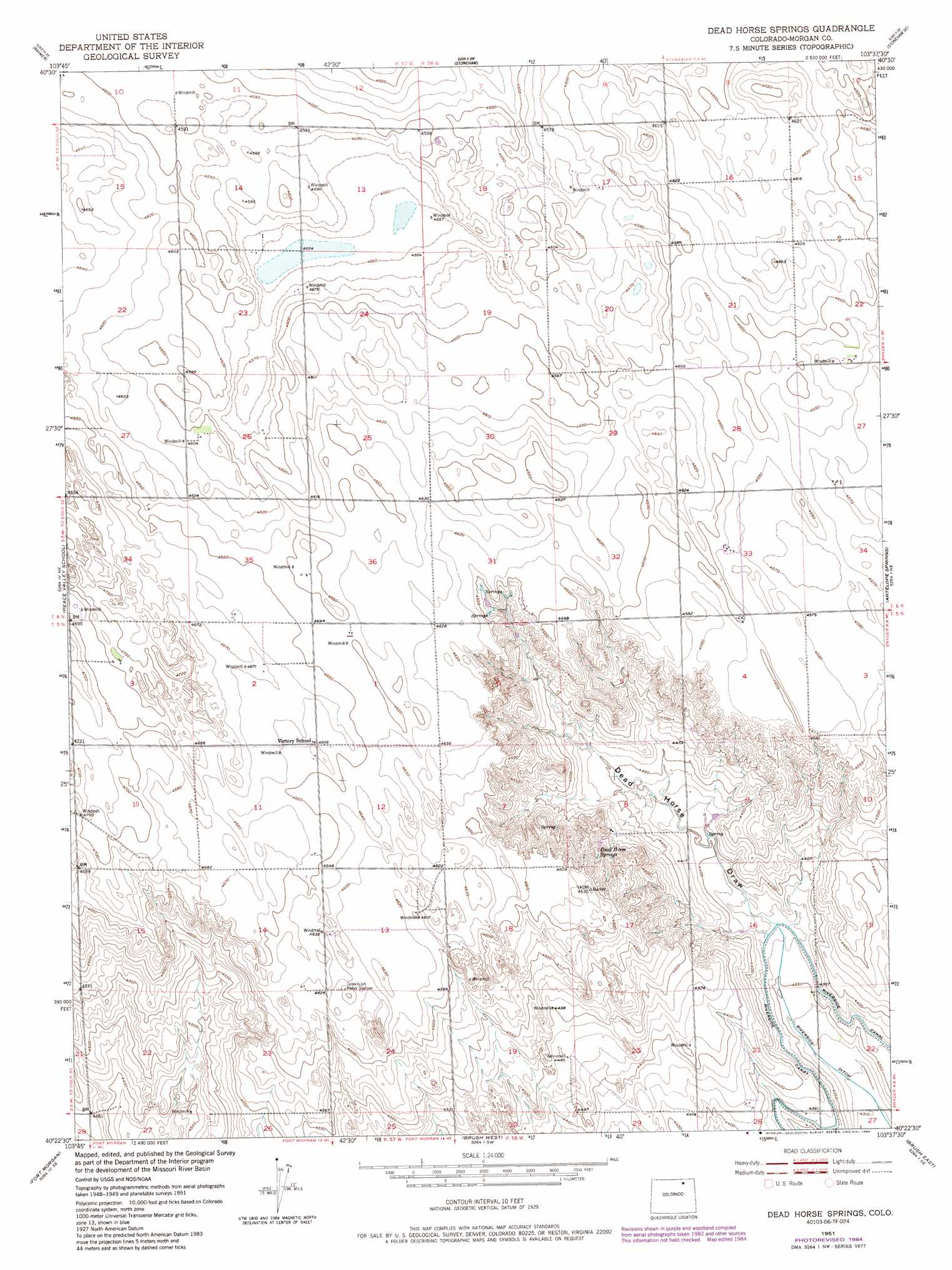
USGS Topo Quad 40103d6 - 1:24,000 scale
| Topo Map Name: | Dead Horse Springs |
| USGS Topo Quad ID: | 40103d6 |
| Print Size: | ca. 21 1/4" wide x 27" high |
| Southeast Coordinates: | 40.375° N latitude / 103.625° W longitude |
| Map Center Coordinates: | 40.4375° N latitude / 103.6875° W longitude |
| U.S. State: | CO |
| Filename: | o40103d6.jpg |
| Download Map JPG Image: | Dead Horse Springs topo map 1:24,000 scale |
| Map Type: | Topographic |
| Topo Series: | 7.5´ |
| Map Scale: | 1:24,000 |
| Source of Map Images: | United States Geological Survey (USGS) |
| Alternate Map Versions: |
Dead Horse Springs CO 1951, updated 1952 Download PDF Buy paper map Dead Horse Springs CO 1951, updated 1952 Download PDF Buy paper map Dead Horse Springs CO 1951, updated 1973 Download PDF Buy paper map Dead Horse Springs CO 1951, updated 1984 Download PDF Buy paper map Dead Horse Springs CO 2010 Download PDF Buy paper map Dead Horse Springs CO 2013 Download PDF Buy paper map Dead Horse Springs CO 2016 Download PDF Buy paper map |
1:24,000 Topo Quads surrounding Dead Horse Springs
Raymer Nw |
Raymer Ne |
Stoneham Nw |
Stoneham Ne |
Wild Horse Lake |
Buckingham |
Raymer |
Stoneham |
Stoneham Se |
Willard |
Judson Hills |
Peace Valley School |
Dead Horse Springs |
Antelope Springs |
Messex |
Weldona |
Fort Morgan |
Brush West |
Brush East |
Merino Sw |
Vallery |
Lamb |
Round Top |
Miller Ranch |
Pinneo |
> Back to 40103a1 at 1:100,000 scale
> Back to 40102a1 at 1:250,000 scale
> Back to U.S. Topo Maps home
Dead Horse Springs topo map: Gazetteer
Dead Horse Springs: Canals
Riverside Ditch elevation 1316m 4317′Dead Horse Springs: Springs
Dead Horse Springs elevation 1382m 4534′Dead Horse Springs digital topo map on disk
Buy this Dead Horse Springs topo map showing relief, roads, GPS coordinates and other geographical features, as a high-resolution digital map file on DVD: