Sterling South Topo Map Colorado
To zoom in, hover over the map of Sterling South
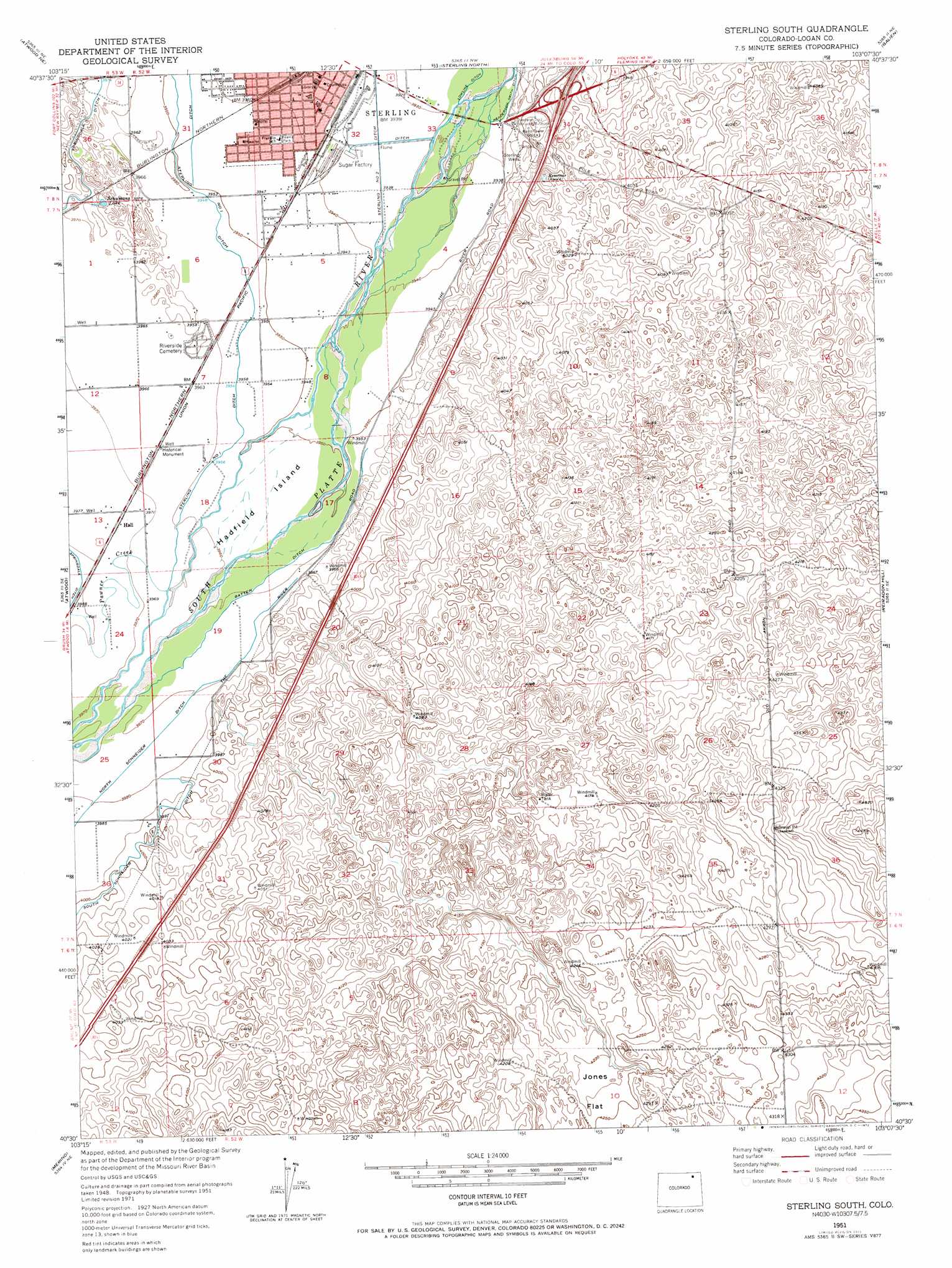
USGS Topo Quad 40103e2 - 1:24,000 scale
| Topo Map Name: | Sterling South |
| USGS Topo Quad ID: | 40103e2 |
| Print Size: | ca. 21 1/4" wide x 27" high |
| Southeast Coordinates: | 40.5° N latitude / 103.125° W longitude |
| Map Center Coordinates: | 40.5625° N latitude / 103.1875° W longitude |
| U.S. State: | CO |
| Filename: | o40103e2.jpg |
| Download Map JPG Image: | Sterling South topo map 1:24,000 scale |
| Map Type: | Topographic |
| Topo Series: | 7.5´ |
| Map Scale: | 1:24,000 |
| Source of Map Images: | United States Geological Survey (USGS) |
| Alternate Map Versions: |
Sterling South CO 1951, updated 1952 Download PDF Buy paper map Sterling South CO 1951, updated 1969 Download PDF Buy paper map Sterling South CO 1951, updated 1972 Download PDF Buy paper map Sterling South CO 2010 Download PDF Buy paper map Sterling South CO 2013 Download PDF Buy paper map Sterling South CO 2016 Download PDF Buy paper map |
1:24,000 Topo Quads surrounding Sterling South
Westplains |
North Sterling Reservoir |
Padroni |
Iliff |
Proctor |
Wild Horse Lake |
Atwood Ne |
Sterling North |
Galien |
Uhler Ranch |
Willard |
Atwood |
Sterling South |
Reiradon Hill |
Leroy |
Messex |
Merino |
Buffalo Springs Ranch Nw |
Buffalo Springs Ranch Ne |
Glacken Hill |
Merino Sw |
Merino Se |
Buffalo Springs Ranch |
Buffalo Springs Ranch Se |
Burdett |
> Back to 40103e1 at 1:100,000 scale
> Back to 40102a1 at 1:250,000 scale
> Back to U.S. Topo Maps home
Sterling South topo map: Gazetteer
Sterling South: Airports
Sterling Regional Medical Center Heliport elevation 1203m 3946′Sterling South: Canals
Batten Ditch elevation 1207m 3959′North Schneider Ditch elevation 1214m 3982′
Sterling South: Flats
Jones Flat elevation 1293m 4242′Sterling South: Islands
Hadfield Island elevation 1206m 3956′Sterling South: Lakes
Schumans Lake elevation 1206m 3956′Sterling South: Mines
Northeastern Pit elevation 1201m 3940′Pre-Ten Pit elevation 1201m 3940′
Sterling Ready Mix Pit elevation 1201m 3940′
Van Gundy Pit elevation 1201m 3940′
Sterling South: Parks
Cheairs Park elevation 1202m 3943′Columbine Park elevation 1202m 3943′
Overland Trail Park and Museum elevation 1199m 3933′
Sterling South: Populated Places
Twin Mills elevation 1280m 4199′Sterling South: Streams
Pawnee Creek elevation 1208m 3963′Sterling South: Wells
Sterling Wells elevation 1204m 3950′Sterling South digital topo map on disk
Buy this Sterling South topo map showing relief, roads, GPS coordinates and other geographical features, as a high-resolution digital map file on DVD: