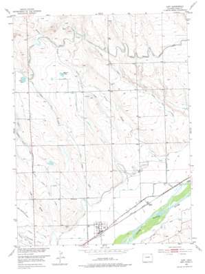
Iliff Topo Map Colorado
To zoom in, hover over the map of Iliff
USGS Topo Quad 40103g1 - 1:24,000 scale
| Topo Map Name: | Iliff |
| USGS Topo Quad ID: | 40103g1 |
| Print Size: | ca. 21 1/4" wide x 27" high |
| Southeast Coordinates: | 40.75° N latitude / 103° W longitude |
| Map Center Coordinates: | 40.8125° N latitude / 103.0625° W longitude |
| U.S. State: | CO |
| Filename: | o40103g1.jpg |
| Download Map JPG Image: | Iliff topo map 1:24,000 scale |
| Map Type: | Topographic |
| Topo Series: | 7.5´ |
| Map Scale: | 1:24,000 |
| Source of Map Images: | United States Geological Survey (USGS) |
| Alternate Map Versions: |
Iliff CO 1951, updated 1953 Download PDF Buy paper map Iliff CO 1951, updated 1975 Download PDF Buy paper map Iliff CO 2010 Download PDF Buy paper map Iliff CO 2013 Download PDF Buy paper map Iliff CO 2016 Download PDF Buy paper map |
1:24,000 Topo Quads surrounding Iliff
> Back to 40103e1 at 1:100,000 scale
> Back to 40102a1 at 1:250,000 scale
> Back to U.S. Topo Maps home
Iliff topo map: Gazetteer
Iliff: Canals
Gillette Number 26 Lateral elevation 1201m 3940′Iliff Ditch elevation 1165m 3822′
Iliff Platte Valley Ditch elevation 1172m 3845′
Naugle Number 27 Lateral elevation 1209m 3966′
North Sterling Number 22 Lateral elevation 1205m 3953′
North Sterling Number 25 Lateral elevation 1208m 3963′
North Sterling Outlet Canal elevation 1219m 3999′
Iliff: Dams
Breidenbach Dam elevation 1203m 3946′Iliff: Lakes
Larson Pond elevation 1216m 3989′McKenzie Pond elevation 1200m 3937′
Iliff: Populated Places
Griff elevation 1162m 3812′Iliff elevation 1170m 3838′
Selma elevation 1164m 3818′
Iliff: Reservoirs
Breidenbach Reservoir elevation 1203m 3946′Iliff: Streams
East Lewis Creek elevation 1201m 3940′Lewis Creek elevation 1161m 3809′
Iliff: Valleys
Trap Draw elevation 1176m 3858′Iliff digital topo map on disk
Buy this Iliff topo map showing relief, roads, GPS coordinates and other geographical features, as a high-resolution digital map file on DVD:


