Gatehook Spring Topo Map Colorado
To zoom in, hover over the map of Gatehook Spring
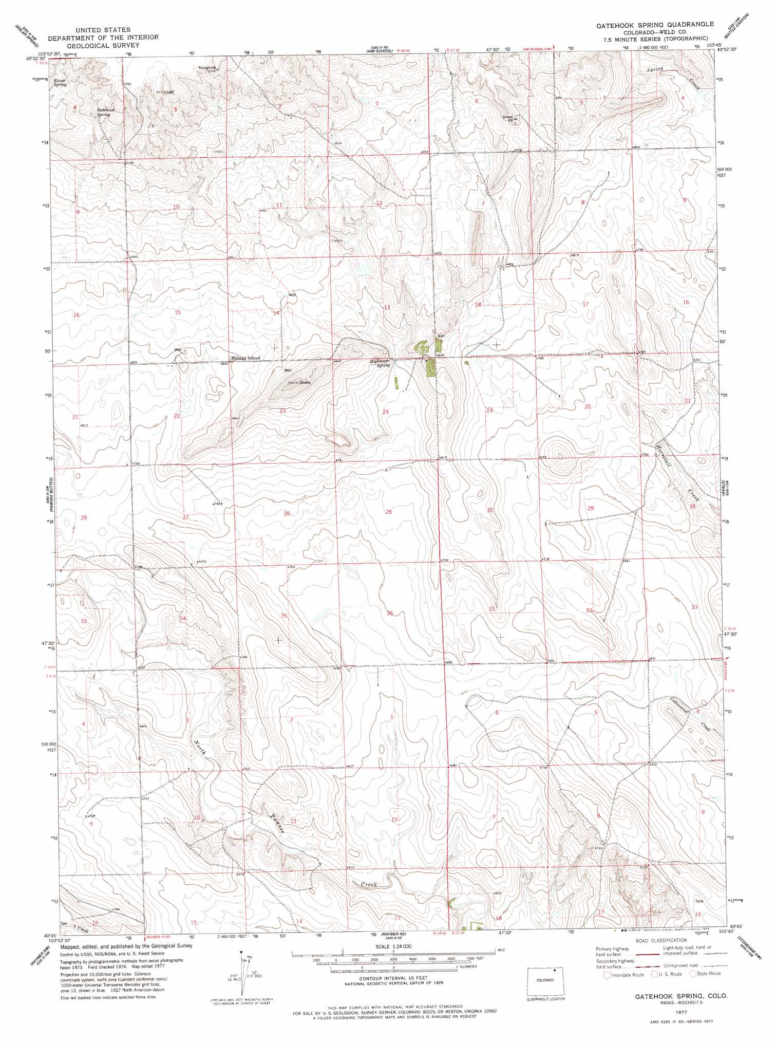
USGS Topo Quad 40103g7 - 1:24,000 scale
| Topo Map Name: | Gatehook Spring |
| USGS Topo Quad ID: | 40103g7 |
| Print Size: | ca. 21 1/4" wide x 27" high |
| Southeast Coordinates: | 40.75° N latitude / 103.75° W longitude |
| Map Center Coordinates: | 40.8125° N latitude / 103.8125° W longitude |
| U.S. State: | CO |
| Filename: | o40103g7.jpg |
| Download Map JPG Image: | Gatehook Spring topo map 1:24,000 scale |
| Map Type: | Topographic |
| Topo Series: | 7.5´ |
| Map Scale: | 1:24,000 |
| Source of Map Images: | United States Geological Survey (USGS) |
| Alternate Map Versions: |
Gatehook Spring CO 1977, updated 1978 Download PDF Buy paper map Gatehook Spring CO 1997, updated 2000 Download PDF Buy paper map Gatehook Spring CO 2011 Download PDF Buy paper map Gatehook Spring CO 2013 Download PDF Buy paper map Gatehook Spring CO 2016 Download PDF Buy paper map |
| FStopo: | US Forest Service topo Gatehook Spring is available: Download FStopo PDF Download FStopo TIF |
1:24,000 Topo Quads surrounding Gatehook Spring
Pine Bluffs Se |
Bushnell Sw |
Bushnell Se |
Kimball Sw |
Kimball Se |
Grover Ne |
Dolan Spring |
Vim School |
Battle Canyon |
Dipper Spring |
Grover Se |
Pawnee Buttes |
Gatehook Spring |
Avalo |
Avalo Se |
Keota |
Raymer Nw |
Raymer Ne |
Stoneham Nw |
Stoneham Ne |
Keota Se |
Buckingham |
Raymer |
Stoneham |
Stoneham Se |
> Back to 40103e1 at 1:100,000 scale
> Back to 40102a1 at 1:250,000 scale
> Back to U.S. Topo Maps home
Gatehook Spring topo map: Gazetteer
Gatehook Spring: Springs
Gatehook Spring elevation 1591m 5219′Hightower Spring elevation 1470m 4822′
Gatehook Spring digital topo map on disk
Buy this Gatehook Spring topo map showing relief, roads, GPS coordinates and other geographical features, as a high-resolution digital map file on DVD: