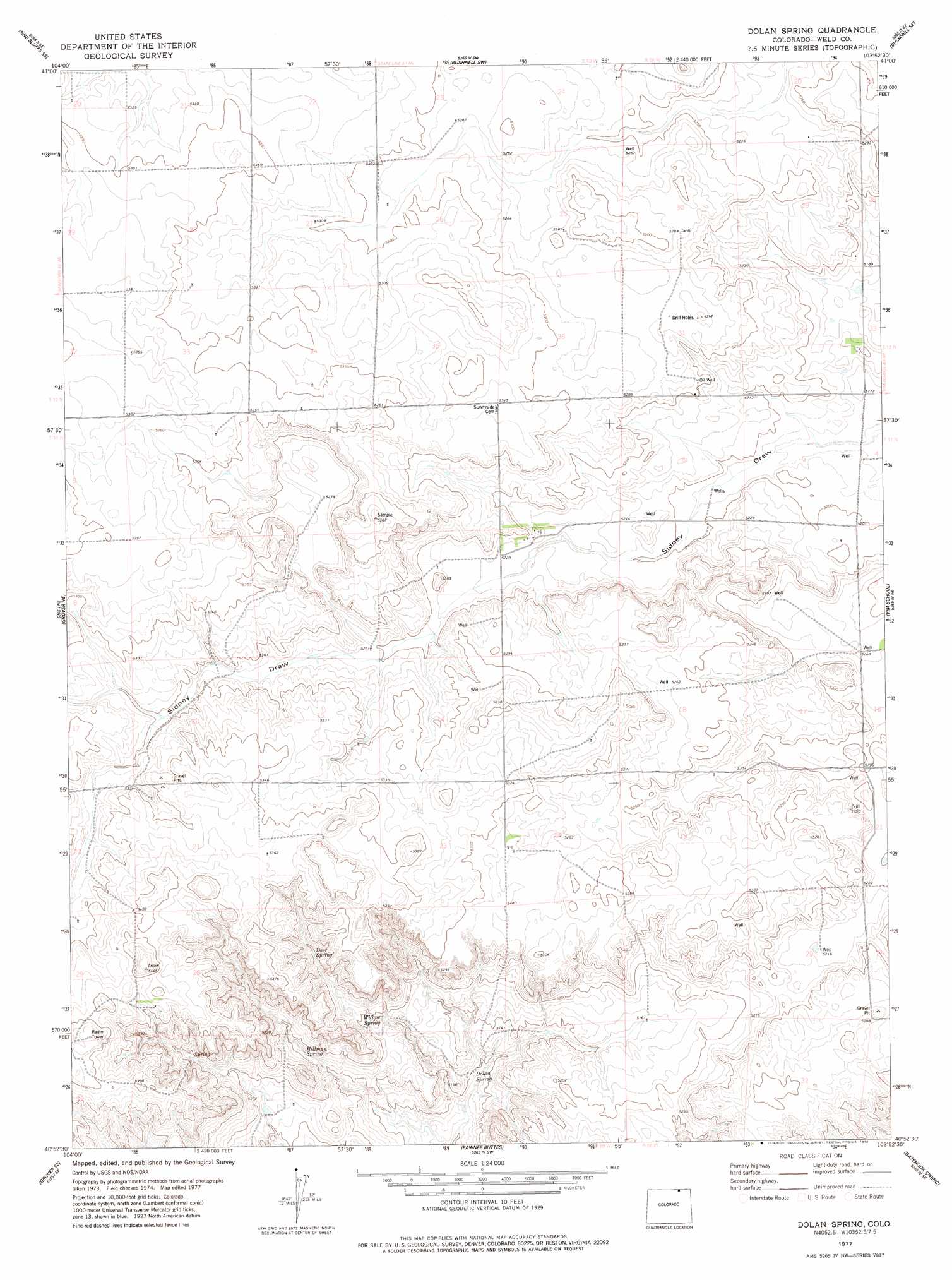
Dolan Spring Topo Map Colorado
To zoom in, hover over the map of Dolan Spring
USGS Topo Quad 40103h8 - 1:24,000 scale
| Topo Map Name: | Dolan Spring |
| USGS Topo Quad ID: | 40103h8 |
| Print Size: | ca. 21 1/4" wide x 27" high |
| Southeast Coordinates: | 40.875° N latitude / 103.875° W longitude |
| Map Center Coordinates: | 40.9375° N latitude / 103.9375° W longitude |
| U.S. State: | CO |
| Filename: | o40103h8.jpg |
| Download Map JPG Image: | Dolan Spring topo map 1:24,000 scale |
| Map Type: | Topographic |
| Topo Series: | 7.5´ |
| Map Scale: | 1:24,000 |
| Source of Map Images: | United States Geological Survey (USGS) |
| Alternate Map Versions: |
Dolan Spring CO 1977, updated 1978 Download PDF Buy paper map Dolan Spring CO 1997, updated 2000 Download PDF Buy paper map Dolan Spring CO 2011 Download PDF Buy paper map Dolan Spring CO 2013 Download PDF Buy paper map Dolan Spring CO 2016 Download PDF Buy paper map |
| FStopo: | US Forest Service topo Dolan Spring is available: Download FStopo PDF Download FStopo TIF |
1:24,000 Topo Quads surrounding Dolan Spring
Tracy |
Pine Bluffs |
Bushnell |
Oliver Reservoir |
Kimball |
Pine Bluffs Sw |
Pine Bluffs Se |
Bushnell Sw |
Bushnell Se |
Kimball Sw |
Grover North |
Grover Ne |
Dolan Spring |
Vim School |
Battle Canyon |
Grover South |
Grover Se |
Pawnee Buttes |
Gatehook Spring |
Avalo |
Keota Nw |
Keota |
Raymer Nw |
Raymer Ne |
Stoneham Nw |
> Back to 40103e1 at 1:100,000 scale
> Back to 40102a1 at 1:250,000 scale
> Back to U.S. Topo Maps home
Dolan Spring topo map: Gazetteer
Dolan Spring: Oilfields
Mustang Oilfield elevation 1603m 5259′Dolan Spring: Springs
Deer Spring elevation 1598m 5242′Dolan Spring elevation 1552m 5091′
Hillman Spring elevation 1576m 5170′
Willow Spring elevation 1578m 5177′
Dolan Spring: Wells
Andy Larkspur Water Well elevation 1583m 5193′Gap Water Well elevation 1590m 5216′
Three Corner Water Well elevation 1592m 5223′
Dolan Spring digital topo map on disk
Buy this Dolan Spring topo map showing relief, roads, GPS coordinates and other geographical features, as a high-resolution digital map file on DVD: