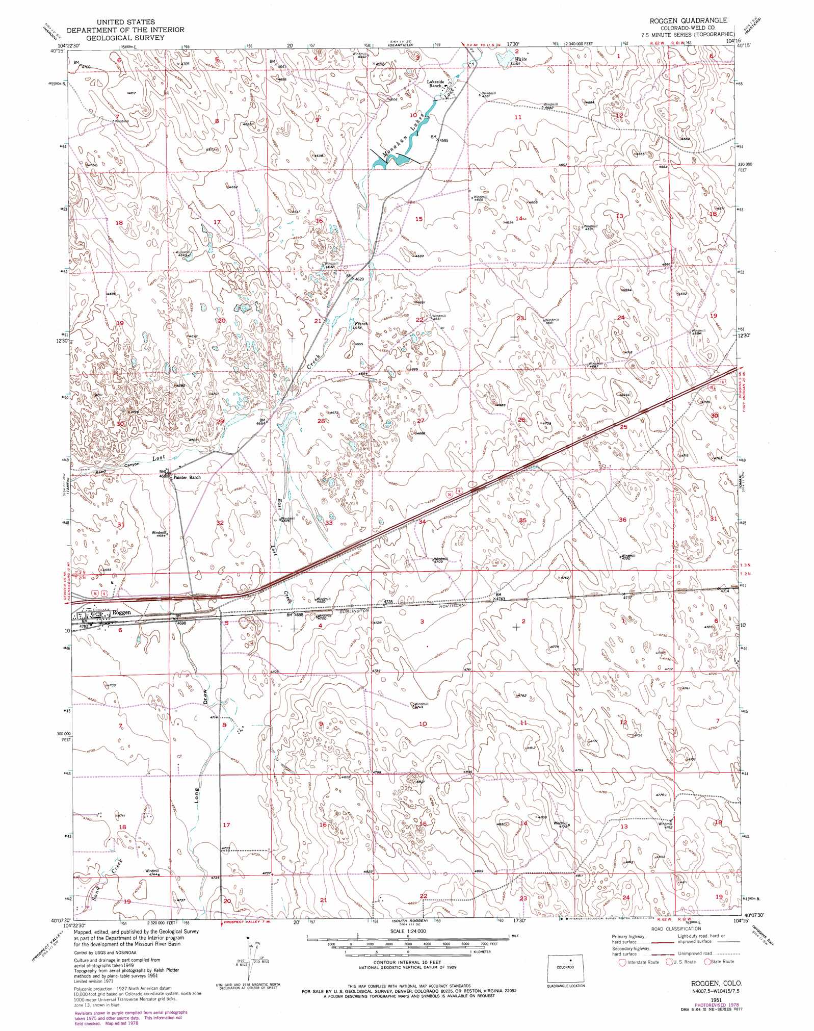
Roggen Topo Map Colorado
To zoom in, hover over the map of Roggen
USGS Topo Quad 40104b3 - 1:24,000 scale
| Topo Map Name: | Roggen |
| USGS Topo Quad ID: | 40104b3 |
| Print Size: | ca. 21 1/4" wide x 27" high |
| Southeast Coordinates: | 40.125° N latitude / 104.25° W longitude |
| Map Center Coordinates: | 40.1875° N latitude / 104.3125° W longitude |
| U.S. State: | CO |
| Filename: | o40104b3.jpg |
| Download Map JPG Image: | Roggen topo map 1:24,000 scale |
| Map Type: | Topographic |
| Topo Series: | 7.5´ |
| Map Scale: | 1:24,000 |
| Source of Map Images: | United States Geological Survey (USGS) |
| Alternate Map Versions: |
Roggen CO 1951, updated 1952 Download PDF Buy paper map Roggen CO 1951, updated 1972 Download PDF Buy paper map Roggen CO 1951, updated 1979 Download PDF Buy paper map Roggen CO 2010 Download PDF Buy paper map Roggen CO 2013 Download PDF Buy paper map Roggen CO 2016 Download PDF Buy paper map |
1:24,000 Topo Quads surrounding Roggen
Kersey |
Barnesville |
Point Of Rocks |
Greasewood Lake |
Sunken Lake |
Valley View School |
Hardin |
Dearfield |
Masters |
Orchard |
Klug Ranch |
Tampa |
Roggen |
Omar |
Wiggins |
Keenesburg |
Prospect Valley |
South Roggen |
Wiggins Sw |
Hoyt |
Horse Creek |
Sunnydale |
Living Springs |
Leader Nw |
Leader |
> Back to 40104a1 at 1:100,000 scale
> Back to 40104a1 at 1:250,000 scale
> Back to U.S. Topo Maps home
Roggen topo map: Gazetteer
Roggen: Dams
Lost Creek Number 1 Dam elevation 1402m 4599′Roggen: Populated Places
Roggen elevation 1436m 4711′Roggen: Reservoirs
French Lake elevation 1414m 4639′Lost Creek Reservoir Number 1 elevation 1402m 4599′
Monahan Lakes elevation 1401m 4596′
Waite Lake elevation 1393m 4570′
Roggen: Streams
East Lost Creek elevation 1424m 4671′Lost Creek elevation 1426m 4678′
Sand Creek elevation 1435m 4708′
Roggen: Valleys
Long Draw elevation 1426m 4678′Sand Canyon elevation 1426m 4678′
Roggen digital topo map on disk
Buy this Roggen topo map showing relief, roads, GPS coordinates and other geographical features, as a high-resolution digital map file on DVD: