Hardin Topo Map Colorado
To zoom in, hover over the map of Hardin
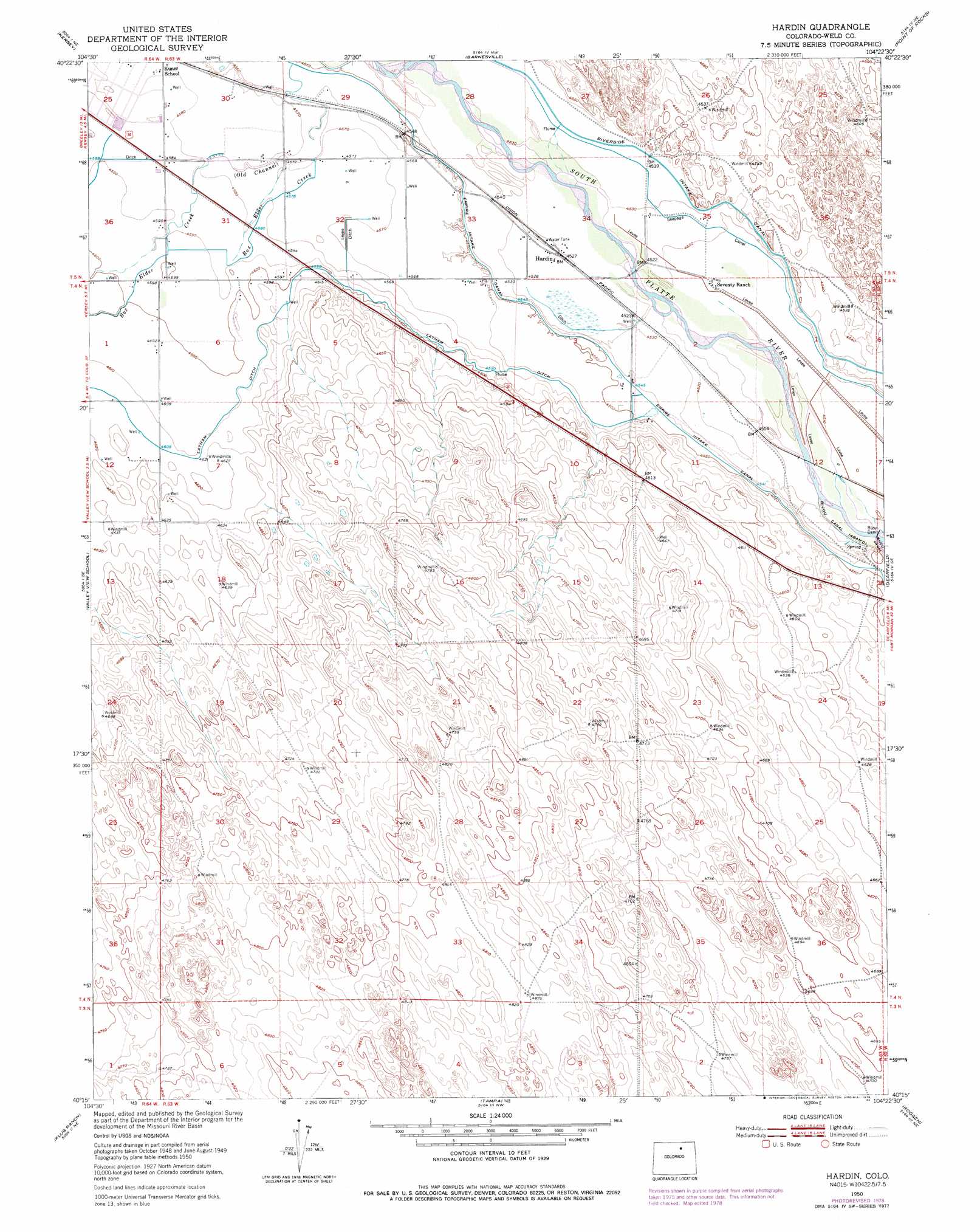
USGS Topo Quad 40104c4 - 1:24,000 scale
| Topo Map Name: | Hardin |
| USGS Topo Quad ID: | 40104c4 |
| Print Size: | ca. 21 1/4" wide x 27" high |
| Southeast Coordinates: | 40.25° N latitude / 104.375° W longitude |
| Map Center Coordinates: | 40.3125° N latitude / 104.4375° W longitude |
| U.S. State: | CO |
| Filename: | o40104c4.jpg |
| Download Map JPG Image: | Hardin topo map 1:24,000 scale |
| Map Type: | Topographic |
| Topo Series: | 7.5´ |
| Map Scale: | 1:24,000 |
| Source of Map Images: | United States Geological Survey (USGS) |
| Alternate Map Versions: |
Hardin CO 1950, updated 1971 Download PDF Buy paper map Hardin CO 1950, updated 1979 Download PDF Buy paper map Hardin CO 1951 Download PDF Buy paper map Hardin CO 1951 Download PDF Buy paper map Hardin CO 2010 Download PDF Buy paper map Hardin CO 2013 Download PDF Buy paper map Hardin CO 2016 Download PDF Buy paper map |
1:24,000 Topo Quads surrounding Hardin
Eaton |
Galeton |
Cornish |
Fosston |
Dutch Girl Lake |
Greeley |
Kersey |
Barnesville |
Point Of Rocks |
Greasewood Lake |
La Salle |
Valley View School |
Hardin |
Dearfield |
Masters |
Milton Reservoir |
Klug Ranch |
Tampa |
Roggen |
Omar |
Hudson |
Keenesburg |
Prospect Valley |
South Roggen |
Wiggins Sw |
> Back to 40104a1 at 1:100,000 scale
> Back to 40104a1 at 1:250,000 scale
> Back to U.S. Topo Maps home
Hardin topo map: Gazetteer
Hardin: Airports
Hardin Heliport elevation 1447m 4747′Hardin: Dams
Bijou Dam elevation 1374m 4507′Hardin: Populated Places
Hardin elevation 1382m 4534′Hardin: Streams
Box Elder Creek elevation 1388m 4553′Hardin digital topo map on disk
Buy this Hardin topo map showing relief, roads, GPS coordinates and other geographical features, as a high-resolution digital map file on DVD: