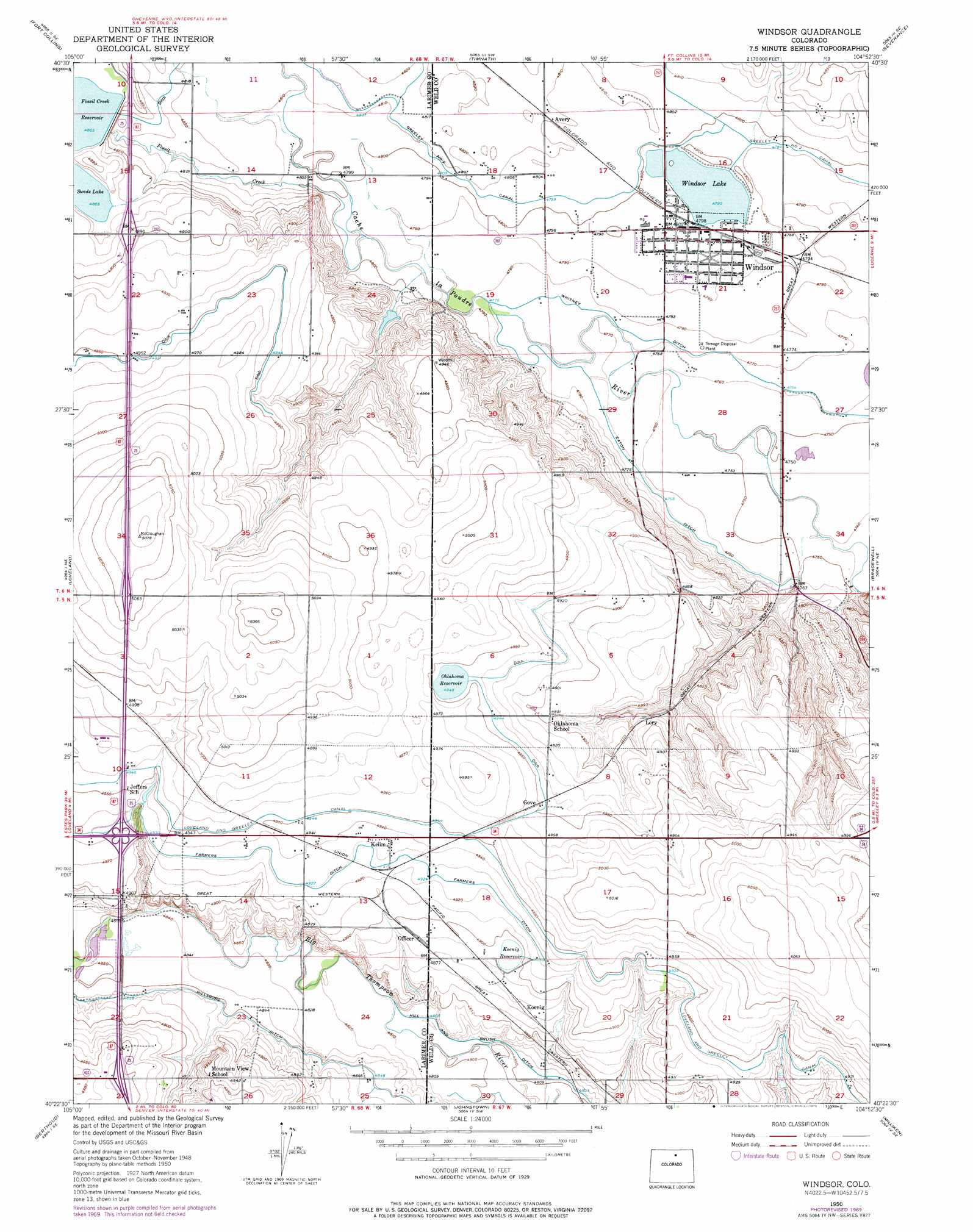
Windsor Topo Map Colorado
To zoom in, hover over the map of Windsor
USGS Topo Quad 40104d8 - 1:24,000 scale
| Topo Map Name: | Windsor |
| USGS Topo Quad ID: | 40104d8 |
| Print Size: | ca. 21 1/4" wide x 27" high |
| Southeast Coordinates: | 40.375° N latitude / 104.875° W longitude |
| Map Center Coordinates: | 40.4375° N latitude / 104.9375° W longitude |
| U.S. State: | CO |
| Filename: | o40104d8.jpg |
| Download Map JPG Image: | Windsor topo map 1:24,000 scale |
| Map Type: | Topographic |
| Topo Series: | 7.5´ |
| Map Scale: | 1:24,000 |
| Source of Map Images: | United States Geological Survey (USGS) |
| Alternate Map Versions: |
Windsor CO 1950 Download PDF Buy paper map Windsor CO 1950, updated 1962 Download PDF Buy paper map Windsor CO 1950, updated 1969 Download PDF Buy paper map Windsor CO 1950, updated 1970 Download PDF Buy paper map Windsor CO 1950, updated 1970 Download PDF Buy paper map Windsor CO 1950, updated 1975 Download PDF Buy paper map Windsor CO 2010 Download PDF Buy paper map Windsor CO 2013 Download PDF Buy paper map Windsor CO 2016 Download PDF Buy paper map |
1:24,000 Topo Quads surrounding Windsor
Laporte |
Wellington |
Cobb Lake |
Nunn |
Antelope Reservoir |
Horsetooth Reservoir |
Fort Collins |
Timnath |
Severance |
Eaton |
Masonville |
Loveland |
Windsor |
Bracewell |
Greeley |
Carter Lake Reservoir |
Berthoud |
Johnstown |
Milliken |
La Salle |
Hygiene |
Longmont |
Gowanda |
Platteville |
Milton Reservoir |
> Back to 40104a1 at 1:100,000 scale
> Back to 40104a1 at 1:250,000 scale
> Back to U.S. Topo Maps home
Windsor topo map: Gazetteer
Windsor: Airports
Harris Marine Center Heliport elevation 1487m 4878′Windsor: Canals
Eaton Ditch elevation 1496m 4908′Fossil Creek Reservoir Outlet elevation 1472m 4829′
Loveland and Greeley Canal elevation 1506m 4940′
Whitney Ditch elevation 1452m 4763′
Windsor: Dams
Fossil Creek Dam elevation 1483m 4865′Koenig Dam elevation 1494m 4901′
Oklahoma Lake Dam elevation 1509m 4950′
Windsor Lake Dam elevation 1461m 4793′
Windsor: Lakes
Swede Lake elevation 1484m 4868′Windsor Lake elevation 1461m 4793′
Windsor: Mines
Windsor Pit elevation 1460m 4790′Windsor: Populated Places
Kelim elevation 1505m 4937′Windsor elevation 1462m 4796′
Windsor: Reservoirs
Fossil Creek Reservoir elevation 1483m 4865′Koenig Reservoir elevation 1494m 4901′
Oklahoma Lake elevation 1509m 4950′
Oklahoma Reservoir elevation 1508m 4947′
Windsor digital topo map on disk
Buy this Windsor topo map showing relief, roads, GPS coordinates and other geographical features, as a high-resolution digital map file on DVD: