Dutch Girl Lake Topo Map Colorado
To zoom in, hover over the map of Dutch Girl Lake
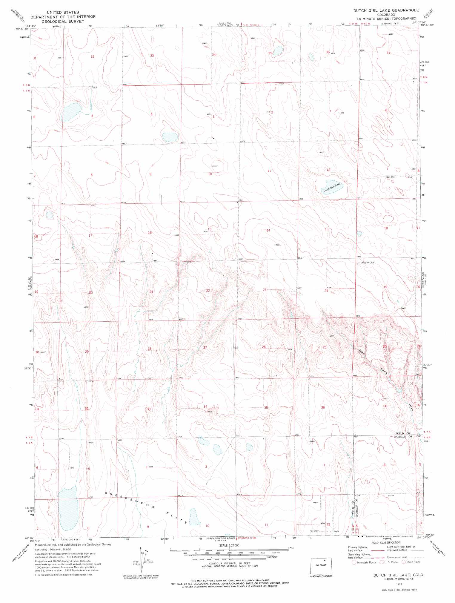
USGS Topo Quad 40104e2 - 1:24,000 scale
| Topo Map Name: | Dutch Girl Lake |
| USGS Topo Quad ID: | 40104e2 |
| Print Size: | ca. 21 1/4" wide x 27" high |
| Southeast Coordinates: | 40.5° N latitude / 104.125° W longitude |
| Map Center Coordinates: | 40.5625° N latitude / 104.1875° W longitude |
| U.S. State: | CO |
| Filename: | o40104e2.jpg |
| Download Map JPG Image: | Dutch Girl Lake topo map 1:24,000 scale |
| Map Type: | Topographic |
| Topo Series: | 7.5´ |
| Map Scale: | 1:24,000 |
| Source of Map Images: | United States Geological Survey (USGS) |
| Alternate Map Versions: |
Dutch Girl Lake CO 1972, updated 1975 Download PDF Buy paper map Dutch Girl Lake CO 2011 Download PDF Buy paper map Dutch Girl Lake CO 2013 Download PDF Buy paper map Dutch Girl Lake CO 2016 Download PDF Buy paper map |
1:24,000 Topo Quads surrounding Dutch Girl Lake
Reno Reservoir |
Hereford Se |
Grover South |
Grover Se |
Pawnee Buttes |
Baker Draw |
Briggsdale |
Keota Nw |
Keota |
Raymer Nw |
Cornish |
Fosston |
Dutch Girl Lake |
Keota Se |
Buckingham |
Barnesville |
Point Of Rocks |
Greasewood Lake |
Sunken Lake |
Judson Hills |
Hardin |
Dearfield |
Masters |
Orchard |
Weldona |
> Back to 40104e1 at 1:100,000 scale
> Back to 40104a1 at 1:250,000 scale
> Back to U.S. Topo Maps home
Dutch Girl Lake digital topo map on disk
Buy this Dutch Girl Lake topo map showing relief, roads, GPS coordinates and other geographical features, as a high-resolution digital map file on DVD: