Keota Topo Map Colorado
To zoom in, hover over the map of Keota
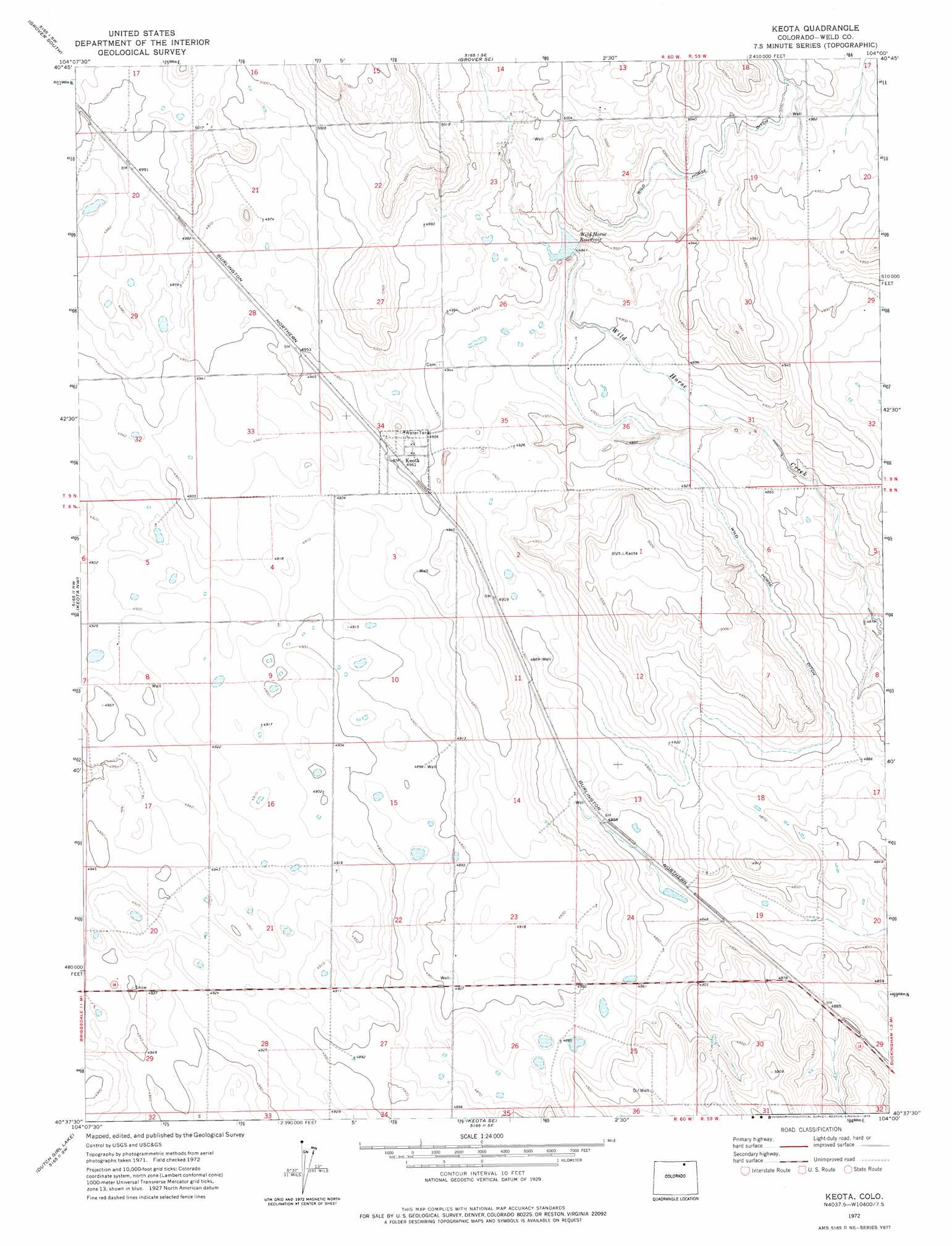
USGS Topo Quad 40104f1 - 1:24,000 scale
| Topo Map Name: | Keota |
| USGS Topo Quad ID: | 40104f1 |
| Print Size: | ca. 21 1/4" wide x 27" high |
| Southeast Coordinates: | 40.625° N latitude / 104° W longitude |
| Map Center Coordinates: | 40.6875° N latitude / 104.0625° W longitude |
| U.S. State: | CO |
| Filename: | o40104f1.jpg |
| Download Map JPG Image: | Keota topo map 1:24,000 scale |
| Map Type: | Topographic |
| Topo Series: | 7.5´ |
| Map Scale: | 1:24,000 |
| Source of Map Images: | United States Geological Survey (USGS) |
| Alternate Map Versions: |
Keota CO 1972, updated 1975 Download PDF Buy paper map Keota CO 1997, updated 2000 Download PDF Buy paper map Keota CO 2011 Download PDF Buy paper map Keota CO 2013 Download PDF Buy paper map Keota CO 2016 Download PDF Buy paper map |
| FStopo: | US Forest Service topo Keota is available: Download FStopo PDF Download FStopo TIF |
1:24,000 Topo Quads surrounding Keota
Hereford |
Grover North |
Grover Ne |
Dolan Spring |
Vim School |
Hereford Se |
Grover South |
Grover Se |
Pawnee Buttes |
Gatehook Spring |
Briggsdale |
Keota Nw |
Keota |
Raymer Nw |
Raymer Ne |
Fosston |
Dutch Girl Lake |
Keota Se |
Buckingham |
Raymer |
Point Of Rocks |
Greasewood Lake |
Sunken Lake |
Judson Hills |
Peace Valley School |
> Back to 40104e1 at 1:100,000 scale
> Back to 40104a1 at 1:250,000 scale
> Back to U.S. Topo Maps home
Keota topo map: Gazetteer
Keota: Canals
Wild Horse Ditch elevation 1499m 4917′Keota: Dams
Wildhorse Number 1 Dam elevation 1505m 4937′Keota: Populated Places
Keota elevation 1513m 4963′Keota: Reservoirs
Wild Horse Reservoir elevation 1506m 4940′Wildhorse Reservoir 1 elevation 1505m 4937′
Keota: Wells
Alkali Well elevation 1493m 4898′Keota Water Well elevation 1510m 4954′
Railroad Water Well elevation 1491m 4891′
Keota digital topo map on disk
Buy this Keota topo map showing relief, roads, GPS coordinates and other geographical features, as a high-resolution digital map file on DVD: