Purcell Topo Map Colorado
To zoom in, hover over the map of Purcell
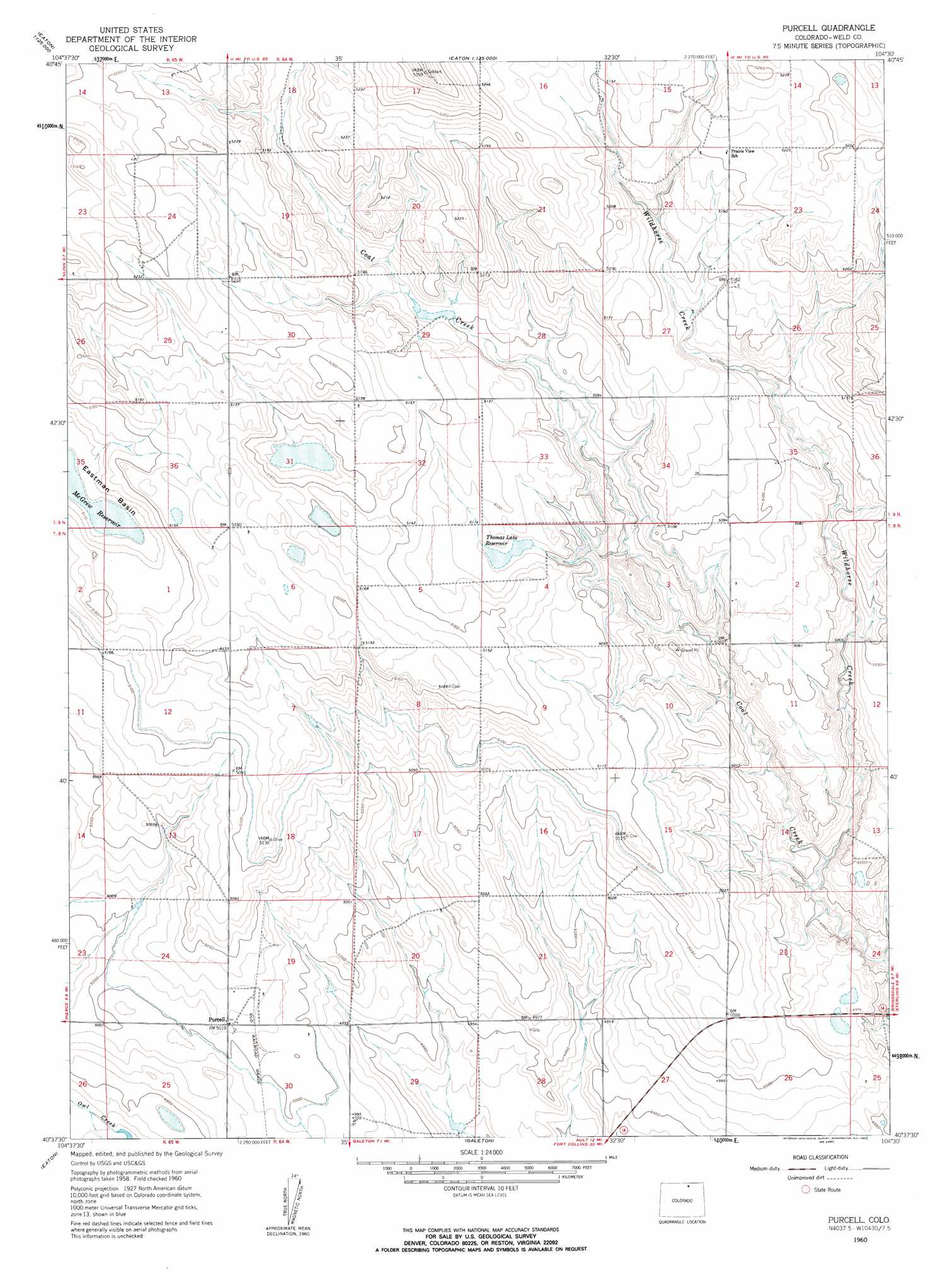
USGS Topo Quad 40104f5 - 1:24,000 scale
| Topo Map Name: | Purcell |
| USGS Topo Quad ID: | 40104f5 |
| Print Size: | ca. 21 1/4" wide x 27" high |
| Southeast Coordinates: | 40.625° N latitude / 104.5° W longitude |
| Map Center Coordinates: | 40.6875° N latitude / 104.5625° W longitude |
| U.S. State: | CO |
| Filename: | o40104f5.jpg |
| Download Map JPG Image: | Purcell topo map 1:24,000 scale |
| Map Type: | Topographic |
| Topo Series: | 7.5´ |
| Map Scale: | 1:24,000 |
| Source of Map Images: | United States Geological Survey (USGS) |
| Alternate Map Versions: |
Purcell CO 1960, updated 1962 Download PDF Buy paper map Purcell CO 1997, updated 2000 Download PDF Buy paper map Purcell CO 2011 Download PDF Buy paper map Purcell CO 2013 Download PDF Buy paper map Purcell CO 2016 Download PDF Buy paper map |
| FStopo: | US Forest Service topo Purcell is available: Download FStopo PDF Download FStopo TIF |
1:24,000 Topo Quads surrounding Purcell
Carr East |
Eastman Creek North |
Squaw Rock |
Hereford Nw |
Hereford |
Dover |
Eastman Creek South |
Eastman Creek Se |
Reno Reservoir |
Hereford Se |
Nunn |
Antelope Reservoir |
Purcell |
Baker Draw |
Briggsdale |
Severance |
Eaton |
Galeton |
Cornish |
Fosston |
Bracewell |
Greeley |
Kersey |
Barnesville |
Point Of Rocks |
> Back to 40104e1 at 1:100,000 scale
> Back to 40104a1 at 1:250,000 scale
> Back to U.S. Topo Maps home
Purcell topo map: Gazetteer
Purcell: Basins
Eastman Basin elevation 1561m 5121′Purcell: Populated Places
Purcell elevation 1531m 5022′Purcell: Reservoirs
Thomas Lake Reservoir elevation 1557m 5108′Purcell: Streams
Wildhorse Creek elevation 1506m 4940′Purcell: Wells
Monument Water Well elevation 1536m 5039′Slab Water Well elevation 1565m 5134′
Purcell digital topo map on disk
Buy this Purcell topo map showing relief, roads, GPS coordinates and other geographical features, as a high-resolution digital map file on DVD: