Antelope Reservoir Topo Map Colorado
To zoom in, hover over the map of Antelope Reservoir
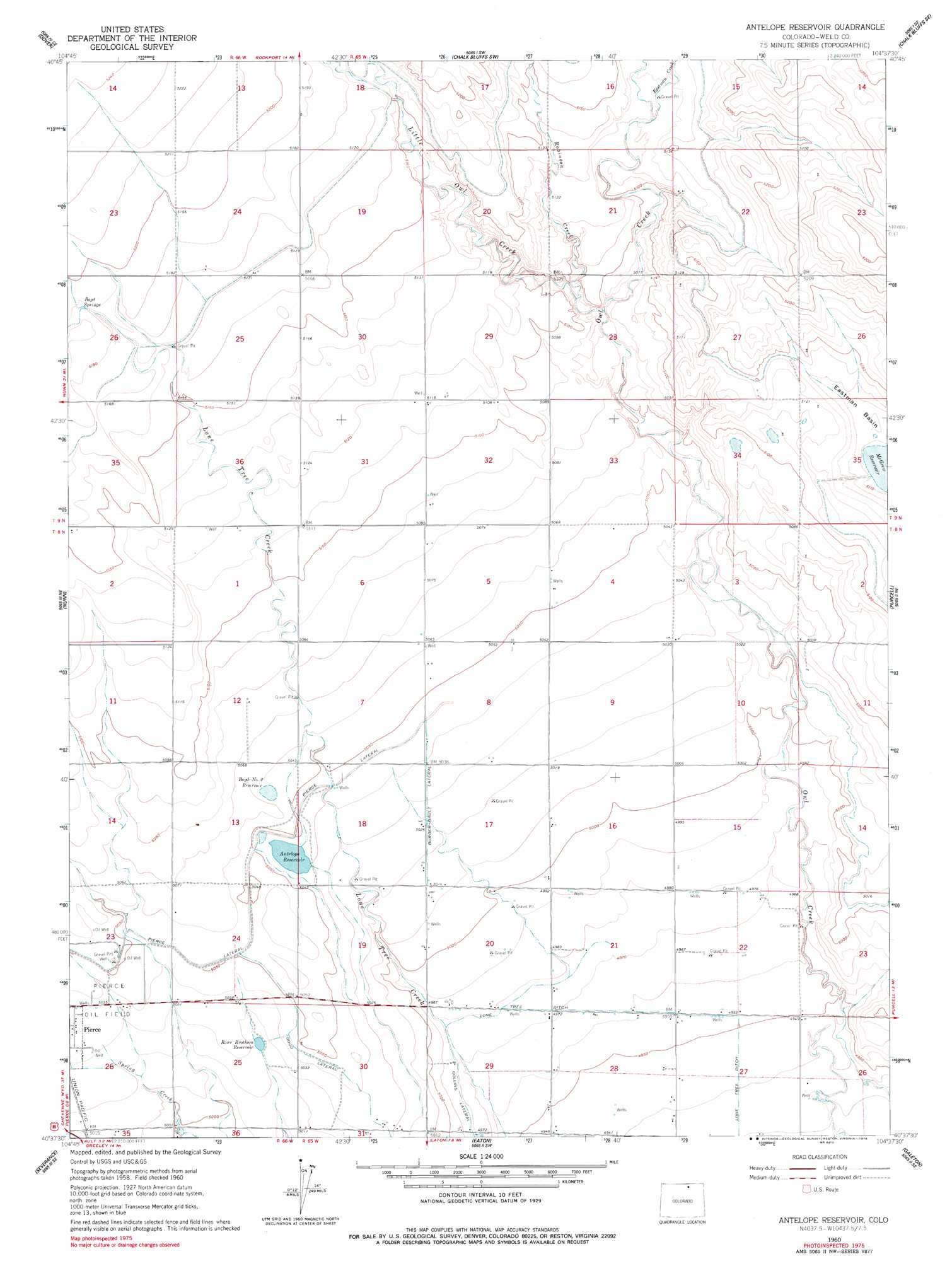
USGS Topo Quad 40104f6 - 1:24,000 scale
| Topo Map Name: | Antelope Reservoir |
| USGS Topo Quad ID: | 40104f6 |
| Print Size: | ca. 21 1/4" wide x 27" high |
| Southeast Coordinates: | 40.625° N latitude / 104.625° W longitude |
| Map Center Coordinates: | 40.6875° N latitude / 104.6875° W longitude |
| U.S. State: | CO |
| Filename: | o40104f6.jpg |
| Download Map JPG Image: | Antelope Reservoir topo map 1:24,000 scale |
| Map Type: | Topographic |
| Topo Series: | 7.5´ |
| Map Scale: | 1:24,000 |
| Source of Map Images: | United States Geological Survey (USGS) |
| Alternate Map Versions: |
Antelope Reservoir CO 1960, updated 1962 Download PDF Buy paper map Antelope Reservoir CO 1960, updated 1978 Download PDF Buy paper map Antelope Reservoir CO 1997, updated 2000 Download PDF Buy paper map Antelope Reservoir CO 2011 Download PDF Buy paper map Antelope Reservoir CO 2013 Download PDF Buy paper map Antelope Reservoir CO 2016 Download PDF Buy paper map |
| FStopo: | US Forest Service topo Antelope Reservoir is available: Download FStopo PDF Download FStopo TIF |
1:24,000 Topo Quads surrounding Antelope Reservoir
Carr West |
Carr East |
Eastman Creek North |
Squaw Rock |
Hereford Nw |
Carr Sw |
Dover |
Eastman Creek South |
Eastman Creek Se |
Reno Reservoir |
Cobb Lake |
Nunn |
Antelope Reservoir |
Purcell |
Baker Draw |
Timnath |
Severance |
Eaton |
Galeton |
Cornish |
Windsor |
Bracewell |
Greeley |
Kersey |
Barnesville |
> Back to 40104e1 at 1:100,000 scale
> Back to 40104a1 at 1:250,000 scale
> Back to U.S. Topo Maps home
Antelope Reservoir topo map: Gazetteer
Antelope Reservoir: Canals
Burger-Gault Lateral elevation 1532m 5026′Good Lateral elevation 1538m 5045′
Lone Tree Ditch elevation 1513m 4963′
Antelope Reservoir: Dams
McGrew Dam elevation 1558m 5111′Antelope Reservoir: Mines
King Solomon Mine elevation 1550m 5085′Antelope Reservoir: Reservoirs
Antelope Reservoir elevation 1538m 5045′Boyd Number 2 Reservoir elevation 1542m 5059′
McGrew Reservoir elevation 1558m 5111′
McGrew Reservoir elevation 1558m 5111′
Rowe Brothers Reservoir elevation 1533m 5029′
Antelope Reservoir: Springs
Boyd Springs elevation 1581m 5187′Antelope Reservoir: Streams
Eastman Creek elevation 1561m 5121′Little Owl Creek elevation 1547m 5075′
Robinson Creek elevation 1546m 5072′
Antelope Reservoir digital topo map on disk
Buy this Antelope Reservoir topo map showing relief, roads, GPS coordinates and other geographical features, as a high-resolution digital map file on DVD: