Grover South Topo Map Colorado
To zoom in, hover over the map of Grover South
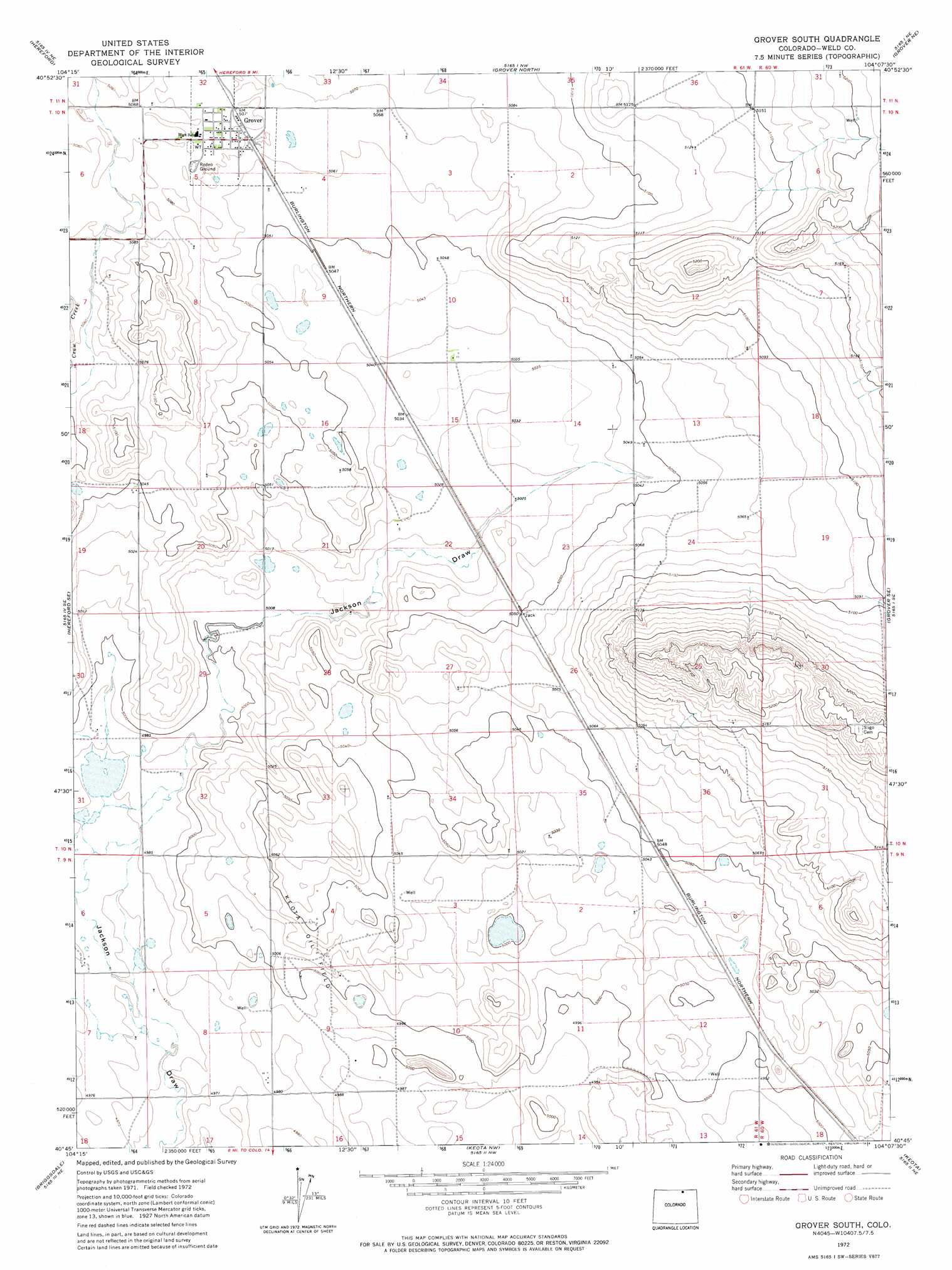
USGS Topo Quad 40104g2 - 1:24,000 scale
| Topo Map Name: | Grover South |
| USGS Topo Quad ID: | 40104g2 |
| Print Size: | ca. 21 1/4" wide x 27" high |
| Southeast Coordinates: | 40.75° N latitude / 104.125° W longitude |
| Map Center Coordinates: | 40.8125° N latitude / 104.1875° W longitude |
| U.S. State: | CO |
| Filename: | o40104g2.jpg |
| Download Map JPG Image: | Grover South topo map 1:24,000 scale |
| Map Type: | Topographic |
| Topo Series: | 7.5´ |
| Map Scale: | 1:24,000 |
| Source of Map Images: | United States Geological Survey (USGS) |
| Alternate Map Versions: |
Grover South CO 1972, updated 1974 Download PDF Buy paper map Grover South CO 1972, updated 1974 Download PDF Buy paper map Grover South CO 1997, updated 2000 Download PDF Buy paper map Grover South CO 2011 Download PDF Buy paper map Grover South CO 2013 Download PDF Buy paper map Grover South CO 2016 Download PDF Buy paper map |
| FStopo: | US Forest Service topo Grover South is available: Download FStopo PDF Download FStopo TIF |
1:24,000 Topo Quads surrounding Grover South
Arcola |
Carpenter |
Pine Bluffs Sw |
Pine Bluffs Se |
Bushnell Sw |
Hereford Nw |
Hereford |
Grover North |
Grover Ne |
Dolan Spring |
Reno Reservoir |
Hereford Se |
Grover South |
Grover Se |
Pawnee Buttes |
Baker Draw |
Briggsdale |
Keota Nw |
Keota |
Raymer Nw |
Cornish |
Fosston |
Dutch Girl Lake |
Keota Se |
Buckingham |
> Back to 40104e1 at 1:100,000 scale
> Back to 40104a1 at 1:250,000 scale
> Back to U.S. Topo Maps home
Grover South topo map: Gazetteer
Grover South: Oilfields
Keota Oil Field elevation 1530m 5019′Grover South: Populated Places
Grover elevation 1547m 5075′Grover South: Valleys
Jackson Draw elevation 1537m 5042′Grover South digital topo map on disk
Buy this Grover South topo map showing relief, roads, GPS coordinates and other geographical features, as a high-resolution digital map file on DVD: