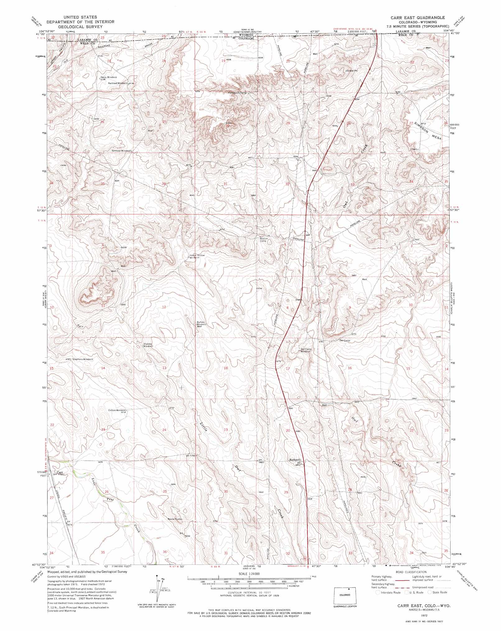
Carr East Topo Map Colorado
To zoom in, hover over the map of Carr East
USGS Topo Quad 40104h7 - 1:24,000 scale
| Topo Map Name: | Carr East |
| USGS Topo Quad ID: | 40104h7 |
| Print Size: | ca. 21 1/4" wide x 27" high |
| Southeast Coordinates: | 40.875° N latitude / 104.75° W longitude |
| Map Center Coordinates: | 40.9375° N latitude / 104.8125° W longitude |
| U.S. States: | CO, WY |
| Filename: | o40104h7.jpg |
| Download Map JPG Image: | Carr East topo map 1:24,000 scale |
| Map Type: | Topographic |
| Topo Series: | 7.5´ |
| Map Scale: | 1:24,000 |
| Source of Map Images: | United States Geological Survey (USGS) |
| Alternate Map Versions: |
Carr East CO 1972, updated 1975 Download PDF Buy paper map Carr East CO 1972, updated 1975 Download PDF Buy paper map Carr East CO 1997, updated 2000 Download PDF Buy paper map Carr East CO 2011 Download PDF Buy paper map Carr East CO 2013 Download PDF Buy paper map Carr East CO 2016 Download PDF Buy paper map |
| FStopo: | US Forest Service topo Carr East is available: Download FStopo PDF Download FStopo TIF |
1:24,000 Topo Quads surrounding Carr East
Silver Crown |
Round Top Lake |
Cheyenne North |
Archer |
Durham |
Emkay |
Borie |
Cheyenne South |
Altvan |
Campstool |
Round Butte |
Carr West |
Carr East |
Eastman Creek North |
Squaw Rock |
Buckeye |
Carr Sw |
Dover |
Eastman Creek South |
Eastman Creek Se |
Wellington |
Cobb Lake |
Nunn |
Antelope Reservoir |
Purcell |
> Back to 40104e1 at 1:100,000 scale
> Back to 40104a1 at 1:250,000 scale
> Back to U.S. Topo Maps home
Carr East topo map: Gazetteer
Carr East: Airports
Mile Hi Airport elevation 1745m 5725′Carr East: Populated Places
Carr elevation 1741m 5711′Rockport elevation 1723m 5652′
Carr East: Summits
Simpson Mesa elevation 1895m 6217′Carr East digital topo map on disk
Buy this Carr East topo map showing relief, roads, GPS coordinates and other geographical features, as a high-resolution digital map file on DVD: