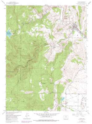
Lyons Topo Map Colorado
To zoom in, hover over the map of Lyons
USGS Topo Quad 40105b3 - 1:24,000 scale
| Topo Map Name: | Lyons |
| USGS Topo Quad ID: | 40105b3 |
| Print Size: | ca. 21 1/4" wide x 27" high |
| Southeast Coordinates: | 40.125° N latitude / 105.25° W longitude |
| Map Center Coordinates: | 40.1875° N latitude / 105.3125° W longitude |
| U.S. State: | CO |
| Filename: | o40105b3.jpg |
| Download Map JPG Image: | Lyons topo map 1:24,000 scale |
| Map Type: | Topographic |
| Topo Series: | 7.5´ |
| Map Scale: | 1:24,000 |
| Source of Map Images: | United States Geological Survey (USGS) |
| Alternate Map Versions: |
Lyons CO 1957, updated 1959 Download PDF Buy paper map Lyons CO 1957, updated 1961 Download PDF Buy paper map Lyons CO 1968, updated 1968 Download PDF Buy paper map Lyons CO 1968, updated 1968 Download PDF Buy paper map Lyons CO 1968, updated 1974 Download PDF Buy paper map Lyons CO 1968, updated 1974 Download PDF Buy paper map Lyons CO 1968, updated 1978 Download PDF Buy paper map Lyons CO 2011 Download PDF Buy paper map Lyons CO 2013 Download PDF Buy paper map Lyons CO 2016 Download PDF Buy paper map |
| FStopo: | US Forest Service topo Lyons is available: Download FStopo PDF Download FStopo TIF |
1:24,000 Topo Quads surrounding Lyons
> Back to 40105a1 at 1:100,000 scale
> Back to 40104a1 at 1:250,000 scale
> Back to U.S. Topo Maps home
Lyons topo map: Gazetteer
Lyons: Canals
Lake Ditch elevation 1710m 5610′South Ledge Ditch elevation 1637m 5370′
Toll Gate Ditch elevation 1682m 5518′
Lyons: Dams
Allen Lake Dam elevation 1729m 5672′Button Rock Dam elevation 1952m 6404′
Lyons: Flats
Antelope Park elevation 2043m 6702′Lyons: Lakes
Allens Lake elevation 1729m 5672′Lake of the Pines elevation 1752m 5748′
Lyons: Mines
Brodies Saint Vrain Quarry elevation 1639m 5377′Cal-Wood Mica Mine elevation 2230m 7316′
Carol Gore Quarry elevation 1639m 5377′
Cashier Mine elevation 2329m 7641′
Clemens Quarry elevation 1856m 6089′
Copper Blush Mine elevation 2253m 7391′
Dale Taylor Lease Quarry elevation 1639m 5377′
December Mine elevation 2475m 8120′
Dewey Rocky Mountain Quarry elevation 1639m 5377′
Durias Mine elevation 2238m 7342′
Ellen Mine elevation 2444m 8018′
Eureka Mine elevation 2414m 7919′
Golden Age Mine elevation 2483m 8146′
Hammons Quarry elevation 1639m 5377′
Heil Quarry elevation 1946m 6384′
Hercules Mine elevation 2329m 7641′
Johnson Quarry elevation 1639m 5377′
King Mountain Quarry elevation 1639m 5377′
Kline Quarry elevation 1639m 5377′
Longfellow Mine elevation 2417m 7929′
Lyons Quarry elevation 1639m 5377′
McCall Quarries elevation 1639m 5377′
Pickett Quarry elevation 1856m 6089′
Rawley Quarry elevation 1639m 5377′
Rocking WP Pit elevation 1628m 5341′
Rusty Gold and Cerite Claims elevation 2379m 7805′
Sisk Mine elevation 1639m 5377′
Sprague Red Pit elevation 1639m 5377′
Steamboat Valley Quarry elevation 1639m 5377′
Summers Quarry elevation 1639m 5377′
United Building Stone Quarry elevation 1639m 5377′
University of Colorado Quarry elevation 1639m 5377′
Lyons: Populated Places
Altona elevation 1707m 5600′Lyons elevation 1637m 5370′
Lyons: Reservoirs
Allen Lake elevation 1729m 5672′Button Rock Reservoir elevation 1952m 6404′
Longmont Reservoir elevation 1836m 6023′
Lyons: Ridges
Berry Ridge elevation 2310m 7578′Lyons: Streams
North Saint Vrain Creek elevation 1622m 5321′South Saint Vrain Creek elevation 1622m 5321′
Lyons: Summits
Coffintop Mountain elevation 2448m 8031′Fairview Peak elevation 2600m 8530′
Indian Lookout Mountain elevation 1993m 6538′
Red Hill elevation 2002m 6568′
Steamboat Mountain elevation 1864m 6115′
Table Mountain elevation 1713m 5620′
Lyons: Tunnels
Saint Vrain Supply Tunnel elevation 1698m 5570′Lyons: Valleys
Ball Gulch elevation 2288m 7506′Big Narrows elevation 1803m 5915′
Central Gulch elevation 1880m 6167′
Coffintop Gulch elevation 1807m 5928′
Deadman Gulch elevation 1728m 5669′
Geer Canyon elevation 1718m 5636′
Geer Gulch elevation 1804m 5918′
Little Narrows elevation 1698m 5570′
Long Gulch elevation 1952m 6404′
Plumely Canyon elevation 1851m 6072′
Red Hill Gulch elevation 1656m 5433′
Spring Gulch elevation 1709m 5606′
Stone Canyon elevation 1622m 5321′
Lyons digital topo map on disk
Buy this Lyons topo map showing relief, roads, GPS coordinates and other geographical features, as a high-resolution digital map file on DVD:


