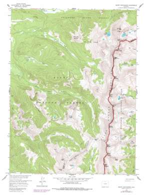
Mount Richthofen Topo Map Colorado
To zoom in, hover over the map of Mount Richthofen
USGS Topo Quad 40105d8 - 1:24,000 scale
| Topo Map Name: | Mount Richthofen |
| USGS Topo Quad ID: | 40105d8 |
| Print Size: | ca. 21 1/4" wide x 27" high |
| Southeast Coordinates: | 40.375° N latitude / 105.875° W longitude |
| Map Center Coordinates: | 40.4375° N latitude / 105.9375° W longitude |
| U.S. State: | CO |
| Filename: | o40105d8.jpg |
| Download Map JPG Image: | Mount Richthofen topo map 1:24,000 scale |
| Map Type: | Topographic |
| Topo Series: | 7.5´ |
| Map Scale: | 1:24,000 |
| Source of Map Images: | United States Geological Survey (USGS) |
| Alternate Map Versions: |
Mount Richthofen CO 1957, updated 1959 Download PDF Buy paper map Mount Richthofen CO 1957, updated 1959 Download PDF Buy paper map Mount Richthofen CO 1957, updated 1961 Download PDF Buy paper map Mount Richthofen CO 1957, updated 1961 Download PDF Buy paper map Mount Richthofen CO 1957, updated 1973 Download PDF Buy paper map Mount Richthofen CO 1957, updated 1978 Download PDF Buy paper map Mount Richthofen CO 1957, updated 1988 Download PDF Buy paper map Mount Richthofen CO 1957, updated 1988 Download PDF Buy paper map Mount Richthofen CO 1957, updated 1988 Download PDF Buy paper map Mount Richthofen CO 2000, updated 2004 Download PDF Buy paper map Mount Richthofen CO 2011 Download PDF Buy paper map Mount Richthofen CO 2013 Download PDF Buy paper map Mount Richthofen CO 2016 Download PDF Buy paper map |
| FStopo: | US Forest Service topo Mount Richthofen is available: Download FStopo PDF Download FStopo TIF |
1:24,000 Topo Quads surrounding Mount Richthofen
> Back to 40105a1 at 1:100,000 scale
> Back to 40104a1 at 1:250,000 scale
> Back to U.S. Topo Maps home
Mount Richthofen topo map: Gazetteer
Mount Richthofen: Flats
Jack Park elevation 3251m 10666′Mount Richthofen: Gaps
Baker Pass elevation 3433m 11263′Mount Richthofen: Lakes
Lake Agnes elevation 3251m 10666′Lake of the Clouds elevation 3485m 11433′
Michigan Lakes elevation 3446m 11305′
Parika Lake elevation 3471m 11387′
Pinnacle Pool elevation 3447m 11309′
Snow Lake elevation 3511m 11519′
Mount Richthofen: Mines
Gaslight Mine elevation 3172m 10406′Mount Richthofen: Pillars
Nokhu Crags elevation 3755m 12319′Mount Richthofen: Ranges
Never Summer Mountains elevation 3788m 12427′Mount Richthofen: Ridges
Hart Ridge elevation 3786m 12421′Mount Richthofen: Summits
Baker Mountain elevation 3763m 12345′Bearpaws Peaks elevation 3268m 10721′
Braddock Peak elevation 3649m 11971′
Farview Mountain elevation 3726m 12224′
Green Knoll elevation 3734m 12250′
Howard Mountain elevation 3890m 12762′
Lead Mountain elevation 3802m 12473′
Mount Cindy elevation 3667m 12030′
Mount Cirrus elevation 3880m 12729′
Mount Cumulus elevation 3881m 12732′
Mount Mahler elevation 3799m 12463′
Mount Nimbus elevation 3854m 12644′
Mount Richthofen elevation 3929m 12890′
Mount Stratus elevation 3798m 12460′
Parika Peak elevation 3769m 12365′
Red Mountain elevation 3535m 11597′
Seven Utes Mountain elevation 3477m 11407′
Static Peak elevation 3833m 12575′
Tepee Mountain elevation 3751m 12306′
Mount Richthofen: Trails
Baker Trail elevation 3307m 10849′Michigan River Trail elevation 3084m 10118′
Parika Trail elevation 3244m 10643′
Mount Richthofen digital topo map on disk
Buy this Mount Richthofen topo map showing relief, roads, GPS coordinates and other geographical features, as a high-resolution digital map file on DVD:


