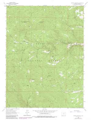
Crystal Mountain Topo Map Colorado
To zoom in, hover over the map of Crystal Mountain
USGS Topo Quad 40105e4 - 1:24,000 scale
| Topo Map Name: | Crystal Mountain |
| USGS Topo Quad ID: | 40105e4 |
| Print Size: | ca. 21 1/4" wide x 27" high |
| Southeast Coordinates: | 40.5° N latitude / 105.375° W longitude |
| Map Center Coordinates: | 40.5625° N latitude / 105.4375° W longitude |
| U.S. State: | CO |
| Filename: | o40105e4.jpg |
| Download Map JPG Image: | Crystal Mountain topo map 1:24,000 scale |
| Map Type: | Topographic |
| Topo Series: | 7.5´ |
| Map Scale: | 1:24,000 |
| Source of Map Images: | United States Geological Survey (USGS) |
| Alternate Map Versions: |
Crystal Mountain CO 1962, updated 1964 Download PDF Buy paper map Crystal Mountain CO 1962, updated 1964 Download PDF Buy paper map Crystal Mountain CO 1962, updated 1970 Download PDF Buy paper map Crystal Mountain CO 1962, updated 1970 Download PDF Buy paper map Crystal Mountain CO 1962, updated 1980 Download PDF Buy paper map Crystal Mountain CO 1962, updated 1980 Download PDF Buy paper map Crystal Mountain CO 2011 Download PDF Buy paper map Crystal Mountain CO 2013 Download PDF Buy paper map Crystal Mountain CO 2016 Download PDF Buy paper map |
| FStopo: | US Forest Service topo Crystal Mountain is available: Download FStopo PDF Download FStopo TIF |
1:24,000 Topo Quads surrounding Crystal Mountain
> Back to 40105e1 at 1:100,000 scale
> Back to 40104a1 at 1:250,000 scale
> Back to U.S. Topo Maps home
Crystal Mountain topo map: Gazetteer
Crystal Mountain: Flats
High Park elevation 2318m 7604′Crystal Mountain: Gaps
Donner Pass elevation 3083m 10114′White Pine Pass elevation 2935m 9629′
Crystal Mountain: Mines
Beryl Number Five Prospect elevation 2588m 8490′Big Boulder Mine elevation 2737m 8979′
Calypso Beryl Number One Mine elevation 2880m 9448′
Clipper Number One Mine elevation 3209m 10528′
Corral Pole Mica Mine elevation 2437m 7995′
Corral Pole One Mine elevation 2427m 7962′
Corral Pole Two Mine elevation 2427m 7962′
Crystal Mountain Mine elevation 2915m 9563′
Crystal Silica Mine elevation 2920m 9580′
Crystal Snow Mine elevation 2688m 8818′
Debbie Doll Beryl Claim elevation 2580m 8464′
Double Opening Mine elevation 2516m 8254′
Eureka Claim Number Eight elevation 2442m 8011′
Eureka Claim Number Five elevation 2442m 8011′
Eureka Claim Number Four elevation 2442m 8011′
Eureka Claim Number One elevation 2442m 8011′
Eureka Claim Number Seven elevation 2442m 8011′
Eureka Claim Number Six elevation 2442m 8011′
Eureka Claim Number Three elevation 2442m 8011′
Eureka Claim Number Two elevation 2442m 8011′
Green Quartz Beryl Claim Number Eight elevation 2613m 8572′
Green Quartz Beryl Claim Number Five elevation 2613m 8572′
Green Quartz Beryl Claim Number Four elevation 2613m 8572′
Green Quartz Beryl Claim Number Nine elevation 2613m 8572′
Green Quartz Beryl Claim Number One elevation 2613m 8572′
Green Quartz Beryl Claim Number Seven elevation 2613m 8572′
Green Quartz Beryl Claim Number Six elevation 2613m 8572′
Green Quartz Beryl Claim Number Three elevation 2613m 8572′
Green Quartz Beryl Claim Number Two elevation 2613m 8572′
Huckleberry Beryl Deposit elevation 2907m 9537′
Humphrey Beryl Pegmatite elevation 2560m 8398′
Kings Kanyon Claims elevation 2704m 8871′
Mona Number Four Mine elevation 2717m 8914′
Pan Claims elevation 2417m 7929′
Plains View Mine elevation 2648m 8687′
Prairie Divide Mine elevation 3147m 10324′
Primrose Beryl Claim elevation 2541m 8336′
Reta Beryl Claim elevation 2860m 9383′
Thodab Claim elevation 2579m 8461′
Tourmaline Prospect elevation 2361m 7746′
Wisdom Ranch Mine elevation 2323m 7621′
Crystal Mountain: Populated Places
Box Prairie elevation 2526m 8287′Crystal Mountain: Streams
Box Prairie Creek elevation 2474m 8116′Cascade Creek elevation 2434m 7985′
Eld Creek elevation 2537m 8323′
Fox Creek elevation 2714m 8904′
Crystal Mountain: Summits
Boiler Hill elevation 2697m 8848′Crystal Mountain elevation 3029m 9937′
East White Pine Mountain elevation 3111m 10206′
Lookout Mountain elevation 3230m 10597′
Turner Hill elevation 2517m 8257′
West White Pine Mountain elevation 3140m 10301′
White Rock elevation 2673m 8769′
Crystal Mountain: Trails
Donner Hill Trail elevation 2811m 9222′Sheep Creek Trail elevation 2531m 8303′
Crystal Mountain: Valleys
Lakey Canyon elevation 2153m 7063′Monument Gulch elevation 2542m 8339′
Twin Cabin Gulch elevation 2119m 6952′
Crystal Mountain digital topo map on disk
Buy this Crystal Mountain topo map showing relief, roads, GPS coordinates and other geographical features, as a high-resolution digital map file on DVD:


