Virginia Dale Topo Map Colorado
To zoom in, hover over the map of Virginia Dale
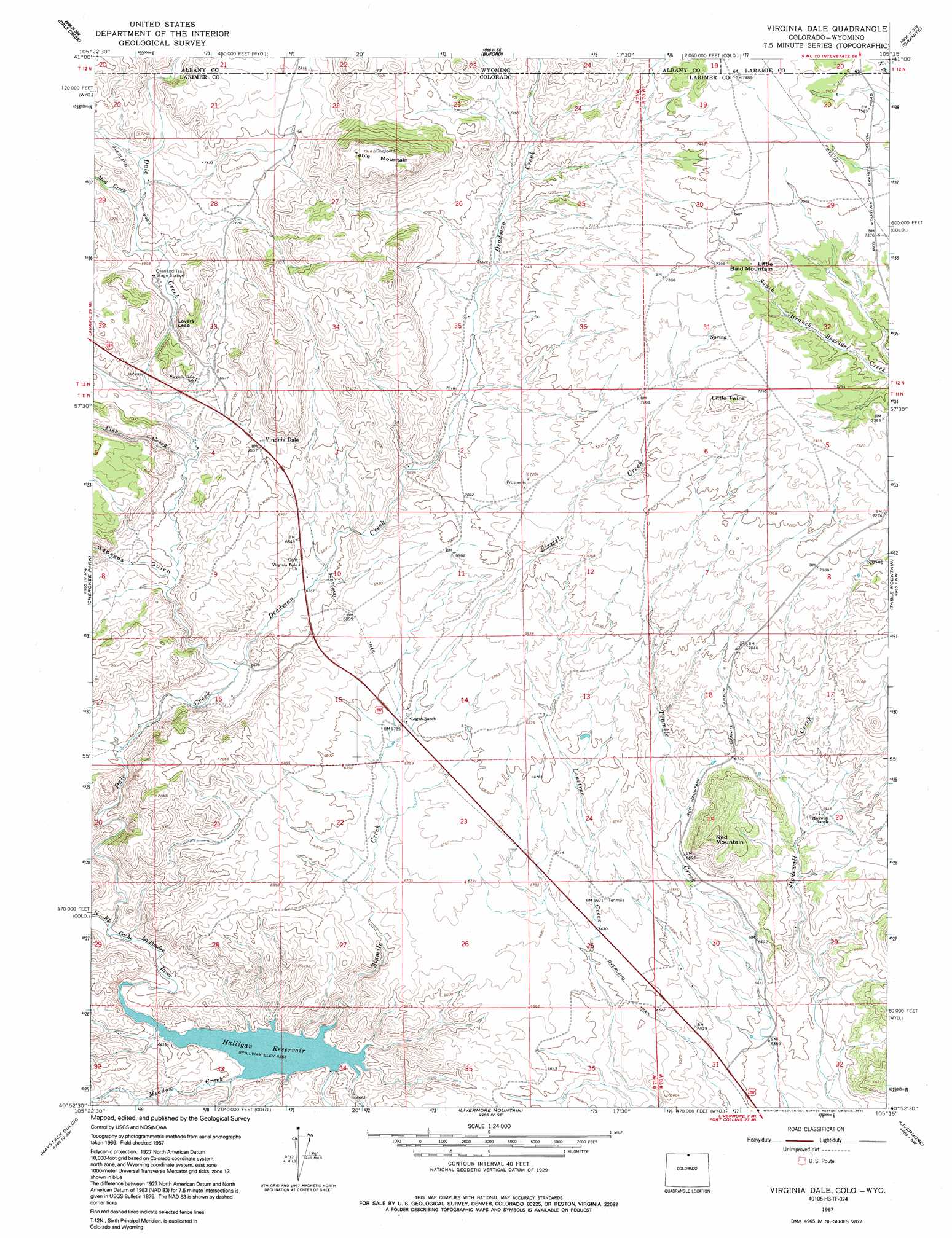
USGS Topo Quad 40105h3 - 1:24,000 scale
| Topo Map Name: | Virginia Dale |
| USGS Topo Quad ID: | 40105h3 |
| Print Size: | ca. 21 1/4" wide x 27" high |
| Southeast Coordinates: | 40.875° N latitude / 105.25° W longitude |
| Map Center Coordinates: | 40.9375° N latitude / 105.3125° W longitude |
| U.S. States: | CO, WY |
| Filename: | o40105h3.jpg |
| Download Map JPG Image: | Virginia Dale topo map 1:24,000 scale |
| Map Type: | Topographic |
| Topo Series: | 7.5´ |
| Map Scale: | 1:24,000 |
| Source of Map Images: | United States Geological Survey (USGS) |
| Alternate Map Versions: |
Virginia Dale CO 1967, updated 1971 Download PDF Buy paper map Virginia Dale CO 1967, updated 1971 Download PDF Buy paper map Virginia Dale CO 1967, updated 1978 Download PDF Buy paper map Virginia Dale CO 1967, updated 1991 Download PDF Buy paper map Virginia Dale CO 1967, updated 1991 Download PDF Buy paper map Virginia Dale CO 2010 Download PDF Buy paper map Virginia Dale CO 2013 Download PDF Buy paper map Virginia Dale CO 2016 Download PDF Buy paper map |
1:24,000 Topo Quads surrounding Virginia Dale
Red Buttes |
Sherman Mountains West |
Sherman Mountains East |
Hecla |
Silver Crown |
Best Ranch |
Dale Creek |
Buford |
Granite |
Emkay |
Diamond Peak |
Cherokee Park |
Virginia Dale |
Table Mountain |
Round Butte |
Red Feather Lakes |
Haystack Gulch |
Livermore Mountain |
Livermore |
Buckeye |
Rustic |
Big Narrows |
Poudre Park |
Laporte |
Wellington |
> Back to 40105e1 at 1:100,000 scale
> Back to 40104a1 at 1:250,000 scale
> Back to U.S. Topo Maps home
Virginia Dale topo map: Gazetteer
Virginia Dale: Cliffs
Lovers Leap elevation 2121m 6958′Virginia Dale: Dams
Halligan Dam elevation 1938m 6358′Virginia Dale: Reservoirs
Halligan Reservoir elevation 1938m 6358′Virginia Dale: Streams
Dale Creek elevation 1950m 6397′Dale Creek elevation 1948m 6391′
Deadman Creek elevation 2028m 6653′
Deadman Creek elevation 2139m 7017′
Fish Creek elevation 2078m 6817′
Lonetree Creek elevation 1939m 6361′
Meadow Creek elevation 1938m 6358′
Mud Creek elevation 2133m 6998′
North Branch Boxelder Creek elevation 2243m 7358′
Virginia Dale: Summits
Little Bald Mountain elevation 2295m 7529′Little Twins elevation 2268m 7440′
Red Mountain elevation 2163m 7096′
Table Mountain elevation 2409m 7903′
Virginia Dale: Valleys
Georges Gulch elevation 2065m 6774′Virginia Dale digital topo map on disk
Buy this Virginia Dale topo map showing relief, roads, GPS coordinates and other geographical features, as a high-resolution digital map file on DVD: