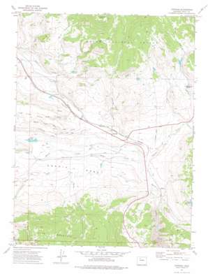
Toponas Topo Map Colorado
To zoom in, hover over the map of Toponas
USGS Topo Quad 40106a7 - 1:24,000 scale
| Topo Map Name: | Toponas |
| USGS Topo Quad ID: | 40106a7 |
| Print Size: | ca. 21 1/4" wide x 27" high |
| Southeast Coordinates: | 40° N latitude / 106.75° W longitude |
| Map Center Coordinates: | 40.0625° N latitude / 106.8125° W longitude |
| U.S. State: | CO |
| Filename: | o40106a7.jpg |
| Download Map JPG Image: | Toponas topo map 1:24,000 scale |
| Map Type: | Topographic |
| Topo Series: | 7.5´ |
| Map Scale: | 1:24,000 |
| Source of Map Images: | United States Geological Survey (USGS) |
| Alternate Map Versions: |
Toponas CO 1972, updated 1976 Download PDF Buy paper map Toponas CO 1972, updated 1976 Download PDF Buy paper map Toponas CO 2000, updated 2004 Download PDF Buy paper map Toponas CO 2011 Download PDF Buy paper map Toponas CO 2013 Download PDF Buy paper map Toponas CO 2016 Download PDF Buy paper map |
| FStopo: | US Forest Service topo Toponas is available: Download FStopo PDF Download FStopo TIF |
1:24,000 Topo Quads surrounding Toponas
> Back to 40106a1 at 1:100,000 scale
> Back to 40106a1 at 1:250,000 scale
> Back to U.S. Topo Maps home
Toponas topo map: Gazetteer
Toponas: Dams
Crowner Dam elevation 2518m 8261′E M Curry Dam elevation 2641m 8664′
Hadley Dam elevation 2672m 8766′
Kelly Dam elevation 2531m 8303′
Noble Dam elevation 2737m 8979′
Toponas Rock Number 2 Dam elevation 2629m 8625′
Toponas: Flats
Egeria Park elevation 2524m 8280′Toponas: Pillars
Toponas Rock elevation 2640m 8661′Toponas: Populated Places
Toponas elevation 2525m 8284′Toponas: Reservoirs
Crowner Reservoir elevation 2518m 8261′E M Curry Reservoir elevation 2641m 8664′
Hadley Reservoir elevation 2672m 8766′
Kelly Reservoir elevation 2531m 8303′
Noble Reservoir elevation 2737m 8979′
Toponas Rock Reservoir Number 2 elevation 2629m 8625′
Toponas: Streams
Channing Creek elevation 2463m 8080′Crowner Creek elevation 2493m 8179′
Five Pine Mesa Creek elevation 2513m 8244′
King Creek elevation 2485m 8152′
Newcomer Creek elevation 2536m 8320′
Sutton Creek elevation 2503m 8211′
Toponas Creek elevation 2482m 8143′
Toponas: Summits
King Mountain elevation 3088m 10131′Toponas: Valleys
Coberly Gulch elevation 2526m 8287′Toponas digital topo map on disk
Buy this Toponas topo map showing relief, roads, GPS coordinates and other geographical features, as a high-resolution digital map file on DVD:


