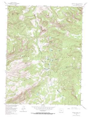
Buffalo Pass Topo Map Colorado
To zoom in, hover over the map of Buffalo Pass
USGS Topo Quad 40106e6 - 1:24,000 scale
| Topo Map Name: | Buffalo Pass |
| USGS Topo Quad ID: | 40106e6 |
| Print Size: | ca. 21 1/4" wide x 27" high |
| Southeast Coordinates: | 40.5° N latitude / 106.625° W longitude |
| Map Center Coordinates: | 40.5625° N latitude / 106.6875° W longitude |
| U.S. State: | CO |
| Filename: | o40106e6.jpg |
| Download Map JPG Image: | Buffalo Pass topo map 1:24,000 scale |
| Map Type: | Topographic |
| Topo Series: | 7.5´ |
| Map Scale: | 1:24,000 |
| Source of Map Images: | United States Geological Survey (USGS) |
| Alternate Map Versions: |
Buffalo Pass CO 1955, updated 1956 Download PDF Buy paper map Buffalo Pass CO 1955, updated 1956 Download PDF Buy paper map Buffalo Pass CO 1955, updated 1962 Download PDF Buy paper map Buffalo Pass CO 1955, updated 1970 Download PDF Buy paper map Buffalo Pass CO 1955, updated 1970 Download PDF Buy paper map Buffalo Pass CO 2000, updated 2004 Download PDF Buy paper map Buffalo Pass CO 2011 Download PDF Buy paper map Buffalo Pass CO 2013 Download PDF Buy paper map Buffalo Pass CO 2016 Download PDF Buy paper map |
| FStopo: | US Forest Service topo Buffalo Pass is available: Download FStopo PDF Download FStopo TIF |
1:24,000 Topo Quads surrounding Buffalo Pass
> Back to 40106e1 at 1:100,000 scale
> Back to 40106a1 at 1:250,000 scale
> Back to U.S. Topo Maps home
Buffalo Pass topo map: Gazetteer
Buffalo Pass: Flats
Horse Thief Park elevation 2963m 9721′Buffalo Pass: Forests
Routt National Forest elevation 3279m 10757′Buffalo Pass: Gaps
Buffalo Pass elevation 3138m 10295′Buffalo Pass: Lakes
George Lake elevation 3170m 10400′Grizzly Lake elevation 3117m 10226′
Jonah Lake elevation 3100m 10170′
Lake Albert elevation 3104m 10183′
Lake Dinosaur elevation 3105m 10187′
Martha Lake elevation 3144m 10314′
Porcupine Lake elevation 3188m 10459′
Round Mountain Lake elevation 3006m 9862′
Shoestring Lake elevation 3044m 9986′
Summit Lake elevation 3146m 10321′
Victoria Lake elevation 2948m 9671′
Whale Lake elevation 3056m 10026′
Buffalo Pass: Streams
Porcupine Creek elevation 2951m 9681′Buffalo Pass: Summits
Buffalo Mountain elevation 3165m 10383′Horse Thief Peak elevation 3314m 10872′
Round Mountain elevation 3218m 10557′
Soda Mountain elevation 3295m 10810′
Buffalo Pass: Trails
Newcomb Creek Trail elevation 2691m 8828′Buffalo Pass digital topo map on disk
Buy this Buffalo Pass topo map showing relief, roads, GPS coordinates and other geographical features, as a high-resolution digital map file on DVD:


