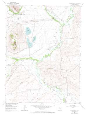
Delaney Butte Topo Map Colorado
To zoom in, hover over the map of Delaney Butte
USGS Topo Quad 40106f4 - 1:24,000 scale
| Topo Map Name: | Delaney Butte |
| USGS Topo Quad ID: | 40106f4 |
| Print Size: | ca. 21 1/4" wide x 27" high |
| Southeast Coordinates: | 40.625° N latitude / 106.375° W longitude |
| Map Center Coordinates: | 40.6875° N latitude / 106.4375° W longitude |
| U.S. State: | CO |
| Filename: | o40106f4.jpg |
| Download Map JPG Image: | Delaney Butte topo map 1:24,000 scale |
| Map Type: | Topographic |
| Topo Series: | 7.5´ |
| Map Scale: | 1:24,000 |
| Source of Map Images: | United States Geological Survey (USGS) |
| Alternate Map Versions: |
Delaney Butte CO 1955, updated 1957 Download PDF Buy paper map Delaney Butte CO 1955, updated 1957 Download PDF Buy paper map Delaney Butte CO 1955, updated 1965 Download PDF Buy paper map Delaney Butte CO 2010 Download PDF Buy paper map Delaney Butte CO 2013 Download PDF Buy paper map Delaney Butte CO 2016 Download PDF Buy paper map |
1:24,000 Topo Quads surrounding Delaney Butte
> Back to 40106e1 at 1:100,000 scale
> Back to 40106a1 at 1:250,000 scale
> Back to U.S. Topo Maps home
Delaney Butte topo map: Gazetteer
Delaney Butte: Canals
Buckeye Ditch elevation 2454m 8051′Dam Ditch elevation 2432m 7979′
Ellen Ditch elevation 2437m 7995′
Erickson and Bohn Extension Ditch elevation 2505m 8218′
Garden Ditch elevation 2451m 8041′
Hell Creek Ditch elevation 2468m 8097′
Homestead Ditch elevation 2454m 8051′
Independent Ditch elevation 2476m 8123′
James Ditch elevation 2445m 8021′
Last Chance Ditch elevation 2459m 8067′
Laune Ditch elevation 2476m 8123′
Little Grizzly Ditch elevation 2457m 8061′
Lorena Ditch elevation 2451m 8041′
Mallon Ditch elevation 2458m 8064′
Mallon Ditch Number 2 elevation 2459m 8067′
Manville Ditch elevation 2451m 8041′
Nile Ditch elevation 2452m 8044′
Outlet Ditch elevation 2472m 8110′
Peterson Ditch Number 1 elevation 2460m 8070′
Sorenson Ditch elevation 2483m 8146′
Victor Ditch elevation 2447m 8028′
West Fork Ditch elevation 2449m 8034′
Delaney Butte: Dams
Butte Dam elevation 2476m 8123′Laune Dam elevation 2484m 8149′
Delaney Butte: Lakes
East Delaney Lake elevation 2474m 8116′North Delaney Lake elevation 2484m 8149′
South Delaney Lake elevation 2475m 8120′
Delaney Butte: Reservoirs
Butte Reservoir elevation 2476m 8123′Laune Reservoir elevation 2484m 8149′
Delaney Butte: Ridges
Peterson Ridge elevation 2579m 8461′Delaney Butte: Streams
Beaver Creek elevation 2461m 8074′Grizzly Creek elevation 2456m 8057′
Hell Creek elevation 2438m 7998′
Little Grizzly Creek elevation 2456m 8057′
Lone Pine Creek elevation 2488m 8162′
Roaring Fork elevation 2443m 8015′
Delaney Butte: Summits
Delaney Butte elevation 2828m 9278′Delaney Butte: Valleys
Baker Draw elevation 2451m 8041′Manville Draw elevation 2451m 8041′
Spring Gulch elevation 2475m 8120′
Delaney Butte digital topo map on disk
Buy this Delaney Butte topo map showing relief, roads, GPS coordinates and other geographical features, as a high-resolution digital map file on DVD:


