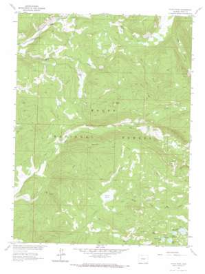
Floyd Peak Topo Map Colorado
To zoom in, hover over the map of Floyd Peak
USGS Topo Quad 40106f7 - 1:24,000 scale
| Topo Map Name: | Floyd Peak |
| USGS Topo Quad ID: | 40106f7 |
| Print Size: | ca. 21 1/4" wide x 27" high |
| Southeast Coordinates: | 40.625° N latitude / 106.75° W longitude |
| Map Center Coordinates: | 40.6875° N latitude / 106.8125° W longitude |
| U.S. State: | CO |
| Filename: | o40106f7.jpg |
| Download Map JPG Image: | Floyd Peak topo map 1:24,000 scale |
| Map Type: | Topographic |
| Topo Series: | 7.5´ |
| Map Scale: | 1:24,000 |
| Source of Map Images: | United States Geological Survey (USGS) |
| Alternate Map Versions: |
Floyd Peak CO 1962, updated 1964 Download PDF Buy paper map Floyd Peak CO 1962, updated 1970 Download PDF Buy paper map Floyd Peak CO 1962, updated 1988 Download PDF Buy paper map Floyd Peak CO 2000, updated 2004 Download PDF Buy paper map Floyd Peak CO 2011 Download PDF Buy paper map Floyd Peak CO 2013 Download PDF Buy paper map Floyd Peak CO 2016 Download PDF Buy paper map |
| FStopo: | US Forest Service topo Floyd Peak is available: Download FStopo PDF Download FStopo TIF |
1:24,000 Topo Quads surrounding Floyd Peak
> Back to 40106e1 at 1:100,000 scale
> Back to 40106a1 at 1:250,000 scale
> Back to U.S. Topo Maps home
Floyd Peak topo map: Gazetteer
Floyd Peak: Canals
Park Ditch elevation 2466m 8090′Floyd Peak: Lakes
Fish Hawk Lake elevation 2958m 9704′Lake Edward elevation 3005m 9858′
Lake Margaret elevation 3042m 9980′
Lake Margaret elevation 3045m 9990′
Floyd Peak: Mines
Floyd Peak Adit elevation 2697m 8848′Floyd Peak: Ridges
Burn Ridge elevation 3001m 9845′Floyd Peak: Streams
Burn Creek elevation 2498m 8195′Coulton Creek elevation 2313m 7588′
Middle Fork Mad Creek elevation 2604m 8543′
Mill Creek elevation 2475m 8120′
Morgan Creek elevation 2482m 8143′
North Fork Big Creek elevation 2498m 8195′
North Fork Mad Creek elevation 2773m 9097′
Roaring Fork Creek elevation 2431m 7975′
Floyd Peak: Summits
Floyd Peak elevation 2870m 9416′Floyd Peak: Trails
Chilton Trail elevation 2487m 8159′Luna Lake Trail elevation 3069m 10068′
Roaring Fork Trail elevation 2790m 9153′
Swamp Park Trail elevation 2782m 9127′
Floyd Peak: Valleys
Bear Canyon elevation 2555m 8382′Floyd Peak digital topo map on disk
Buy this Floyd Peak topo map showing relief, roads, GPS coordinates and other geographical features, as a high-resolution digital map file on DVD:


