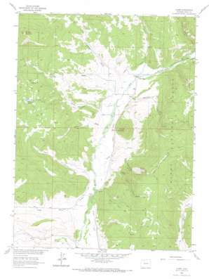
Clark Topo Map Colorado
To zoom in, hover over the map of Clark
USGS Topo Quad 40106f8 - 1:24,000 scale
| Topo Map Name: | Clark |
| USGS Topo Quad ID: | 40106f8 |
| Print Size: | ca. 21 1/4" wide x 27" high |
| Southeast Coordinates: | 40.625° N latitude / 106.875° W longitude |
| Map Center Coordinates: | 40.6875° N latitude / 106.9375° W longitude |
| U.S. State: | CO |
| Filename: | o40106f8.jpg |
| Download Map JPG Image: | Clark topo map 1:24,000 scale |
| Map Type: | Topographic |
| Topo Series: | 7.5´ |
| Map Scale: | 1:24,000 |
| Source of Map Images: | United States Geological Survey (USGS) |
| Alternate Map Versions: |
Clark CO 1962, updated 1964 Download PDF Buy paper map Clark CO 1962, updated 1964 Download PDF Buy paper map Clark CO 1962, updated 1968 Download PDF Buy paper map Clark CO 1962, updated 1968 Download PDF Buy paper map Clark CO 2000, updated 2004 Download PDF Buy paper map Clark CO 2011 Download PDF Buy paper map Clark CO 2013 Download PDF Buy paper map Clark CO 2016 Download PDF Buy paper map |
| FStopo: | US Forest Service topo Clark is available: Download FStopo PDF Download FStopo TIF |
1:24,000 Topo Quads surrounding Clark
> Back to 40106e1 at 1:100,000 scale
> Back to 40106a1 at 1:250,000 scale
> Back to U.S. Topo Maps home
Clark topo map: Gazetteer
Clark: Bridges
Moon Hill Bridge elevation 2174m 7132′Clark: Canals
Campbell Ditch elevation 2141m 7024′Frantz Ditch elevation 2179m 7148′
Keller Ditch elevation 2122m 6961′
Murphy Ditch elevation 2249m 7378′
Sand Creek Ditch elevation 2255m 7398′
Clark: Lakes
Pond Lily Lakes elevation 2445m 8021′Clark: Mines
Greenville Mine elevation 2539m 8330′Greenville Shaft elevation 2531m 8303′
Clark: Populated Places
Clark elevation 2213m 7260′Glen Eden elevation 2217m 7273′
Clark: Streams
Corral Creek elevation 2264m 7427′Franz Creek elevation 2147m 7043′
Greenville Creek elevation 2195m 7201′
McPhee Creek elevation 2169m 7116′
Reed Creek elevation 2250m 7381′
Sand Creek elevation 2175m 7135′
South Franz Creek elevation 2209m 7247′
Willow Creek elevation 2262m 7421′
Clark: Summits
McAlpin Mountain elevation 2759m 9051′Moon Hill elevation 2441m 8008′
Mount Candy elevation 2552m 8372′
Mount Candy elevation 2561m 8402′
Mount Pau elevation 2481m 8139′
Round Mountain elevation 2447m 8028′
Clark: Trails
Big Creek Bridge Trail elevation 2585m 8480′Clark: Valleys
Cottonwood Gulch elevation 2228m 7309′Dutch Gulch elevation 2155m 7070′
Impassable Canyon elevation 2217m 7273′
Long Draw elevation 2537m 8323′
Long Gulch elevation 2129m 6984′
Taylor Canyon elevation 2212m 7257′
Willow Creek Canyon elevation 2306m 7565′
Clark digital topo map on disk
Buy this Clark topo map showing relief, roads, GPS coordinates and other geographical features, as a high-resolution digital map file on DVD:


